
SMITH RAPIDS PAVILION
Campground · Fee not listed
Fast facts
- Cost
- Not listed. Check locally.
- Type
- Campground
- Phone
- 715-762-2461
- Coordinates
- 45.9103, -90.1739
- Last verified
- September 19, 2026
About this place
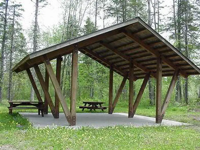
Overview Smith Rapids Pavilion is day-use picnicking area contained within Smith Rapids Campground. Both accommodate equestrians and are situated near a variety of scenic spots in the Chequamegon-Nicolet National Forest in northern Wisconsin. The pavilion is popular for its access to miles of horseback riding trails. Recreation Smiths Rapids is specifically tailored to accommodate horseback riders, providing direct access to the 18.5-mile Smith River Saddle Equestrian Trail. The trails in the area are very rugged and have a limited maintenance schedule, but remain popular with equestrian riders and campers alike. The fast-flowing South Fork of the Flambeau River is popular among canoeists. A carry-down boat ramp is available at the campground. The river is populated with a variety of trout. The campground is in close proximity to the 70-mile Flambeau Trail System, open to off-road vehicles, hiking and mountain biking. The trail is highlighted by rolling terrain, tree-lined corridors, wooden bridges and vistas overlooking various bogs and lakes. It is a popular snowmobiling location during winter months. Off road vehicles are not allowed to operate in Smith Rapids Campground. Facilities The accessible pavilion is a day-use picnic area for groups of up to 30 people. No overnight camping is available at the pavilion. Picnic tables, grills and trash service is provided, as are vault toilets and drinking water. Natural Features At an elevation of about 1,500 feet, the pavilion provides a shaded picnic site. Smith Rapids is located on the South Fork of the Flambeau River, with a scenic view of Smith Rapids Covered Bridge. Constructed in 1991, the bridge is the only glue-laminated town lattice covered bridge in Wisconsin. Nearby Attractions Park Falls, Wisconsin is approximately 17 miles from the campground and is a full service community.
From the managing agency.
Is SMITH RAPIDS PAVILION free?
We do not have a fee on record for SMITH RAPIDS PAVILION. Confirm the cost locally before you go.
How do I get to SMITH RAPIDS PAVILION?
SMITH RAPIDS PAVILION is at 45.9103, -90.1739. We do not hold written directions for this one, so navigate to the coordinates.
Nearby
- SMITH RAPIDS0.0 mi
- TWIN LAKES (WI)5.8 mi
- SAILOR LAKE PAVILION6.3 mi
- SAILOR LAKE6.8 mi
- Emily Lake8.7 mi
- Emily Lake Recreation Area8.7 mi
- STOCKFARM BRIDGE27.5 mi
- Stock Farm Bridge Cg27.5 mi
No other services within 50 mi on the record.
SourceSource data is agency published. Last synced September 19, 2026. Community reports and photos are submitted by travelers and are not verified by the agency.
