
PHILLIP'S CREEK GROUP PICNIC AREA
Campground · Fee not listed
Fast facts
- Cost
- Not listed. Check locally.
- Type
- Campground
- Phone
- 276-679-8370
- Nearest dump station
- Cosby RV Sanitary Station · 97.9 mi
- Coordinates
- 37.1082, -82.6710
- Last verified
- September 19, 2026


About this place
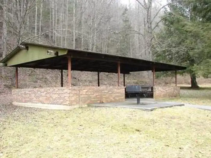
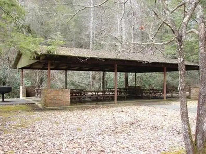
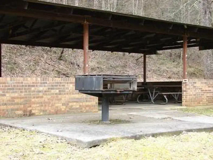
Overview Phillips's Creek Group Picnic area is a secluded site surrounded by forest. It is a great facility for family reunions, organization activities and other group events. Recreation Open lawn areas are adjacent to the picnic area can be used for activities such as horseshoes, sports and games (bring your own game and sports equipment). Hiking trails are available within easy driving distance and include Pine Mountain and Red Fox Trails. The Phillip's Creek Trail is near the picnic area. Facilities Parking is adjacent to the picnic shelters and restroom facilities. The restrooms are vault toilets. The toilets are adjacent to shelter #1 but are a short walk (850 feet) from shelter #2. A large charcoal grill is available at both shelters. Picnic tables are located inside the shelters. There is no electricity or drinking water available. Natural Features The picnic area is surrounded by forest. The North Fork of Pound Reservoir is nearby and is a popular boating and fishing destination. Nearby Attractions The Pine Mountain and Red Fox Trails are within easy driving distance.
From the managing agency.
Is PHILLIP'S CREEK GROUP PICNIC AREA free?
We do not have a fee on record for PHILLIP'S CREEK GROUP PICNIC AREA. Confirm the cost locally before you go.
How do I get to PHILLIP'S CREEK GROUP PICNIC AREA?
PHILLIP'S CREEK GROUP PICNIC AREA is at 37.1082, -82.6710. We do not hold written directions for this one, so navigate to the coordinates.
Nearby
SourceSource data is agency published. Last synced September 19, 2026. Community reports and photos are submitted by travelers and are not verified by the agency.
