
COSSATOT REEFS
Campground · Fee not listed
Fast facts
- Cost
- Not listed. Check locally.
- Type
- Campground
- Phone
- 870-386-7261
- Coordinates
- 34.2067, -94.2313
- Last verified
- September 19, 2026
About this place
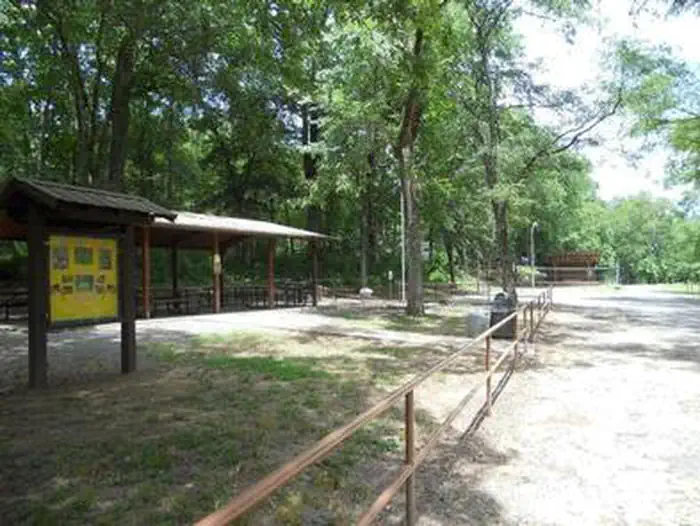
Overview Cossatot Reefs Campground sits along the lush banks of Gillham Lake in southwest Arkansas. Nicknamed the "Bright Spot on the Cossatot," Gillham Lake is a recreational oasis for outdoor enthusiasts. Recreation Visitors enjoy the lake for its vast boating opportunities, and a boat ramp is provided for easy water access. The river can be canoed from a point below the dam to U.S. Highway 71 South, a distance of about 16 miles. For shorter canoe trips, there are access roads to the river at Mize Crossing and Ladd Bridge. Anglers will find smallmouth, largemouth, and spotted bass, crappie, channel and flathead catfish and various species of sunfish in the river. A short nature trail within the campground weaves through a quaint wooded section. In spring, the trail is painted with colorful redbud and dogwood blossoms. Facilities Cossatot Reefs offers 31 shady campsites, including a large group shelter. Hot showers, drinking water and flush toilets help create a comfortable camping experience. Natural Features Gillham Lake spans 1,370 surface acres and boasts 36 miles of shoreline. The lake stems from the Cossatot River, designated as a National Wild and Scenic River.
From the managing agency.
Is COSSATOT REEFS free?
We do not have a fee on record for COSSATOT REEFS. Confirm the cost locally before you go.
How do I get to COSSATOT REEFS?
COSSATOT REEFS is at 34.2067, -94.2313. We do not hold written directions for this one, so navigate to the coordinates.
Nearby
- BIG COON CREEK1.3 mi
- LITTLE COON CREEK PARK2.0 mi
- JEFFERSON RIDGE7.2 mi
- Blue Ridge Park8.0 mi
- Overlook (Dierks Lake)9.1 mi
- Horseshoe Bend (Dierks Lake)9.2 mi
- BELLAH MINE11.1 mi
- Oak Grove (AR)12.0 mi
No other services within 50 mi on the record.
SourceSource data is agency published. Last synced September 19, 2026. Community reports and photos are submitted by travelers and are not verified by the agency.
