
Sand Island Recreation Area
Campground · Fee not listed
Fast facts
- Cost
- Not listed. Check locally.
- Type
- Campground
- Coordinates
- 37.2626, -109.6103
- Last verified
- September 19, 2026
About this place
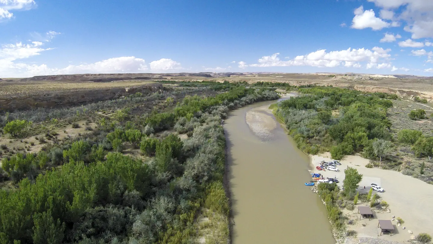
Overview Sand Island Recreation Area is a good camping option for visitors launching San Juan River float trips , or wishing to camp close to the town of Bluff or the Cedar Mesa area of Bears Ears National Monument. The campground provides 21 campsites that each feature a tent/trailer space, a picnic table, a fire ring, and vault toilets. Drinking water is available seasonally (typically March through October). Each campsite can hold 8 people and 2 vehicles. Reservations are not available for camping at this location. Individual campsites are available on a first come, first served basis upon arrival at the self-register kiosk at the site. The Sand Island Group Sites are available for larger groups, and may be reserved here . Recreation Sand Island is the primary launch point for multi-day San Juan River float trips. San Juan River trips provide boaters with access to spectacular canyons rich in scenery, geology, archeology, history and wildlife. A river permit is required in advance. The Sand Island Petroglyph Panel site is located on the sandstone walls on the north side of the recreation area. There are many nearby hiking and scenic driving opportuites in the Cedar Mesa area of Bears Ears National Monument. Natural Features Sand Island is located along the San Juan River. Cottonwood trees line the banks of the river and are scattered throughout the campground, providing shade at many of the sites. The north side of the campground is lined with red sandstone walls. Contact Info For facility specific information, please call (435) 587-1500. Nearby Attractions Bears Ears National Monument San Juan River Cedar Mesa Valley of the Gods Goosenecks State Park Charges & Cancellations No refunds are available.
From the managing agency.
Is Sand Island Recreation Area free?
We do not have a fee on record for Sand Island Recreation Area. Confirm the cost locally before you go.
How do I get to Sand Island Recreation Area?
Sand Island Recreation Area is at 37.2626, -109.6103. We do not hold written directions for this one, so navigate to the coordinates.
Nearby
- Sand Island Group Sites0.1 mi
- Hovenweep Campground30.9 mi
- Natural Bridges Campground31.5 mi
- DEVILS CANYON34.5 mi
- Devils Canyon Campground34.7 mi
- Nizhoni Campground36.0 mi
- NIZHONI36.0 mi
- Dalton Springs Campground43.3 mi
No other services within 50 mi on the record.
SourceSource data is agency published. Last synced September 19, 2026. Community reports and photos are submitted by travelers and are not verified by the agency.
