
Sand Island Group Sites
Campground · Fee
Fast facts
- Cost
- Fee charged
- Type
- Campground
- Phone
- 435-587-1500
- Coordinates
- 37.2631, -109.6122
- Last verified
- September 19, 2026

About this place
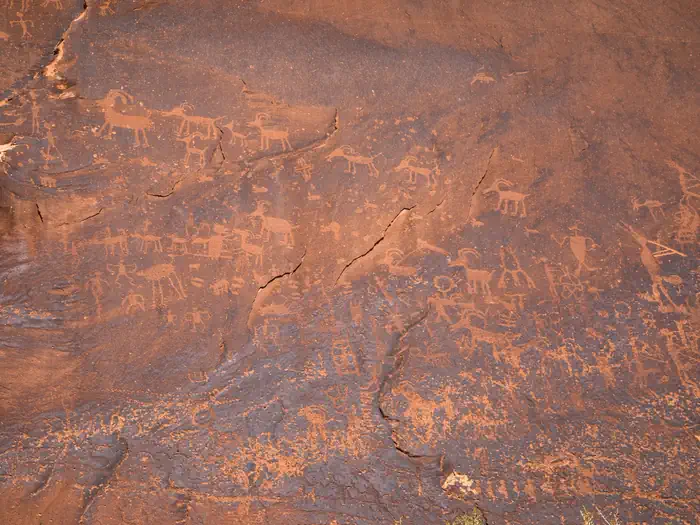
Overview Sand Island Campground’s two group campsites are ideal for groups wishing to be close to the town of Bluff and the San Juan River. The area offers outdoor enthusiasts many options for river floating, scenic driving and rock art viewing. Recreation Sand Island is the main put-in for the 102-mile section of the San Juan River between Montezuma Creek and Clay Hills Crossing that provides boaters with access to spectacular canyons rich in scenery, geology, archeology, history and wildlife. Within the campground there are numerous petroglyphs and pictographs on the ledges above and it is a popular destination for both sightseeing and bird watching. Facilities Group Site A is located near the boat ramp and features picnic tables, a fire grate, a shade structure and has water nearby. The site may be reserved in advance for groups of 10 to 20 people for a maximum of fourteen days. Group Site B can accommodate group sizes from 15 to 40 people and is located in Loop B of the campground and features picnic tables, a large fire grate, a shade structure, water on site and a single vault toilet. The group sites do not have dump stations or electric hook ups. There are dumpsters located at the campground entrance. Natural Features Sand Island Campground is beside the San Juan River. Nearby Attractions Sand Island is close to Goosenecks State Park, Bears Ears National Monument (Shash Jaa Unit), and Cedar Mesa.
From the managing agency.
Is Sand Island Group Sites free?
No. Sand Island Group Sites charges a fee.
How do I get to Sand Island Group Sites?
Sand Island Group Sites is at 37.2631, -109.6122. We do not hold written directions for this one, so navigate to the coordinates.
Nearby
- Sand Island Recreation Area0.1 mi
- Hovenweep Campground30.9 mi
- Natural Bridges Campground31.4 mi
- DEVILS CANYON34.5 mi
- Devils Canyon Campground34.7 mi
- Nizhoni Campground35.9 mi
- NIZHONI36.0 mi
- Dalton Springs Campground43.3 mi
No other services within 50 mi on the record.
SourceSource data is agency published. Last synced September 19, 2026. Community reports and photos are submitted by travelers and are not verified by the agency.
