
BLOODY DICK CABIN
USFS · Campground · Fee
Fast facts
- Cost
- Fee charged
- Managed by
- USFS
- Type
- Campground
- Hours
- Open year-round.
- Reservations
- recreation.gov
- Phone
- 406-683-3900
- Nearest dump station
- Newland Ranch Dump Station · 33.8 mi
- Coordinates
- 45.1163, -113.4579
- Last verified
- September 19, 2026
About this place
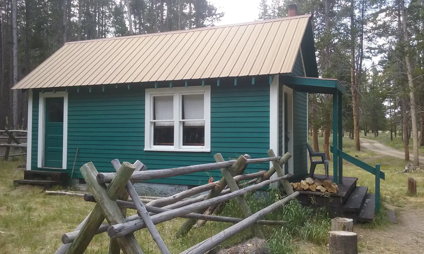
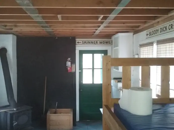
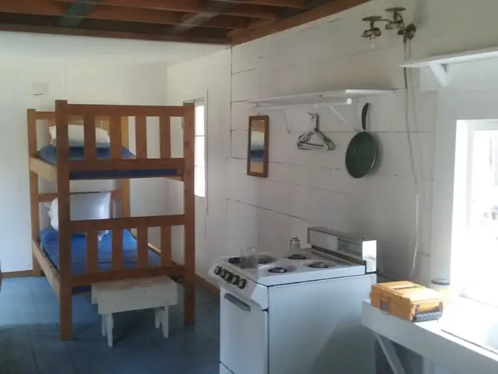
Overview Bloody Dick Cabin, named after the English Trapper Richard "Bloody" Leigh, is a small wood frame cabin. Nestled in the evergreens near Reservoir Lake in Southwestern Montana's Bitterroot Mountains - the cabin is available for rental year-round. Popularity peaks during the summer and fall seasons with hikers, ohv enthusiasts, and big game hunters. During spring and winter, the nearby lake freezes promoting ice fishing while several area winter trails offer cross-country skiing and snowmobiling. During the snow free season- the cabin is accessible by passenger vehicle, however some portions are gravel, dirt and rock, making it rough and slow going. Snow conditions limit mobility in the area. Depending on the snow levels, renters may need to travel up to 23 miles by snowmobile or skis to reach the cabin. Renters are responsible for their own travel arrangements and safety, and must bring several of their own amenities. There is no cell phone coverage in the area. Recreation Fishing is available in Bloody Dick Creek, as well as on nearby Reservoir Lake - where non-motorized boats are welcome. Anglers might catch a variety of trout, including Rainbow or Brown. Montana fishing licenses are required. All boats must be inspected and registered - to reduce the spread of aquatic nussiances. Hiking and mountain biking are popular at nearby trailheads. Trails include to the Nez Perce National Historic Trail, Lewis and Clark National Historic Trail and the Continental Divide National Scenic Trail. Snowmobiling, cross country skiing and snowshoeing are popular in the area throughout the winter. Obtaining the South Beaverhead National Forest Map will aid in navigating the forest's roads and trails. Maps are available electronically (for mobile devices) or in paper form via a computer at http://www.fs.usda.gov/bdnf. Maps are also available at the Dillon District Office located at 420 Barrett Street Dillon, MT 59725 (406) 683-3958. Office hours are Monday - Friday 7:30 - 4:30. Facilities The small one-room cabin sleeps four and has two bunkbeds with mattresses. A table and chairs, small wood burning stove and a propane cook stove are provided, as well as cooking and eating utensils, shovel, bucket and cleaning equipment. Firewood is provided, but not guaranteed . Please be conservative with wood, this will help us maintain the supply for heating purposes. An axe is provide but do not split wood inside the cabin or on the porch. Finally, if the wood supply is low please call the Dillon Ranger District at (406) 683-3900 and leave a message if calling outside of regular business hours. The cabin has no electricity. Water is available for drinking during June through the end of September. A small sink and faucet provide water inisde the cabin. Please refreain from plugging up the sink drain with food scraps as there's no disposal and the drain will easily clog if not treated with respect. An outhouse with a vault toilet is provided. The cabin has s small oven stovetop. Renters must remember to light all three of the pilots, two on the stovetop and one at the rear bottom of the oven. FAILURE TO LIGHT THE REAR BOTTOM OVEN PILOT - has resulted in renters leaking propane into the cabin. Renters will need to bring their own bedding, matches or lighters, toilet paper and garbage bags, among other necessities. Garbage and cleaning services are not provided. Guests should replenish the supply of split wood and kindling, and clean the cabin prior to leaving. Natural Features The cabin is located beneath the Continental Divide in a Lodgepole Pine Forest. Access from Highway 278 places the cabin around 25 miles south of Jackson, Montana. Access from Highway 324 is a similar distance northwest of Grant, MT. It is situated next to Bloody Dick Creek at an elevation of about 7,100 feet. The creek is fed by cold water springs in the area. A variety of shorebirds can be seen near the winding creek and plenty of wildlife make their home in the area as well. Bears, both Black and Grizzly, are present in the area - proper Food Storage is a REQUIRED. Reservoir Lake is about a mile north of the cabin. The 11-acre lake is equipped with a primitive boat ramp. A small campground sits on the edge of the lake.
From the USFS.Official page
Is BLOODY DICK CABIN free?
No. BLOODY DICK CABIN charges a fee. It is managed by the USFS. Sites are reservable through recreation.gov.
How do I get to BLOODY DICK CABIN?
The cabin is located 23 miles south of Jackson, MT. There are two ways to access the cabin. From Dillon: Take Interstate 15 from Dillon and continue 19 miles. Turn Right (West) onto Highway 324 at Clark Canyon Reservoir. Continue 19 miles to Red Butte, 7 miles west of Grant. Turn North on the Bloody Dick Road FS #181. Continue approximately 19 miles to the junction at Reservoir Lake Campground. Take the left fork over Bloody Dick Creek and continue to bear left through the woods for about a mile until you reach the cabin. From Jackson: Take Bloody Dick Road #181 South from Jackson, MT. In the winter this is a snowmobile route. Continue approximately 23 miles to Reservoir Lake Campground. Turn right and continue to the creek. Cross the creek and bear left for about a mile. Snow levels vary each year and affect these roads. Please call the Dillon Ranger Station (406)683-3900 for road conditions ahead of your trip.
What are the rules at BLOODY DICK CABIN?
Livestock prohibited.
Nearby
SourceData from the USFS. Last synced September 19, 2026. Community reports and photos are submitted by travelers and are not verified by the agency.
