
TUTTLETOWN RECREATION AREA
Campground · Fee not listed
Fast facts
- Cost
- Not listed. Check locally.
- Type
- Campground
- Phone
- 209-536-9094
- Nearest dump station
- Indian Creek Camp Ground-Trailer Dump Site · 65.4 mi
- Nearest water fill
- Indian Creek Camp Ground-Potable Water · 65.7 mi
- Coordinates
- 37.9839, -120.5081
- Last verified
- September 19, 2026
About this place
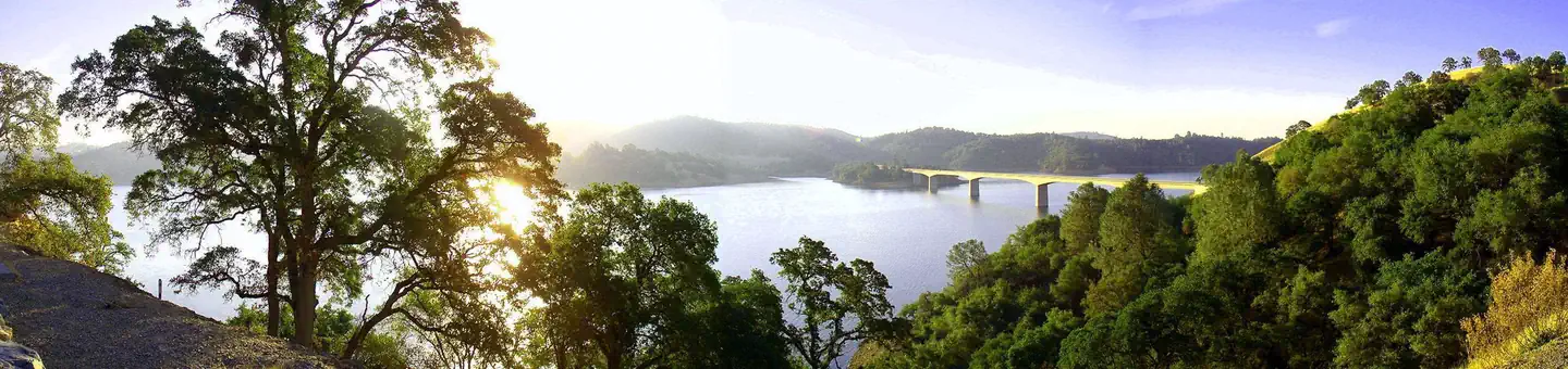
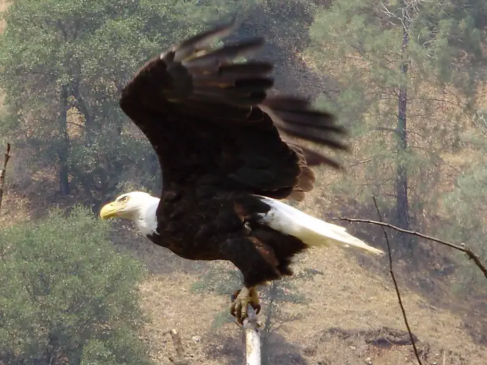
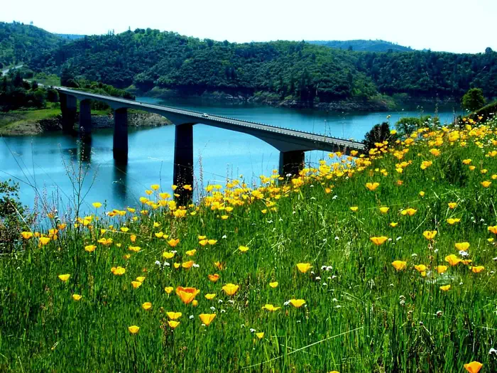
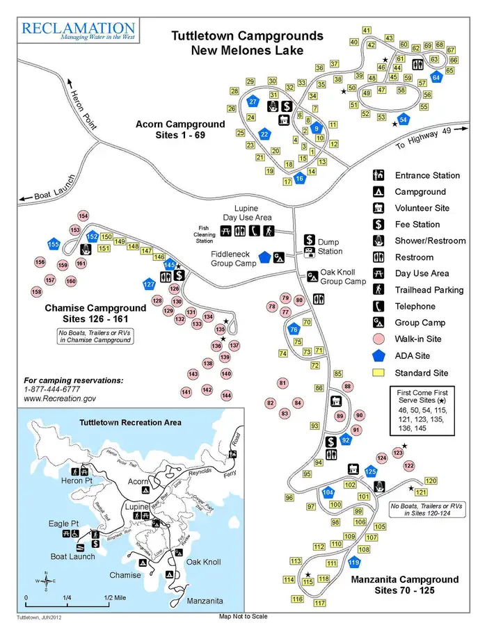
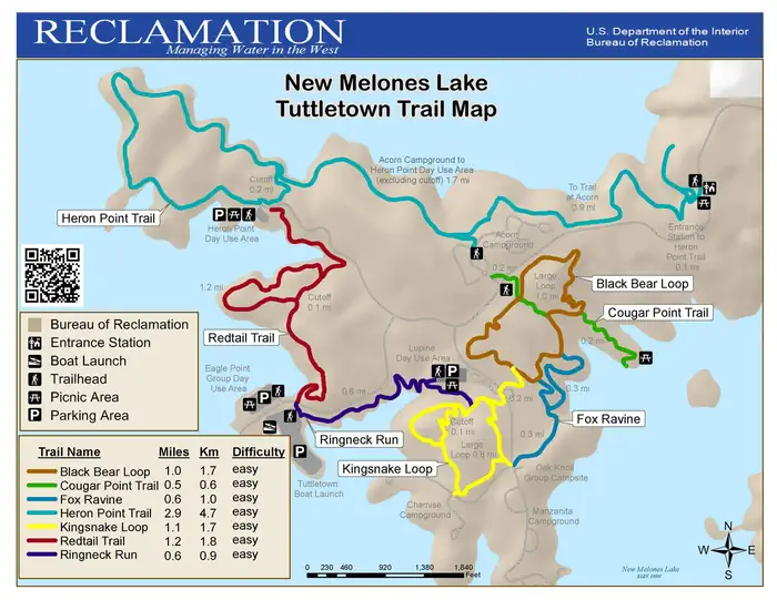
Overview Tuttletown Recreation Area is located at New Melones Lake on the Stanislaus River. The 12,500 surface-acre lake is the fourth largest reservoir in California and is situated along the edge of the Mother Lode, the rich gold vein that prompted the California Gold Rush of 1849. At an elevation of 1100 feet, the Foothill Oak Woodlands hug the 100 miles of shoreline. Popular activities on and around the large lake include fishing, boating, water skiing, wake boarding, jet skiing, sailing, swimming, kayaking, canoeing, wildlife viewing, rock climbing, hiking, biking, and picknicking. The New Melones Visitor Center offers year-round interpretive events and a museum highlighting natural and cultural resources. *COMING APRIL 2021: A new disc-golf course is being constructed and will be available for play! Recreation Hiking, fishing, wakeboarding, waterskiing, boating, sailing and biking are just some of the activities available in Tuttletown Recreation Area. Equestrian trails are also present in the Peoria Wildlife Mitigation Area and open for the general public. Camping is also permitted in designated campsites. Other interesting sites include Natural Bridges, which can be accessed from Parrott's Ferry Road. It has a hiking trail and creek that flow through a marble cave. The Table Mountain Trail provides visitors an opportunity to hike to the top of an extensive lava flow which occurred over nine million years ago. Facilities The campground provides modern conveniences like flush toilets, showers and water spigots. Visitors will also find a fish cleaning station and electric vehicle charging station in the Lupine day use area. Picnic tables and fire rings are provided at each campsite. Recreation Area entrance gates close at 9:00 PM, and open at 4:00 AM. Exit gates are never closed. Natural Features New Melones Lake is located in Northern California between the historic gold rush towns of Sonora and Angels Camp. The terrain varies from rolling hills to steep marble cliffs, and the vegetation consists of oaks, Ponderosa pines, chamise and buckbrush shrubs. Visitors can experience the beauty of New Melones by hiking the many trails in the Tuttletown and Glory Hole Recreation Areas. The climate is Mediterranean with warm, dry summers and cool, wet winters. For those who wish to venture outside the main recreation areas, there are many unique places to visit. Overall, the geography is quite varied and provides many opportunities for all types of recreation. Contact Info For facility specific information, please call (209) 459-7290. Nearby Attractions Tuttletown Recreation Area is surrounded by countless places of natural beauty, including Natural Bridges, Camp Nine, Yosemite National Park, Stanislaus National Forest, Moaning Caverns, Big Trees State Park and Columbia State Park. Angels Camp Museum, Calaveras County Museum and Sonora Military Museum provide great opportunities for learning interesting information about the area. Surrounding communities are popular vacation and retirement destinations and provide necessary services and shopping opportunities. Golfing, snow skiing, river rafting, commercial caves, historical railroad and Native American museums are also located nearby. Charges & Cancellations All site changes and cancellations need to be done through the Recreation.gov website.
From the managing agency.
Is TUTTLETOWN RECREATION AREA free?
We do not have a fee on record for TUTTLETOWN RECREATION AREA. Confirm the cost locally before you go.
How do I get to TUTTLETOWN RECREATION AREA?
TUTTLETOWN RECREATION AREA is at 37.9839, -120.5081. We do not hold written directions for this one, so navigate to the coordinates.
Nearby
- GLORY HOLE RECREATION AREA2.4 mi
- Hacienda Campground17.9 mi
- COYOTE POINT18.4 mi
- OBSERVATION POINT PICNIC SHELTER (CA)20.4 mi
- DEER FLAT BOAT IN CAMPGROUND20.4 mi
- ACORN CAMPGROUND20.7 mi
- OAK KNOLL CAMPGROUND21.1 mi
- Sand Bar Flat Campground23.6 mi
- Indian Creek Camp Ground-Trailer Dump Site65.4 mi
- Indian Creek Camp Ground-Potable Water65.7 mi
SourceSource data is agency published. Last synced September 19, 2026. Community reports and photos are submitted by travelers and are not verified by the agency.
