
SAN MIGUEL ISLAND
Campground · Fee not listed
Fast facts
- Cost
- Not listed. Check locally.
- Type
- Campground
- Phone
- 805-658-5730
- Coordinates
- 34.0406, -120.3491
- Last verified
- September 19, 2026
About this place
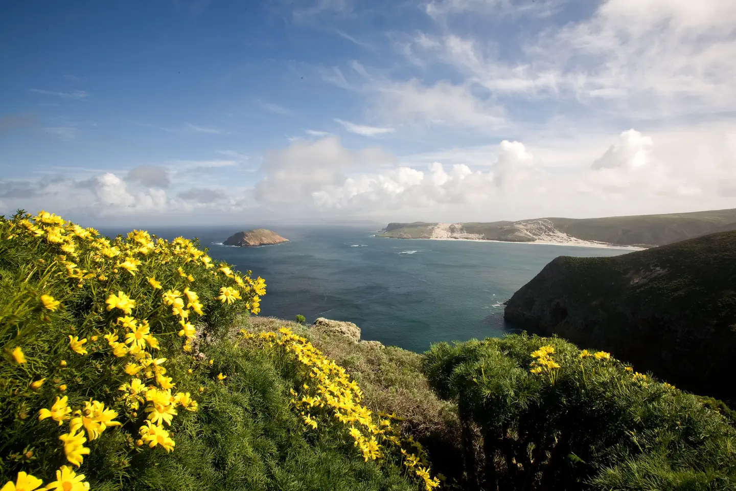
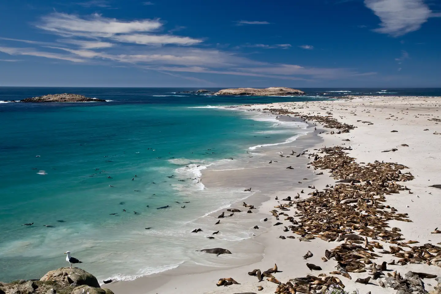
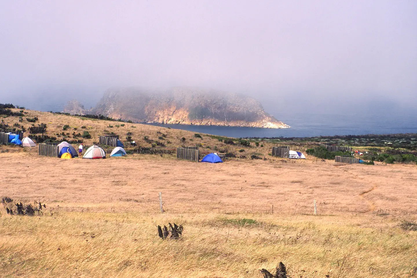
Overview Wind and weather constantly sweep across the North Pacific to batter the shores of this westernmost of all the islands. This extreme weather creates a harsh but profoundly beautiful environment. Although it can be challenging to reach the San Miguel Island Campground, it's always worth the effort. Perched on a plateau, the campground offers incredible island views and access to a variety of recreational activities and unique natural and cultural resources. Although a century's worth of sheep ranching and overgrazing caused scientists in 1875 to describe the island as "a barren lump of sand," with the grazing animals removed, vegetative recovery is in progress. Giant coreopsis, dudleya, locoweed, lupine, buckwheat, coastal sagebrush, and poppies are all recolonizing the island to their former extent, returning San Miguel to its more natural state. Also making a comeback, after years of hunting, are the thousands of pinnipeds (seals and sea lions) that breed, pup, and haul out on the island's 27 miles of isolated coastline. Other wildlife include a variety of landbirds, 13 nesting seabird species, and unique animals like the island fox and deer mouse. Both of these little creatures are endemics -- they are found only on the Channel Islands. In addition to the variety of natural resources, San Miguel hosts an array of cultural resources as well. The Chumash and their ancestors lived on San Miguel almost continuously for nearly 12,000 years. Juan Rodriguez Cabrillo and his men laid eyes on San Miguel Island in 1542 which is commemorated by a monument on the island. Other outstanding island resources that visitors may experience on San Miguel include the caliche forest (sand-castings of ancient vegetation), fossil bones of the Pleistocene pygmy mammoths that stood four to six feet at the shoulders, 150 years of ranching history and numerous shipwrecks. Recreation A permit (including liability waiver) is required to visit the island. If you are traveling to San Miguel Island with Island Packers, Channel Islands Aviation, or Truth Aquatics, they will provide the forms to you upon your reservation. Private boaters can obtain the forms at a self-registration station at the Nidever Canyon trailhead entry on San Miguel Island. Several trails traverse San Miguel Island providing visitors with spectacular hiking opportunities. While many parts of the island are closed to protect wildlife, fragile plants, and geological features, several areas are open for you to explore. Visitors may explore the two-mile-long Cuyler Harbor beach and one-mile-long trail to the ranger station on their own. To see other parts of the island, such as Point Bennett or the caliche forest, you must go with a ranger or volunteer. If arriving with a concessionaire, park staff are usually available to offer guided hikes. However, there is no guarantee that hikes will be offered to all locations. Visitors must coordinate with island staff upon arrival. All hikers must stay on the trails to protect fragile vegetation and for visitor safety. No off-trail hiking is allowed. Due to the strong, persistent wind, swimming, snorkeling, diving and kayaking are limited and recommended for the experienced visitor only. In addition, landing and beach access is only allowed at Cuyler Harbor. No fishing is allowed within the marine reserves located around the island. Fishing is allowed outside of these areas. For more information about recreational activities in the park, visit https://www.nps.gov/chis/planyourvisit/index.htm . Facilities A one mile, steep uphill hike from the boat landing in Cuyler Harbor to the 9-site campground is required. If you fly in, then its a short, flat 1/4 mile hike. Camping is primitive and campers must bring their own food, equipment and water. Picnic table, five-foot tall windbreak, food storage box and pit toilet are provided. Natural Features The 9,500-acre island is a plateau at 500 feet in elevation, with two 800-ft. rounded hills and 27 miles of coastline. As the westernmost island in the park, the weather can be windy anytime of the year -- 30 knots of wind is not uncommon. Nearby Attractions Despite the wind, Cuyler Harbor (one-mile from the campground) is one of the most scenic beaches in the park. Beach access is only allowed at Cuyler Harbor. The guided, 16-mile roundtrip hike to Point Bennett requires some stamina, but visitors are rewarded with the chance to see one of the largest congregations of wildlife in the world-over 30,000 animals and up to five different species. All hikers must stay on the trails for visitor safety and to protect fragile vegetation and nesting seabirds. No off-trail hiking is allowed.
From the managing agency.
Is SAN MIGUEL ISLAND free?
We do not have a fee on record for SAN MIGUEL ISLAND. Confirm the cost locally before you go.
How do I get to SAN MIGUEL ISLAND?
SAN MIGUEL ISLAND is at 34.0406, -120.3491. We do not hold written directions for this one, so navigate to the coordinates.
Nearby
- San Miguel Island Campground0.0 mi
- SANTA ROSA ISLAND BACKCOUNTRY BEACH CAMPING15.5 mi
- Santa Rosa Island Backcountry Beach Camping17.2 mi
- SANTA ROSA ISLAND17.6 mi
- Water Canyon Campground17.6 mi
- Del Norte Backcountry Campground39.6 mi
- SANTA CRUZ ISLAND DEL NORTE BACKCOUNTRY39.6 mi
- SANTA CRUZ ISLAND SCORPION45.2 mi
No other services within 50 mi on the record.
SourceSource data is agency published. Last synced September 19, 2026. Community reports and photos are submitted by travelers and are not verified by the agency.
