
South Brush Creek Campground (WY)
Campground · Fee
Fast facts
- Cost
- Fee charged
- Type
- Campground
- Phone
- (307) 326-5258
- Nearest dump station
- Rocky Mountain National Park Dump Station · 82.8 mi
- Coordinates
- 41.3443, -106.5029
- Last verified
- September 19, 2026
About this place
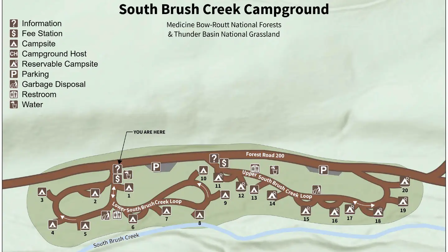
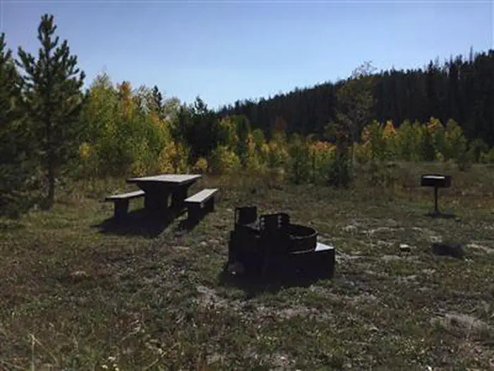
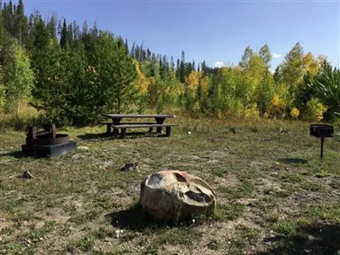
Overview South Brush Creek Campground is located on the west side of the Snowy Range along the shore of South Brush Creek and is a sunny campground composed of two sections located in a dense stand of Lodgepole pines, fir and Aspen trees next to South Brush Creek. The campground has 20 sites, with 6 pull-through sites for trailers under 25 feet. Amenities include picnic tables, fire grates, toilets, trash service, and a camp host on site, and water is available late May through mid September. Pets are allowed but must be kept on a leash no longer than 6 feet and under control at all times. Many hiking, OHV, and fishing opportunities are available in the area Recreation The Snowy Range area in the Medicine Bow National Forest is located in southeast Wyoming. The Laramie Ranger District, Brush Creek/Hayden Ranger District, and Parks Ranger District manage portions of the Snowy Range. Year-round recreation uses include hiking, fishing, hunting, snowmobiling, skiing, OHV riding, camping, and biking. Primary access across the Snowy Range is by Highway 130, known as the Snowy Range Scenic Byway. Mountain Biking Areas for Mountain Biking at Snowy Range Area Bow River Campground Deep Creek Campground French Creek Campground French Creek Canyon Trail Keystone Cabins Lake Owen Trailhead Little Brooklyn Guard Station Little Laramie Trailhead North Fork Campground Pinkham Mountain Trailhead Rock Creek Trailhead Sheep Lake Trailhead Snow Survey Cabin Spruce Mountain Fire Lookout Tie Hack Lower Trailhead Tie Hack Upper Trailhead Tipple Trail Trailhead Mountain Climbing Areas for Mountain Climbing at Snowy Range Area Lewis Lake Picnic Site Libby Lake Picnic Site Day Hiking Areas for Day Hiking at Snowy Range Area Brooklyn Lake Campground Brush Creek Trails Chimney Park Trailhead Corner Mountain Trailhead Crater Lake Trailhead Deep Creek Campground Deep Lake Trail Dipper Lake Trail French Creek Campground French Creek Canyon Trail Green Rock Parking Lot Green Rock Picnic Site Keystone Cabins Lake Owen Trailhead Lakes Trailhead Lewis Lake Picnic Site Libby Lake Picnic Site Little Brooklyn Guard Station Little Laramie Trailhead Meadow Falls Trailhead Miner's Cabin Trailhead North Fork Campground Platte River Wilderness Quealy Lake Trailhead Rock Creek Trailhead Routt Access Trailhead Ryan Park Campground Savage Run Wilderness Sheep Lake Trailhead Silver Lake Campground Silver Lake Trailhead Six Mile Trailhead Snow Survey Cabin South Brush Creek Campground Spruce Mountain Fire Lookout Sugarloaf Campground Tie Hack Lower Trailhead Tie Hack Upper Trailhead Tipple Trail Trailhead West Lake Marie Backpacking Areas for Backpacking at Snowy Range Area Crater Lake Trailhead Deep Lake Trail Dipper Lake Trail Lakes Trailhead Lewis Lake Picnic Site Libby Lake Picnic Site Platte River Wilderness Quealy Lake Trailhead Rock Creek Trailhead Savage Run Wilderness Sheep Lake Trailhead Six Mile Trailhead Viewing Wildlife Areas for Viewing Wildlife at Snowy Range Area Brooklyn Lake Campground Keystone Cabins Libby Flats Observation Site Little Brooklyn Guard Station Snow Survey Cabin Spruce Mountain Fire Lookout Tipple Trail Trailhead Facilities South Brush Creek Campground has sites able to accommodate tents, trailers and RVs. Sites are equipped with picnic tables and campfire rings. The campground also offers vault toilets, trash receptacles, and potable water. Natural Features South Brush Creek Campground is situated in a pine, fir and aspen forest forest on the shores of South Brush Creek in the Medicine Bow National Forest in south-central Wyoming. Black bear, bobcat, coyote, elk, mule deer and moose are just some of the many animals that inhabit these rich and diverse lands. Nearby Attractions The Snowy Range Scenic Byway is a 29-mile stretch of paved road crosses through spectacular alpine habitats.
From the managing agency.
Is South Brush Creek Campground (WY) free?
No. South Brush Creek Campground (WY) charges a fee.
How do I get to South Brush Creek Campground (WY)?
South Brush Creek Campground (WY) is at 41.3443, -106.5029. We do not hold written directions for this one, so navigate to the coordinates.
Nearby
SourceSource data is agency published. Last synced September 19, 2026. Community reports and photos are submitted by travelers and are not verified by the agency.
