
Esterbrook Campground
USFS · Campground · Dispersed · Fee
Fast facts
- Cost
- Fee charged
- Managed by
- USFS
- Type
- Campground
- Reservations
- fs.usda.gov
- Phone
- 307-358-4690 Douglas RD
- Coordinates
- 42.4222, -105.3216
- Last verified
- September 19, 2026
About this place
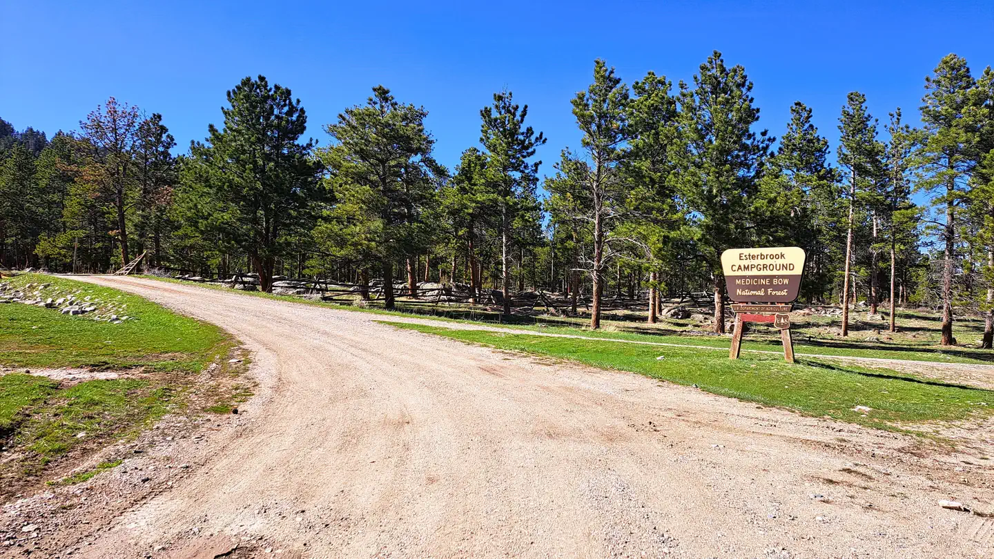
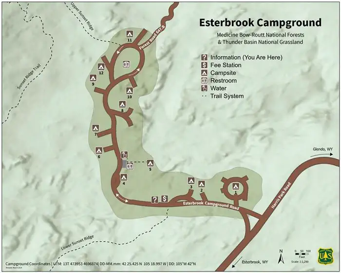
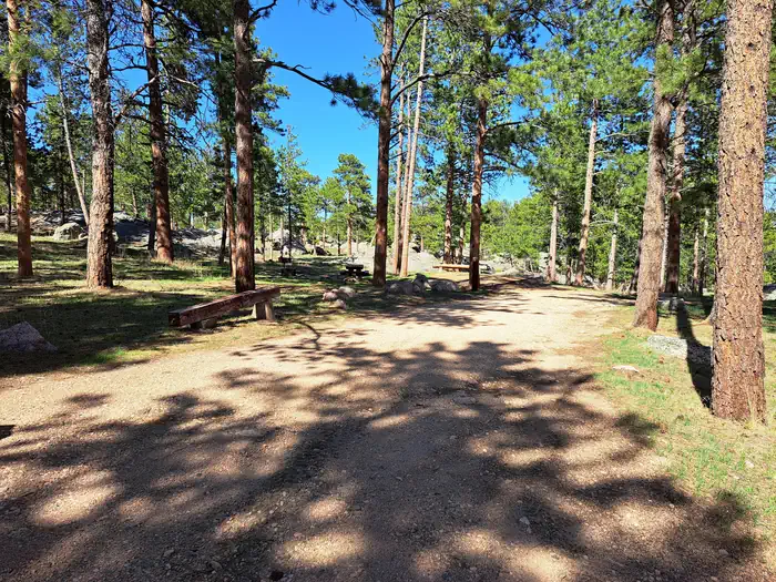
Overview Esterbrook Campground is nestled within a pine forest along a broad ridge north of Laramie Peak. A favorite of both RV and tent campers, it is a terrific jumping-off point for recreating in the Laramie Peak Unit of the Douglas Ranger District. The campground is popular for OHV riding, fishing, hiking, hunting, and mountain biking. Recreation Recreation The Laramie Peak area in the Medicine Bow National Forest is located in Central Wyoming. The Douglas Ranger District manages the Laramie Peak and Thunder basin National Grasslands areas. Year-round recreation uses include hiking, fishing, hunting, OHV riding, camping, biking and horseback trail riding. Primary access across the district is by I-25 and Highway 59. Mountain Biking • Upper Roaring Fork Trail • Friend Park Trail • North Laramie River Trail • Harris Park Trail • Laramie Peak Trail • Sunset Ridge Trail • Lost Creek Trail • Albany Peak Trails • Black Mountain Look out Mountain Climbing • Curtis Gulch Trail Day Hiking • Upper Roaring Fork Trail • Friend Park Trail • North Laramie River Trail • Harris Park Trail • Laramie Peak Trail • Sunset Ridge Trail • Lost Creek Trail • Albany Peak Trails • Black Mountain Look out Backpacking • Upper Roaring Fork Trail • North Laramie River Trail • Harris Park Trail • Lost Creek Trail • Albany Peak Trails Horseback riding • Upper Roaring Fork Trail • Friend Park Trail • North Laramie River Trail • Harris Park Trail • Laramie Peak Trail • Sunset Ridge Trail • Lost Creek Trail • Black Mountain Look out Horseback riding • Upper Roaring Fork Trail • Friend Park Trail • North Laramie River Trail • Harris Park Trail • Laramie Peak Trail • Sunset Ridge Trail • Lost Creek Trail • Albany Peak Trails • Black Mountain Look out OHV Riding • FSRD633 Trails • Sunset Ridge Trail • North Laramie River Trail • Laramie Peak Trail • Albany Peak trails • Black Mountain Look out Facilities There are 12 campsites in a lightly wooded, rocky area with picnic tables, fire rings, pedestal grills, vault toilets, trash collection, and potable water. Most campsites have a dispersed feel as they are widely spaced apart. Potable water is typically available in this campground from mid-May to late November. These dates may vary due to weather. Potable water availability may vary due to well and/or pump maintenance, and water testing requirements. As such, we encourage you to bring your own potable water or call ahead. Natural Features Located at an elevation of 6,300 feet, the campground sits in an open forest of ponderosa pine. The Laramie Peak Unit of the Medicine Bow-Routt National Forests and Thunder Basin National Grassland encompass approximately 352,000 acres of the Laramie Range in central Wyoming. Mule deer, elk, black bear, whitetail deer, antelope, bald eagles, gos hawks, bobcat, coyote, big horned sheep, yellow-bellied marmots, and mountain lions are just some of the many animals that inhabit the diverse lands on Laramie Peak. Nearby Attractions Visitors can find many outdoor opportunities in the surrounding area including OHV riding, hiking, backpacking, mountain biking, hunting, fishing, sightseeing, photography, and horseback riding. Fishing opportunities nearby at Lower Horseshoe Creek. Sunday services available nearby at the historic Esterbrook Community Church (non-denominational). Charges & Cancellations If I book this reservation today, what are my options to change or cancel? Please remember that reservations at these facilities prevent other visitors from using these sites. Planned changes to your stay should be made as far in advance as possible. You can make changes to your reservation ahead of your arrival date in My Reservations. Changes If your new stay dates are completely different from your original stay dates, there is a $10 change fee (per reserved site). There are no additional fees for: Adding or removing nights to your stay. Changing to a different campsite. Balances will adjust based on your new stay's nightly rate. Cancellations You can cancel the reservation any time before the date of your scheduled arrival. You will receive a refund for your stay, minus the following fees: $10 cancellation fee Any reservation fees (only if paid when booking) Any previous change fees Late cancellation penalties may also apply: What is “Late”? For individual campsites, a late cancellation applies starting from midnight 1 calendar day before your scheduled check-in. For cabins and group sites, a late cancellation applies starting from midnight 14 calendar days or fewer before your scheduled check-in. Late Fee In addition to the fees listed above, a late cancellation will also subtract your first night's recreation use fee from any refund owed. As of the expected check-in day, cancellations or changes to your stay are not possible through My Reservations. It is at the facility's discretion to support additional Late Cancellations, No Show, or Early Departure updates – on-site personnel may not be able to assist. These changes carry penalties and may forfeit recreation use fees. For additional details, please visit here. Scan and Pay Rules The above guidance for modifications, cancellations, and refunds do not apply to campsites reserved using the Scan and Pay feature. There are no refunds, modifications, cancellations, or other fee changes allowed with Scan and Pay payments. This system is the same as putting cash into a fee tube and cannot be refunded.
From the USFS.
Is Esterbrook Campground free?
No. Esterbrook Campground charges a fee. It is managed by the USFS. Sites are reservable through fs.usda.gov.
How do I get to Esterbrook Campground?
From Douglas, take WY 94 16.4 miles to a Y intersection with County Road 5/Esterbrook Rd. Bear left onto Esterbrook Rd. and go 10.8 miles to the Esterbrook Work Center at a Y intersection with Forest Route 633. Continue straight on FR 633 and go 0.2 miles through a small community to another Y intersection. Bear left, staying on FR 633; go 3 miles to campground.
What are the rules at Esterbrook Campground?
No horses. OHV use inside the campground for coming/going from campsite or through traffic only. Wyoming State OHV stickers are required for driving any Forest Service OHV trails. Accessible fishing platform.
Nearby
- Friend Park Campground14.2 mi
- Curtis Gulch Campground15.4 mi
- LA PRELE GUARD STATION26.3 mi
- Campbell Creek Campground26.4 mi
No other services within 50 mi on the record.
SourceData from the USFS. Last synced September 19, 2026. Community reports and photos are submitted by travelers and are not verified by the agency.
