
Marble Mountain Group Picnic Site
Campground · Fee
Fast facts
- Cost
- Fee charged
- Type
- Campground
- Phone
- 360-449-7800
- Nearest dump station
- Bumping Lake Dump Station · 64.8 mi
- Coordinates
- 46.1307, -122.1698
- Last verified
- September 19, 2026
About this place
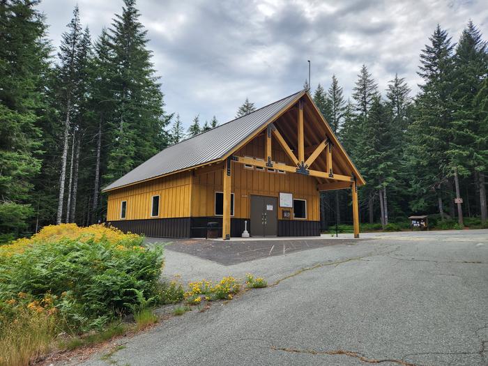
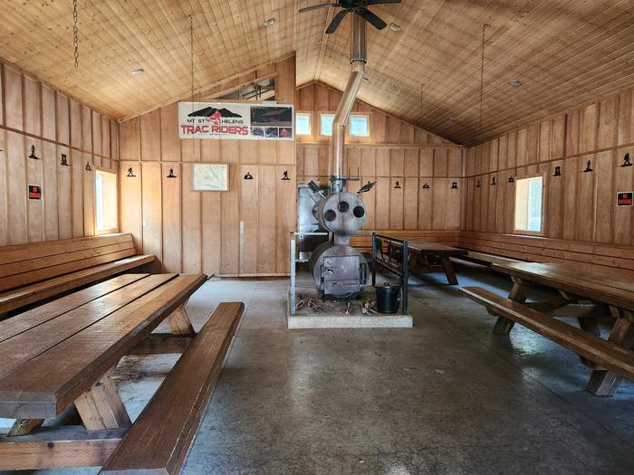
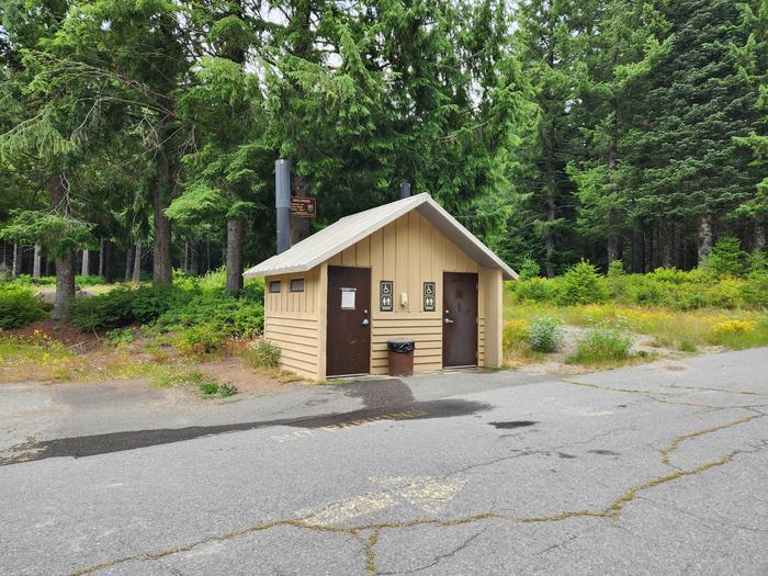
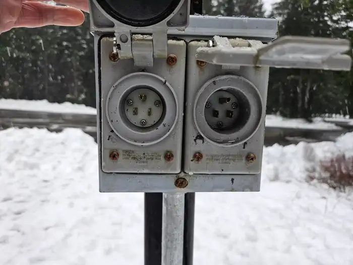
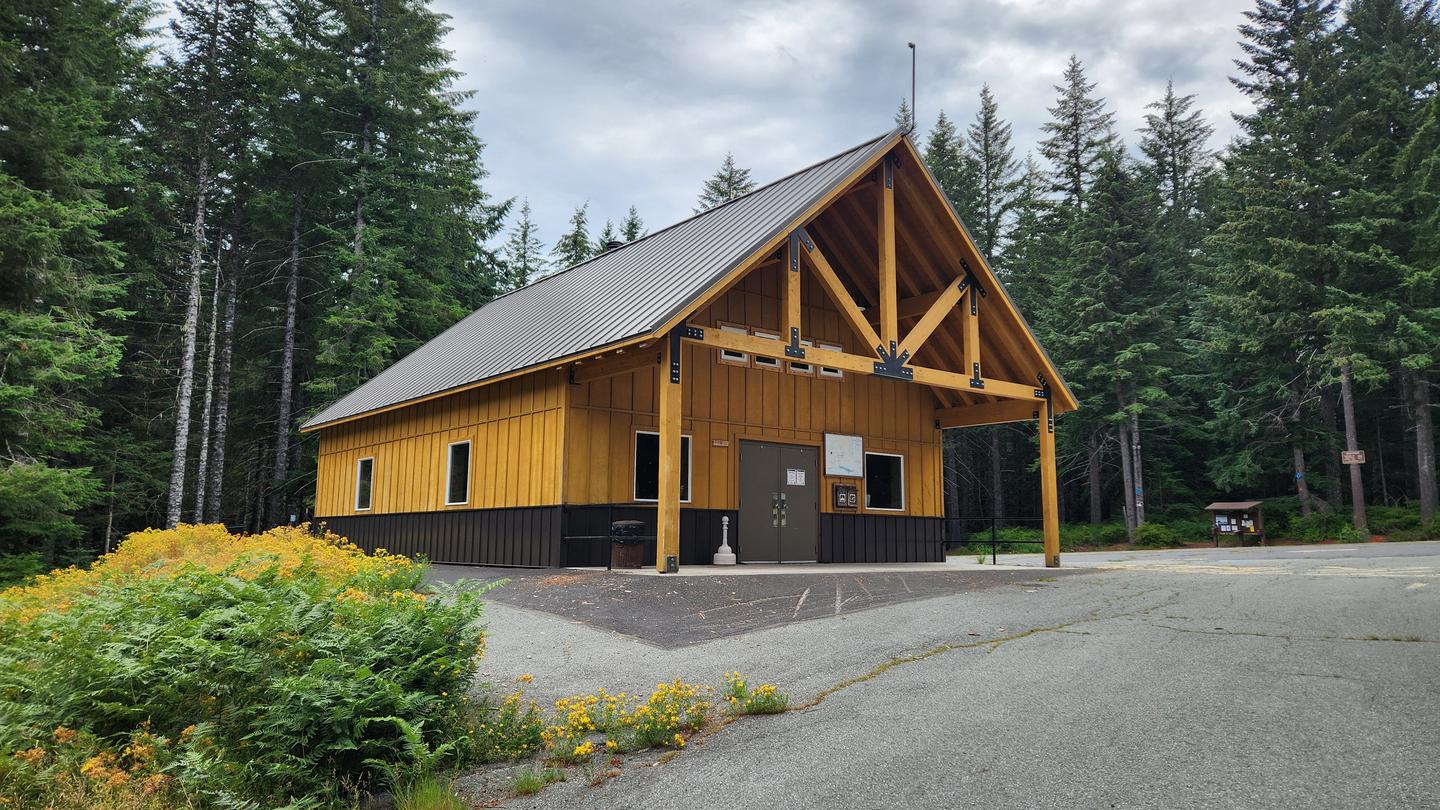
Overview Marble Mountain Group Picnic Site is on the Gifford Pinchot National Forest and is located at the Marble Mountain SnoPark on the south side of Mount St. Helens. A part of the WA State Sno-Park program in the winter months, Marble Mountain Group Picnic Site is offered as a day use group picnic area Saturdays only, May - September. (The site may be available for reservation as early as April or as late as June depending on conditions, i.e., whether there is snow on the ground or not). This site is a great location for a family reunion, birthday gathering or outdoors group meeting. The 1000 square foot shelter, built in 2018, contains three large picnic tables and a wood stove for heating. There is no potable water available at this site. The shelter is wired for electricity to power the lights, outlets and fans; you must provide your own generator and 110 V connector cord (see photos). This shelter is maintained by the US Forest Service in cooperation with a volunteer organization. Recreation During the summer, the Marble Mountain recreaiton site provides trailhead access to the Worm Flow climbing route, the Loowit trail, and several cross-country hiking and mountain biking loop trails such as the Pine Marten, Fir, Silver and Pika Trails. Nearby trailheads include June Lake, Ape Canyon and Lava Canyon. The site is also close to the Lahar Viewpoint along Forest Road 83. Ape Cave is also nearby and makes for a great family experience (tickets required, open May-October). Facilities Facilities available include a 1000 square foot accessible shelter with picnic tables and a wood stove. There is an accessible CXT vault toilet in the parking area. There is abundant parking for vehicles and trailers. The area is gated closed to the public in the summer; only your group will have access to the shelter. The facility is for day use only, 9 AM to 9 PM; no overnight use is allowed. Natural Features Marble Mountain Group Picnic Site is on the Gifford Pinchot National Forest, tucked away in the Douglas fir trees at 2700 feet in elevation. Nearby Attractions Marble Mountain Group Picnic Site is located near the south entrance to Mount St. Helens National Volcanic Monment. Also along Forest Road 83 is Lahar Viewpoint, an interpretive site where you can view and learn about the power of the 1980 Mount St. Helens eruption. Douglas fir and pine trees are slowly reestablishing themselves on the landscape devastated by the landslide from one of Mount St. Helen's glaciers during the eruption. Other nearby attractions include the Trail of Two Forests boardwalk, Ape Cave Interpretive Site, June Lake and Lava Canyon Trails.
From the managing agency.
Is Marble Mountain Group Picnic Site free?
No. Marble Mountain Group Picnic Site charges a fee.
How do I get to Marble Mountain Group Picnic Site?
Marble Mountain Group Picnic Site is at 46.1307, -122.1698. We do not hold written directions for this one, so navigate to the coordinates.
Nearby
SourceSource data is agency published. Last synced September 19, 2026. Community reports and photos are submitted by travelers and are not verified by the agency.
