
HEYBROOK LOOKOUT
USFS · Campground · Fee
Fast facts
- Cost
- Fee charged
- Managed by
- USFS
- Type
- Campground
- Hours
- reservation only
- Reservations
- recreation.gov
- Phone
- 360-677-2414
- Nearest dump station
- Bumping Lake Dump Station · 66.8 mi
- Coordinates
- 47.8084, -121.5352
- Last verified
- September 19, 2026



About this place
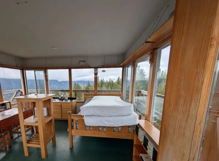
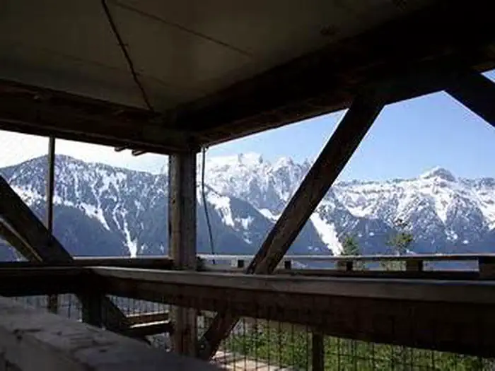
Overview The Heybrook Lookout sits atop its namesake ridge at 1,700 feet. The lookout itself rises 67 feet above the ridgeline and provides spectacular views of breathtaking glacial peaks surrounding the valley. The first Heybrook fire lookout was a simple tent platform built in 1925. The Forest Service replaced it seven years later with a 45-foot log leg tower, with a ground-level cabin intended as sleeping quarters for fire rangers; however, rampant rodents eventually drove the rangers up into the tower where they lived until a 67-foot lookout was built in 1964. Heybrook Lookout is one of only 106 lookouts left in Washington State. Recreation Hiking, birding and wildlife viewing are popular activities around the lookout. Facilities The 14 x14-ft. lookout cabin sleeps four and is furnished with one twin-sized bed with mattress, two additional floor mattresses, a table and chairs, propane stove, pot, pan, silverware, coffee pot and battery operated lanterns. A primitive vault toilet is located several hundred feet down the ridge from the lookout. There is a picnic table at the bottom of the tower. There is no water at the site. Guests must bring water for drinking, cooking and washing. Guests must also bring flashlights, sleeping bags, towels, dish soap, matches, a first aid kit, toilet paper and garbage bags. All trash and food must be packed out, and guests are expected to clean the cabin before leaving Natural Features On a clear day, guests at Heybrook Lookout see views of Mount Index and Bridal Veil Falls, Mount Baring, Mount Persis and the Wild Sky Wilderness. Wildlife is abundant, and guests may catch a glimpse of black bears, bobcat, elk or bald eagle. Wolves are making a comeback to the area, but they are usually heard and not seen. Contact Info For facility specific information, please call (360) 677-2414. Nearby Attractions Deception Falls Picnic Area, Lake Serene/Bridal Veil Falls hikes, and the Iron Goat historic interpretive trail.
From the USFS.Official page
Is HEYBROOK LOOKOUT free?
No. HEYBROOK LOOKOUT charges a fee. It is managed by the USFS. Sites are reservable through recreation.gov.
How do I get to HEYBROOK LOOKOUT?
Drive US Highway 2 to the boundary of Mt. Baker-Snoqualmie National Forest at milepost 37.5, just east of the town of Index turnoff.
Nearby
SourceData from the USFS. Last synced September 19, 2026. Community reports and photos are submitted by travelers and are not verified by the agency.
