
Little Rock Campground
USFS · Campground · Fee
Fast facts
- Cost
- Fee charged
- Managed by
- USFS
- Type
- Campground
- Reservations
- fs.usda.gov
- Nearest dump station
- Soldier Creek Comfort Station · 42.5 mi
- Coordinates
- 39.5443, -111.1640
- Last verified
- September 19, 2026
About this place
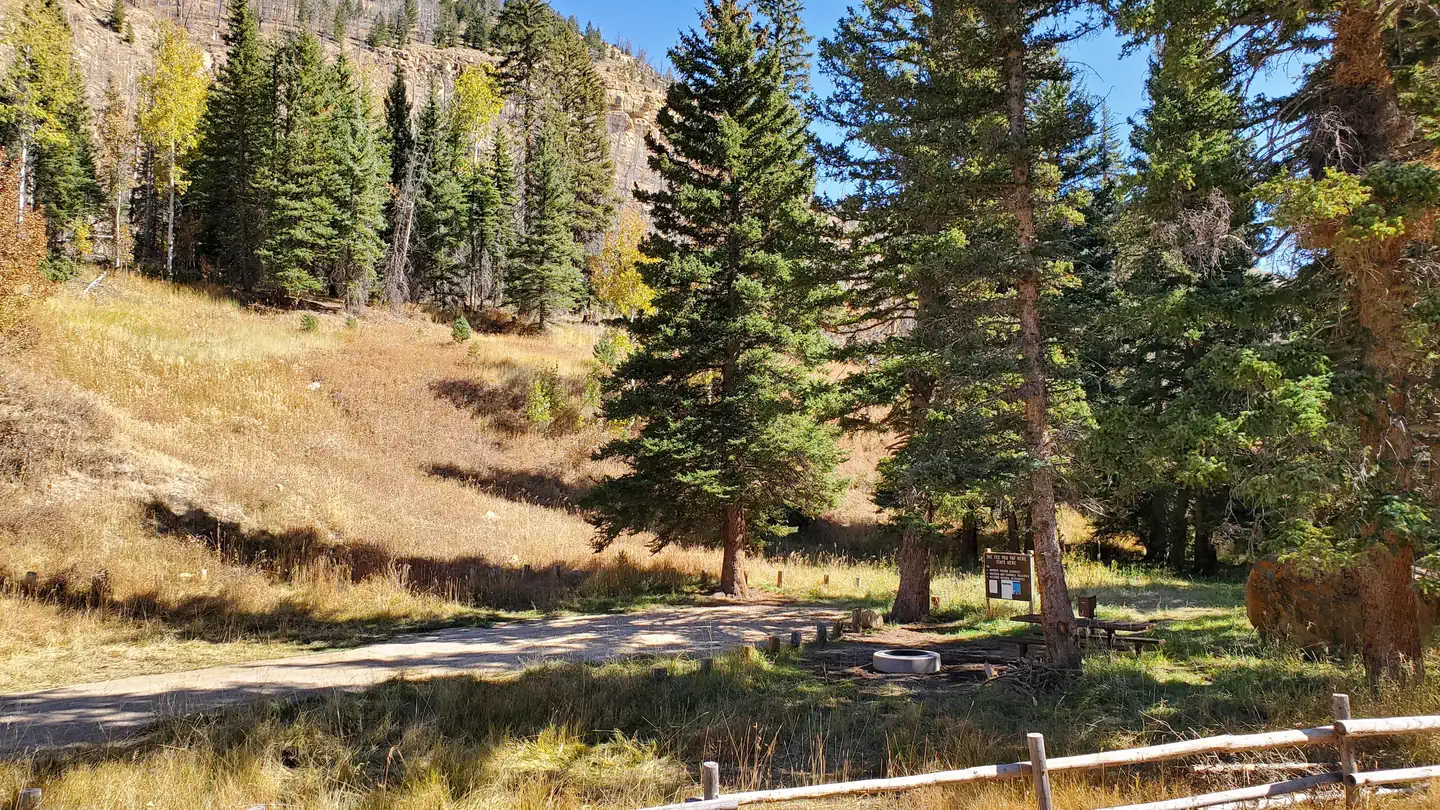
Overview Little Rock Campground is nestled in beautiful Huntington Canyon along the Huntington Canyon National Scenic Byway on Utah Highway 31. The canyon area has numerous lakes and streams, vibrant summer wildflowers, colorful fall foliage, and abundant wildlife. Trailheads are about a mile away in either direction and a trail passes behind the campground that can take you north towards Engineer Canyon or south to Stuart Guard Station. This location is available on a first-come, first-served basis only. Visitors are required to physically arrive at the campground to purchase and claim a site. Once on-site, you can pay for your campsite(s) by scanning a QR code using the Recreation.gov mobile app. Download the free Recreation.gov mobile app on Android or iOS prior to your arrival as some remote areas have limited or no cellular service. Recreation Popular activities include fishing, hunting, hiking, mountain biking, horseback ridding, rock climbing, and scenic driving. Nearby Huntington Creek is a Blue Ribbon fishery, offering high-quality fishing for brown, cutthroat and rainbow trout. The 6-mile Left Fork of Huntington National Recreation Trail is nearby and open to hikers and horseback riders. Huntington Pipeline Trail: 3.5 Miles Left Fork of Huntington National Recreational Trail: 6 Miles Tie Fork/Wild Cattle/Pole Canyon Trails: 7+ Miles Horse Canyon Trails: 8+ Miles Facilities This campsite is a primitive campsite nestled in a shaded spruce stand that provides a graveled parking spur, picnic table, and fire ring. There is no water or vault toilet on site but potable water and flush restroom can be accessed 1/2 mile south of Little Rock Campground at Old Folks Flat Campground. Natural Features Little Rock Campground is nestled in beautiful Huntington Canyon along the Huntington Canyon National Scenic Byway on Utah Highway 31. The canyon area has numerous lakes and streams, vibrant summer wildflowers, colorful fall foliage, and abundant wildlife.
From the USFS.
Is Little Rock Campground free?
No. Little Rock Campground charges a fee. It is managed by the USFS. Sites are reservable through fs.usda.gov.
How do I get to Little Rock Campground?
From Huntington, Utah head northwest on Hwy. 31 for approximately 21 miles. The campsite is 1/2 mile past Old Folks Flat Campground and will be on the right hand side of the road.
Nearby
SourceData from the USFS. Last synced September 19, 2026. Community reports and photos are submitted by travelers and are not verified by the agency.
