
DOVER
Campground · Fee not listed
Fast facts
- Cost
- Not listed. Check locally.
- Type
- Campground
- Phone
- 270-362-4236
- Coordinates
- 36.4903, -87.8431
- Last verified
- September 19, 2026
About this place
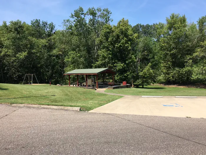
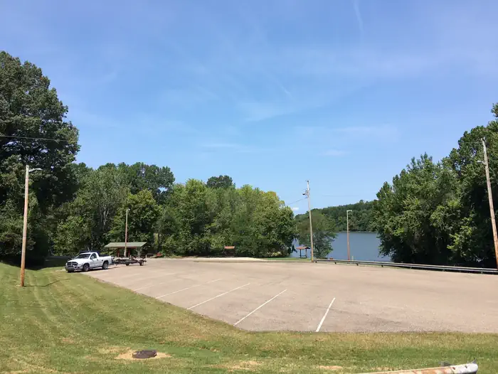
Overview Dover is a day-use area that overlooks the lovely Lake Barkley. Whether it's a gathering of family or friends, visitors can enjoy nature at its best in one of the country's greatest freshwater recreational complexes. Recreation Boating, fishing and picnicking are popular activities at Dover day-use area. Wildlife including the occasional deer, raccoon or golden eagle, are commonly spotted in the area. Facilities The group picnic shelter accomidates about 35 people and 10 vehicles. The facility has lights and electricity and a water spigot. Natural Features Lake Barkley, the westernmost lake on the Cumberland River, sits among wooded rolling hills. The lake is connected by canal to Kentucky Lake, a reservoir that stems from the Tennessee River. Nearby Attractions Dover is close to Fort Donelson National Battlefield, where the Union Army won their first battle of the Civil War. Shopping, grocery stores and gas stations are conveniently located nearby.
From the managing agency.
Is DOVER free?
We do not have a fee on record for DOVER. Confirm the cost locally before you go.
How do I get to DOVER?
DOVER is at 36.4903, -87.8431. We do not hold written directions for this one, so navigate to the coordinates.
Nearby
- DYERS CREEK0.9 mi
- Gatlin Point Campground5.7 mi
- Brandon Spring Group Campground6.2 mi
- BUMPUS MILLS9.1 mi
- Neville Bay9.4 mi
- Boswell Landing Campground10.3 mi
- Piney Campground10.7 mi
- LINTON14.1 mi
No other services within 50 mi on the record.
SourceSource data is agency published. Last synced September 19, 2026. Community reports and photos are submitted by travelers and are not verified by the agency.
