
LAWRENCE RECREATION AREA
Campground · Fee
Fast facts
- Cost
- Fee charged
- Type
- Campground
- Phone
- 570-835-5281
- Coordinates
- 41.9761, -77.1694
- Last verified
- September 19, 2026

About this place
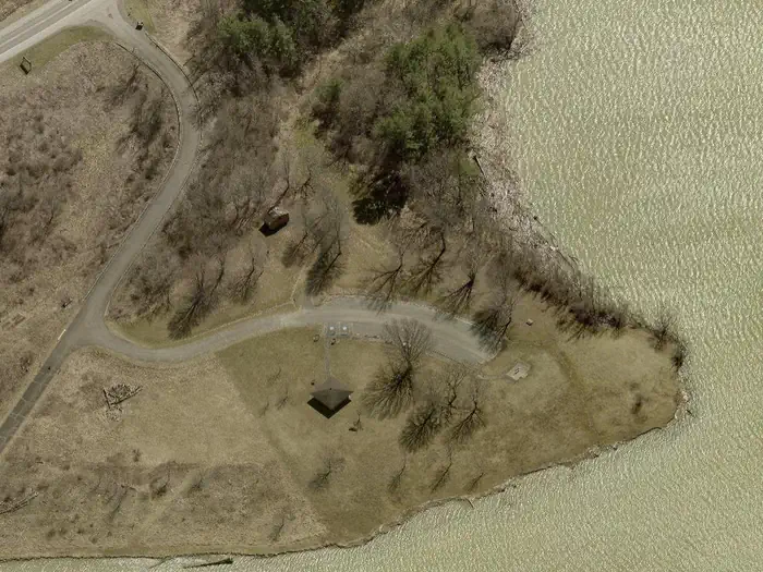
Overview Lawrence Recreation Area is a day-use facility on the south side of Cowanesque Lake. It is conveniently located on State Route 49 approximately 4 miles west of Lawrenceville, Pennsylvania. The area offers a great location for picnicking and shoreline fishing. Recreation Cowanesque Lake offers many outdoor activities including boating and fishing. A variety of native fish inhabits the area's streams and lakes. The North and South Tailrace areas provide access for fishing below the dam. The fields and forests around the lake are popular destinations for hunters looking for large and small game species that inhabit the eastern hardwood forests. Many miles of hiking trails surround the lake, including the Mid State Trail, which links the trails at Cowanesque and nearby Hammond Lake into a long path that extends all the way through Pennsylvania from Maryland to New York. Facilities The Cayuga Shelter is reservable for group picnicking. It is fully accessible and comfortably accommodates groups of up to 100 people in a lovely lakeside setting. Natural Features Cowanesque Lake is situated in the Endless Mountains region of Pennsylvania, along the Allegheny Plateau in the Appalachian Mountains. The surrounding land paints a scenic picture of rolling terrain and open fields.
From the managing agency.
Is LAWRENCE RECREATION AREA free?
No. LAWRENCE RECREATION AREA charges a fee.
How do I get to LAWRENCE RECREATION AREA?
LAWRENCE RECREATION AREA is at 41.9761, -77.1694. We do not hold written directions for this one, so navigate to the coordinates.
Nearby
- TOMPKINS1.1 mi
- SOUTH SHORE RECREATION AREA2.0 mi
- IVES RUN6.2 mi
- LAMBS CREEK RECREATION AREA11.1 mi
- Finger Lakes Trail Shelter37.0 mi
- Backbone Horse Camp39.7 mi
- Backbone Horse Campground39.8 mi
- Blueberry Patch Campground39.8 mi
No other services within 50 mi on the record.
SourceSource data is agency published. Last synced September 19, 2026. Community reports and photos are submitted by travelers and are not verified by the agency.
