
FAREWELL BEND CAMPGROUND
USFS · Campground · Fee
Fast facts
- Cost
- Fee charged
- Managed by
- USFS
- Type
- Campground
- Reservations
- recreation.gov
- Phone
- 541-560-3900
- Nearest dump station
- Aspen Point Dump Station · 38.4 mi
- Coordinates
- 42.9158, -122.4358
- Last verified
- September 19, 2026

About this place
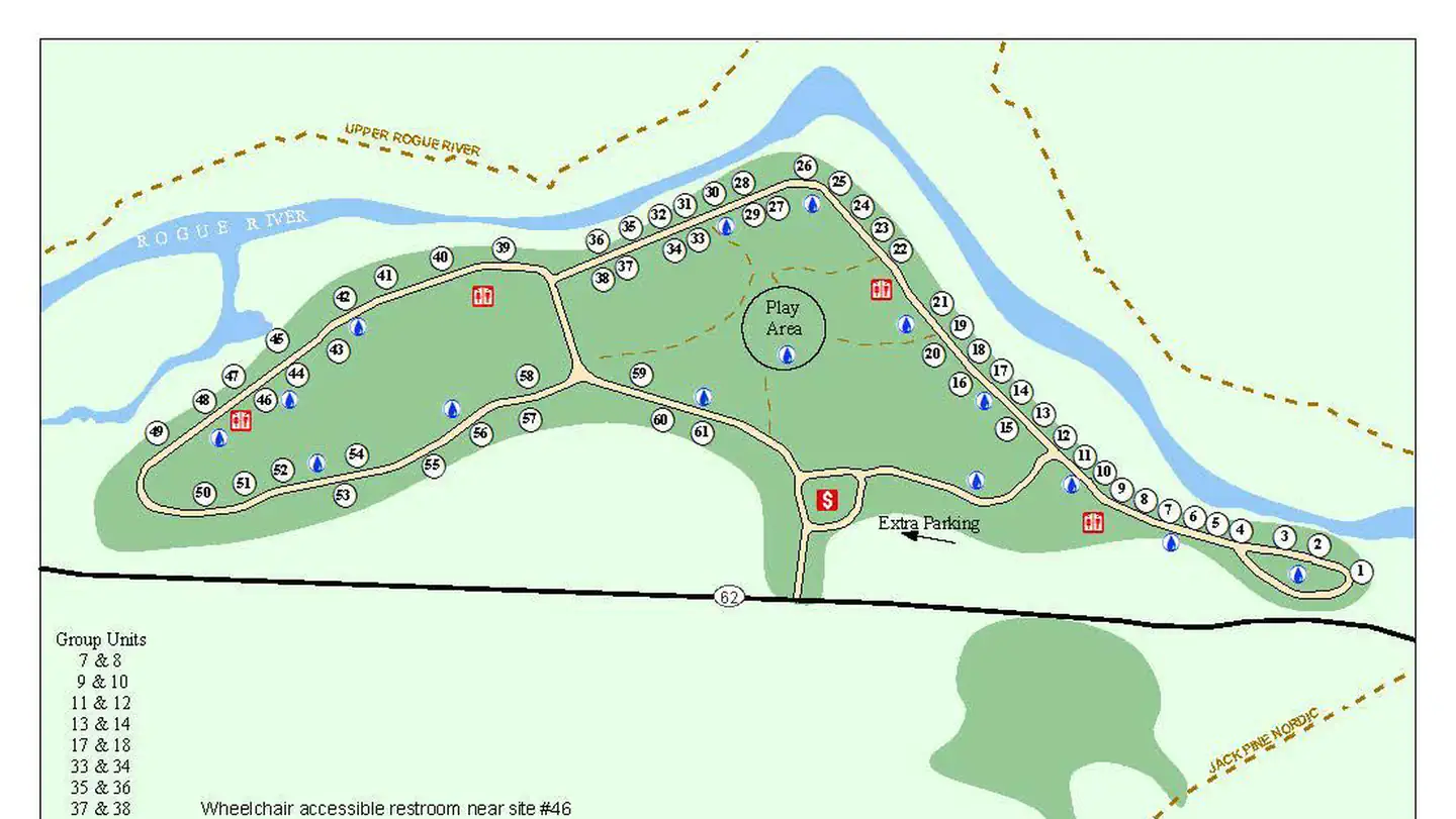
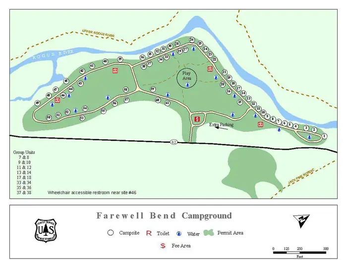
Overview Farewell Bend Campground was constructed in 1934 by the Civilian Conservation Corp. The campground is located 18 miles west of Crater Lake National Park and in the midst of an old growth forest. There are 60 campsites that can accommodate trailers, rvs and tents. The Rogue River is located within the campground allowing for fishing and swimming. Union Creek Resort is within a mile from the campground and provides access to a convenience store, restaurant, ice cream shop and lodging. Recreation The entire length of the Upper Rogue River is closely followed by the Upper Rogue River Trail. The trail is hiker-only and easily traveled for short segments at a time. Hikers can also enjoy the Rogue Gorge Trail System that travels from Farewell Bend Campground through Union Creek Campground and down to Natural Bridge Day Use Area. Facilities This large campground contains a variety of campsites to accommodatetents trailers and rvs. Drinking water and flush toilets are provided, as well as picnic tables and campfire rings. Firewood is available for purchase at the Campground Host Site. Natural Features The Upper Rogue River is fed by snowmelt and springs originating on the peaks of the Cascade Range, including the slopes of Mt. Mazama—the volcanic caldera that contains Crater Lake. Along the uppermost portion of the Upper Rogue, the river is narrow and shallow, but very swift. The river has, for a two-mile stretch, carved more than 200 feet down into the Mazama pumice (which was deposited about 8,000 years ago during the explosion that created Crater Lake). Downstream, the Upper Rogue passes through the narrow, turbulent Rogue Gorge of black lava and soon plunges entirely underground (into a lava tube) for about 250 feet at Natural Bridge. Interpretive trails at both of these places provide good views of the river, with signs that explain the natural history. Contact Info For facility specific information, please call (541) 560-3400. Nearby Attractions Diamond Lake Resort, Crater Lake National Park, Lost Creek Lake, Rogue-Umpqua Scenic Byway, National Falls, Rogue Gorge, Natural Bridge and Mount McLoughlin are all wonderful sights to see.
From the USFS.Official page
Is FAREWELL BEND CAMPGROUND free?
No. FAREWELL BEND CAMPGROUND charges a fee. It is managed by the USFS. Sites are reservable through recreation.gov.
Can I bring an RV to FAREWELL BEND CAMPGROUND?
Yes. FAREWELL BEND CAMPGROUND is set up for RVs.
How do I get to FAREWELL BEND CAMPGROUND?
From Medford, OR, travel Highway 62 towards Crater Lake National Park; continuing by the town of Prospect, OR, and through Union Creek, OR, for 56.7 miles to the campground entrance to the west (left).
What are the rules at FAREWELL BEND CAMPGROUND?
Quiet hours between 10 p.m. and 6 a.m.Campfires in developed fire pits onlyFireworks are prohibitedDogs must be on leashOHV/ATV use prohibited in the campgroundMaximum vehicle length: 40 feet
Nearby
SourceData from the USFS. Last synced September 19, 2026. Community reports and photos are submitted by travelers and are not verified by the agency.
