
Linville Falls Campground
Campground · Fee
Fast facts
- Cost
- $30.00
- Type
- Campground
- Sites
- 64 total · 39 reservable · 25 first come
- Reservations
- recreation.gov
- Phone
- 828-765-7818 (MAY-OCTOBER)
- Nearest dump station
- Cosby RV Sanitary Station · 73.1 mi
- Coordinates
- 35.9681, -81.9322
- Last verified
- September 19, 2026





About this place
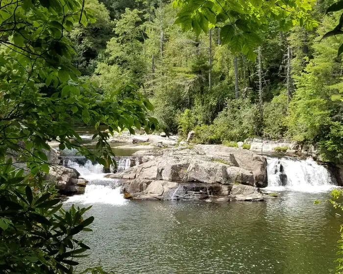
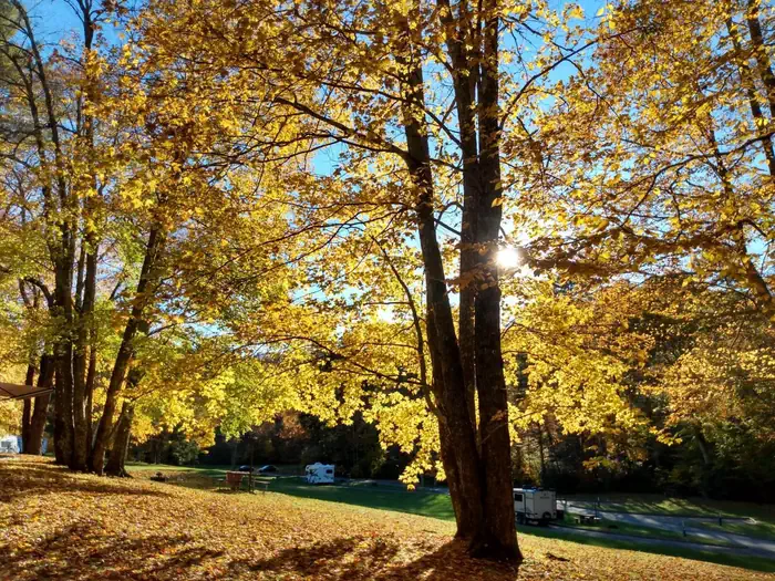
Overview Located in a dense pine canopy, within hiking distance of Linville Gorge, and along the famous Blue Ridge Parkway, Linville Falls Campground is an ideal location for your next family camping excursion. Linville River, which winds beside the campground, is stocked for fishing, and the location is central to many area attractions including the Linville Falls waterfall, which has three waterfall overlooks in a one-mile hike. Recreation The Linville Falls area is a hiker's paradise, and the campground provides easy access to several trails that allow visitors to experience the stunning scenery and abundant wildlife. Once at the Linville Gorge , visitors can hike more challenging trails down to the river, where fishing for trout is a popular pastime. Linville Falls is another must-see, carrying water from the river over several layers of falls, ending in a spectacular 45-foot waterfall pouring into the sparkling riverbed below. Duggers Creek Falls : accessible from the Linville Falls Visitor Center on a small loop trail. See views of the falls from the foot bridge. These are native brook trout waters (fishing regulations apply). Lost Cove Cliff Overlook : view Brown Mountain and see the Brown Mountain Lights--a natural occurrence which is believed to be caused by natural gases. A good spot to view hawks and peregrine falcons in the spring and fall. Facilities The campground offers comfortable tent or RV camping, with the convenience of flush toilets, dump station, and drinking water. Grills/fire rings and picnic tables at each site create a perfect environment for family barbecues or late-night marshmallow roasting. In addition to the 39 sites available for advance reservation, 25 campsites are available on a first come, first-served basis. The availability of first come, first served sites cannot be tracked through Recreation.gov. The sites must be booked in person at the campground kiosk. Natural Features Linville Gorge is a vast designated Wilderness area that sits on 11,786 acres of rolling hills and thick forest. The gorge surrounds the Linville River, which is located some 1,400 feet below the ridge, creating a stunning canyon that has earned the nickname "The Grand Canyon of North Carolina." The Blue Ridge Parkway is a scenic byway with plenty of natural attractions and recreational opportunities for visitors. Aside from natural features, the parkway is also a cross-section of Appalachian mountain history. Stretching almost 500 miles along the crest of the Blue Ridge Mountains through North Carolina and Virginia, it encompasses some of the oldest historical sites of both pre-historic and early European settlements. The surrounding forest offers hemlock, white pine, oaks, hickory and birch trees, along with a colorful assortment of wildflowers in the spring and an epic array of orange and red shades of leaves in the autumn. Nearby Attractions Linville Caverns , a privately maintained cave just south of Linville Falls, offers guided tours year-round.
From the managing agency.Official page
Is Linville Falls Campground free?
No. Linville Falls Campground charges $30.00. 39 of its sites are reservable through recreation.gov.
Can I bring an RV to Linville Falls Campground?
Linville Falls Campground has 64 sites on record. 39 sites are reservable and 25 are first come.
How do I get to Linville Falls Campground?
GPS Info. (Latitude, Longitude): 35.96806, -81.93222 35°58'5"N, 81°55'56"W From I-40 East, take Highway 221 north to the Blue Ridge Parkway at Linville Falls. Go north for one mile to Linville Falls Spur Road, located at Milepost 317, and continue a half mile to the campground.
What is the weather like at Linville Falls Campground?
The Parkway varies in elevation from under 650 feet at Virginia's James River to over 6,000 feet near Mount Pisgah in North Carolina. Weather can vary tremendously. Higher elevations can be cloudy and foggy while lower elevations are clear. Temperatures along the Parkway are often cooler than in surrounding foothills. Carry a jacket or blanket and emergency supplies in the car. Be aware of changing weather conditions and approaching weather systems, as summer heat can bring afternoon thunderstorms.
Nearby
SourceSource data is agency published. Last synced September 19, 2026. Community reports and photos are submitted by travelers and are not verified by the agency.
