
STRAWBERRY CABIN
USFS · Campground · Fee
Fast facts
- Cost
- Fee charged
- Managed by
- USFS
- Type
- Campground
- Season
- December 1 to April 30
- Phone
- 406-449-5201
- Coordinates
- 46.4756, -111.9153
- Last verified
- September 19, 2026
About this place
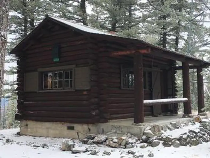
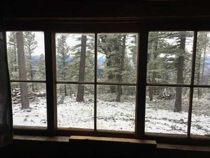
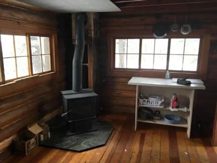
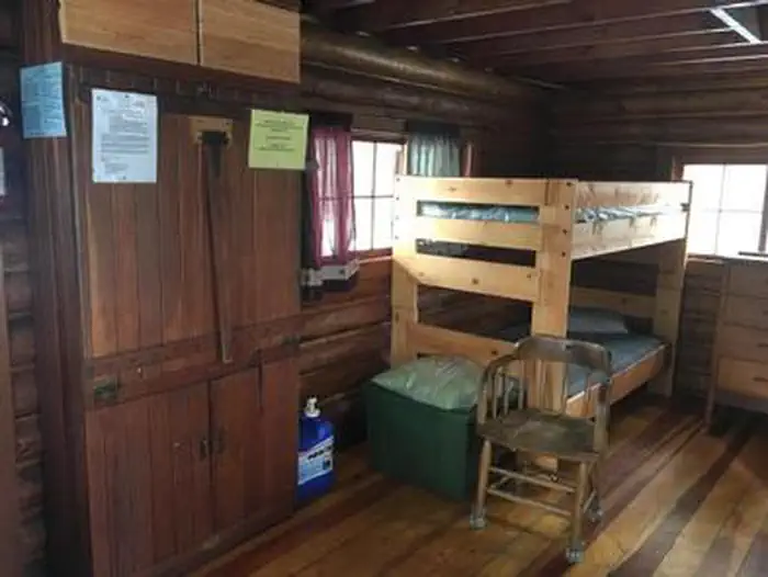
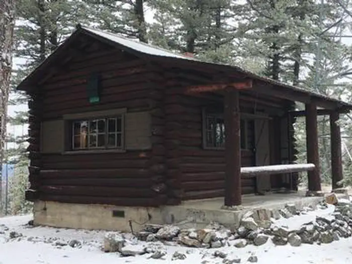
Overview Explore a magnificent recreation and wildlife resource at the doorstep of Montana's Capital City. From prairie to alpine, mayflies to mountain goats, and scenic driving to expert climbing routes -- the Elkhorns you will discover a diverse landscape! Built in 1941, Strawberry Cabin lies at the top of Strawberry Butte (6,100 feet) in the heart of the Elkhorn Mountains. The combination of lookout and log cabin are typical of this period. The cabin is an excellent example of a C-46 one room cabin plan, which was designed by William Fox. This cabin style is one of the standard building plans used for housing personnel working at intermediate stations and at lookouts. The C-46 design offers distinctive characteristics of ventral saddle notches and log ends finished in "chopper cut" style, which symbolizes rustic Forest Service log architecture of the second half of the 1930 and early 1940s. Recreation The area offers great access to the north end of the Elkhorn Mountains with numerous hiking trails and roads leading to the Elkhorn's historical resources. Popular hikes include Strawberry Creek, Casey Peak, and Willard Creek. When snow allows, cross country skiing or snowshoeing gives visitors an up-close look at concentrations of wintering elk. Facilities Strawberry Cabin is designed for up to four guests. One portion of the cabin has two twin beds, all with mattresses. The kitchen is equipped with a small table and two chairs, dishes, utensils, cookware, with a Coleman stove and lights. The cabin has a wood stove. The cabin is not wired for electricity. Fuel is not provided for the propane stove or lanterns, so guests should bring a couple of small propane cylinders, as well as backup lighting. An outhouse with vault toilet is located on-site. A picnic table and campfire ring offer comfortable outdoor dining. Firewood may available, but it is not guaranteed. No firewood is provided from June 1st - August 31. An axe and snow shovel are provided. There is no water on site, so guests must bring a sufficient supply for drinking, cooking and washing. Guests should bring their own sleeping bags, lanterns or flashlights, towels, dish soap, matches, and garbage bags. All garbage must be packed out, and guests are expected to clean the cabin before leaving. A fire lookout tower sits next to the cabin. This is one of the few metal lookout structures in the area and was built in the 1940s. The lookout is not open to the public and is no longer an active lookout. Natural Features The Elkhorn Mountains span both Broadwater and Jefferson counties, with the nearest city being Helena, Montana. The Elkhorns are surrounded by the Divide Mountains and Boulder Batholith to the west, and the Missouri and Boulder River valleys on the north, east, and south. The form of the Elkhorn Mountains is rounded and furrowed from extensive weathering. Drainages have carved steep gulches and canyons. The majority of the Elkhorns (north, west, southwest) is a part of a batholith. This geologic history has left the area rich in minerals. Evidence of glaciation is localized with boulder strewn areas of granitic rocks. The remaining approximate quarter (southwest) of the geographic area is underlain by sedimentary rock that lacks the same mineralization as the batholith but is rich in calcareous rock. The landforms are rugged, low mountains with hogback ridges and dry valleys. The sedimentary geologic area in the east is a gradient of foothill prairie and partially forested low mountains. Grassland is a major component. Limber pine and juniper woodland ebb and flow through this prairie landscape. The plant communities on the batholith portion are mostly forested with conifers. Aspen stands and water-loving plants take advantage of riparian areas and wet seeps. Parks, rich with grasses and forbs, are frequent at lower elevations and break up the forest in montane elevations. A large expanse of this area burned in 1988. The Elkhorns have been occupied by human inhabitants for thousands of years. However, prehistoric occupation is less evident than the more recent Euro-American settlement. After the discovery of valuable mineral deposits, mines and associated settlements sprang up in portions of the geographic area and remnant tools and infrastructure of the mining era are still evident. Strawberry Lookout, Eagle and Tizer Guard Stations are living reminders of Forest Service history in the area. Fire has historically has been a major influence to plant communities. A large forest fire in 1988 burned almost 50,000 acres of the mountain range, leaving carpets of seedlings growing into new lodgepole pine forests. Due to the rich wildlife habitats throughout the mountain range, the Elkhorns were designated a Wildlife Management Unit in 1986, the first of its kind in the nation. Collaborative groups composed of federal, state, and private land holders work toward habitat restoration and interpretation of the area's history. Nearby Attractions The Elkhorn Mountains are an island mountain range that provide open space, clean water and diverse animal and plant communities. The Elkhorns also provide livelihoods and places to hunt and recreate for the citizens in the surrounding communities and beyond. About 160,000 acres within the Elkhorn Mountains is managed by both the Helena and Beaverhead-Deerlodge National Forests as a Wildlife Management Unit, the only one of its kind in the entire National Forest System. In addition, there is another 75,000 acres of foothills that is managed by the Bureau of Land Management as an Area of Critical Environment Concern.
From the USFS.
Is STRAWBERRY CABIN free?
No. STRAWBERRY CABIN charges a fee. It is managed by the USFS.
When is STRAWBERRY CABIN open?
The season on record runs December 1 to April 30. Dates move with weather and with the managing office, so check before a shoulder-season trip.
How do I get to STRAWBERRY CABIN?
STRAWBERRY CABIN is at 46.4756, -111.9153. We do not hold written directions for this one, so navigate to the coordinates.
Nearby
- Park Lake Campground12.3 mi
- EAGLE GUARD STATION13.3 mi
- Riverside Campground15.2 mi
- CAVE POINT GROUP USE AREA15.6 mi
- Clark's Bay Day Use Area Shelter (MT)15.6 mi
- White Earth Campground15.9 mi
- Chinamen's Campground15.9 mi
- COURT SHERIFF CAMPGROUND16.0 mi
No other services within 50 mi on the record.
SourceData from the USFS. Last synced September 19, 2026. Community reports and photos are submitted by travelers and are not verified by the agency.
