
LAKES BASIN
Campground · Fee not listed
Fast facts
- Cost
- Not listed. Check locally.
- Type
- Campground
- Phone
- CAMPGROUND/CAMPSITE STATUS CALL (530) 832-1076
- Nearest dump station
- Jackson Meadows Rv Dump Station · 12.9 mi
- Nearest water fill
- Indian Creek Camp Ground-Potable Water · 78.7 mi
- Coordinates
- 39.6667, -120.6578
- Last verified
- September 19, 2026

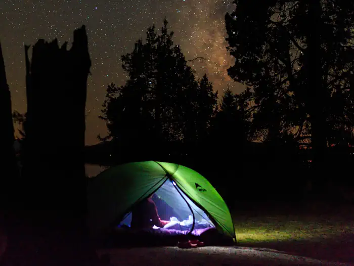
About this place
Overview Lakes Basin Campground (6,445 feet) is situated in the ruins of an old lodge, Lakes Center Lodge, built in 1912 and removed in the late 1970's. Some of the old stonework still exists, including steps leading into a deep pool of Gray Eagle Creek. This campground is within easy reach of many trailheads. The campground also offers a tent only group campsite by reservation only. Recreation Gold Lakes Basin offers a variety of recreational activities including boating, fishing and hiking. A network of over 30 miles of maintained trails branch out across the area, and the Pacific Crest trail can be easily reached from the trail system. Many of the trails are open to hiking, biking and horseback riding, including the 1-mile Grassy Lakes Trail, accessible from the campground. At nearby Gold Lake, where a boat ramp is provided, visitors enjoy convenient access to boating and fishing. Once on the water, anglers won't have any trouble trolling for brown and rainbow trout and Mackinaws in the cool, clear waters. Facilities The single loop campground offers family campsites and one group tent-only site. One double-family site is also available. Vault toilets, drinking water and trash collection are provided. All sites have fire rings with grills and picnic tables. Sites are as listed. SITE NUMBER, SITE LENGTH, SHADE, MAXIMUM VEHICLES, ALLOWABLE EQUIPMENT SIte #001 GROUP FULL #2 Site Lenght-42', Shade-SUN, Max Vehicles-2, Equipment-RV, TENT, TRAILER, VAN #4 Site Length-28', Shade-PARTIAL, Max Vehicles-2, Equipment- RV, TENT, TRAILER, VAN #6A,6B Site Lenght-MULTI 45', Shade-SUN, Max Vehicles-4, Equipment- RV, TENT, TRAILER, VAN #10 Site Lenght-26', Shade-FULL, Max Vehicles -1, Equipment- TENT, VAN #13 Site Lenght-41', Shade-FULL, Max Vehicles-2, Equipment- TENT, VAN, SMALL TRAILER #15 Site Length-40', Shade-FULL, Max Vehicles-2, Equipment- RV, TENT, TRAILER, VAN #18 Site Lenght-42', Shade-PARTIAL, Max Vehicles-2, Equipment- RV, TENT, TRAILER, VAN #20 Site Length-42', Shade-PARTIAL, Max Vehicles-2, Equipment-RV, TENT, TRAILER, VAN #21 Site Length-30', Shade-PARTIAL, Max Vehicles-2, Equipment- RV, TENT, TRAILER, VAN #22 Site Lenght-26", Shade-PARTIAL, Max Vehicles- 1, Equipment- TENT, VAN Natural Features The area was formed by glaciers and is characterized by breathtaking mountain scenery--most notably the craggy peaks of the Sierra Buttes and over 20 natural glacial lakes, most of which are accessible by well-maintained hiking trails. The campground sits among fir and aspen trees along Gray Eagle Creek. Mt. Elwell towers to the west. Contact Info For facility specific information, please call (530) 836-2575. Nearby Attractions Visiting Plumas Eureka State Park is a worthy side trip. About 18 miles from the campground, this historic site offers a gift shop, visitor center, walking tour and information about local mining history. Mills Peak Fire Lookout provides a panoramic view of Sierra Peaks and Mohawk Valley. Visit the Red Fir Interpretive Trail along the way. Frazier Falls Trail is best viewed in the Spring. This is a 1 mile paved accessible trail to an overview across from the falls. The Sierra Buttes and its lookout overlook the southern end of Lakes Basin in Tahoe National Forest. Gold Lake Boat Launch Facility has a two lane ramp, loading dock and day use area. A hand launch gravel ramp suitable for launching small water craft is located at Gold Lake Dam Day Use Area.
From the managing agency.
Is LAKES BASIN free?
We do not have a fee on record for LAKES BASIN. Confirm the cost locally before you go.
How do I get to LAKES BASIN?
LAKES BASIN is at 39.6667, -120.6578. We do not hold written directions for this one, so navigate to the coordinates.
Nearby
- Lightning Tree Campground0.2 mi
- Gold Lake 4x4 Campground0.2 mi
- Gold Lake 4 X 4 Campground0.3 mi
- Gold Lake Campground (CA)1.0 mi
- Gold Lake Boat Ramp1.2 mi
- Goose Lake Campground1.3 mi
- Haven Lake Campground1.5 mi
- Gold Lake Picnic Area1.6 mi
- Jackson Meadows Rv Dump Station12.9 mi
- Indian Creek Camp Ground-Potable Water78.7 mi
SourceSource data is agency published. Last synced September 19, 2026. Community reports and photos are submitted by travelers and are not verified by the agency.
