
ANACAPA ISLAND
Campground · Fee not listed
Fast facts
- Cost
- Not listed. Check locally.
- Type
- Campground
- Phone
- 805-658-5730
- Coordinates
- 34.0142, -119.3678
- Last verified
- September 19, 2026
About this place
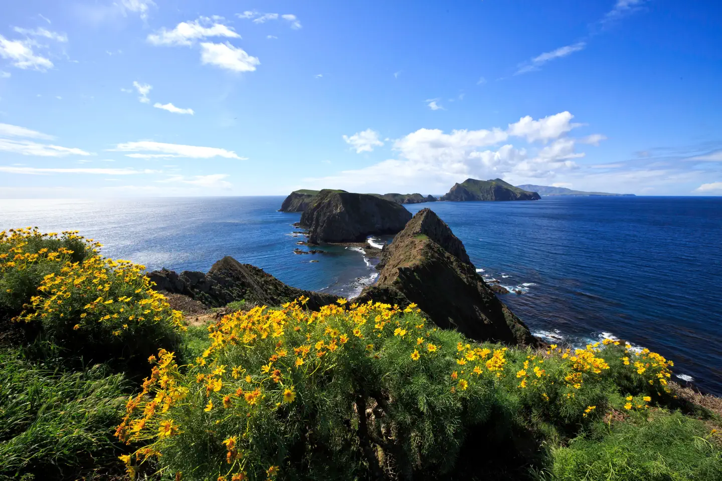
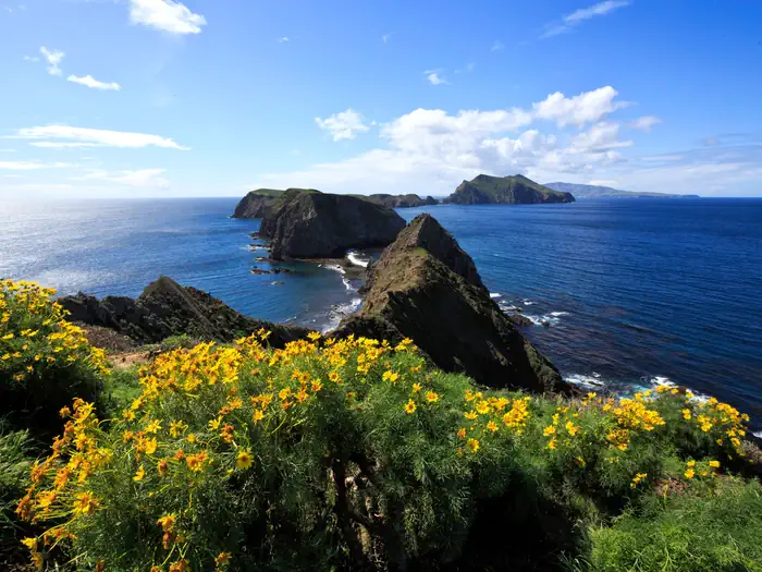
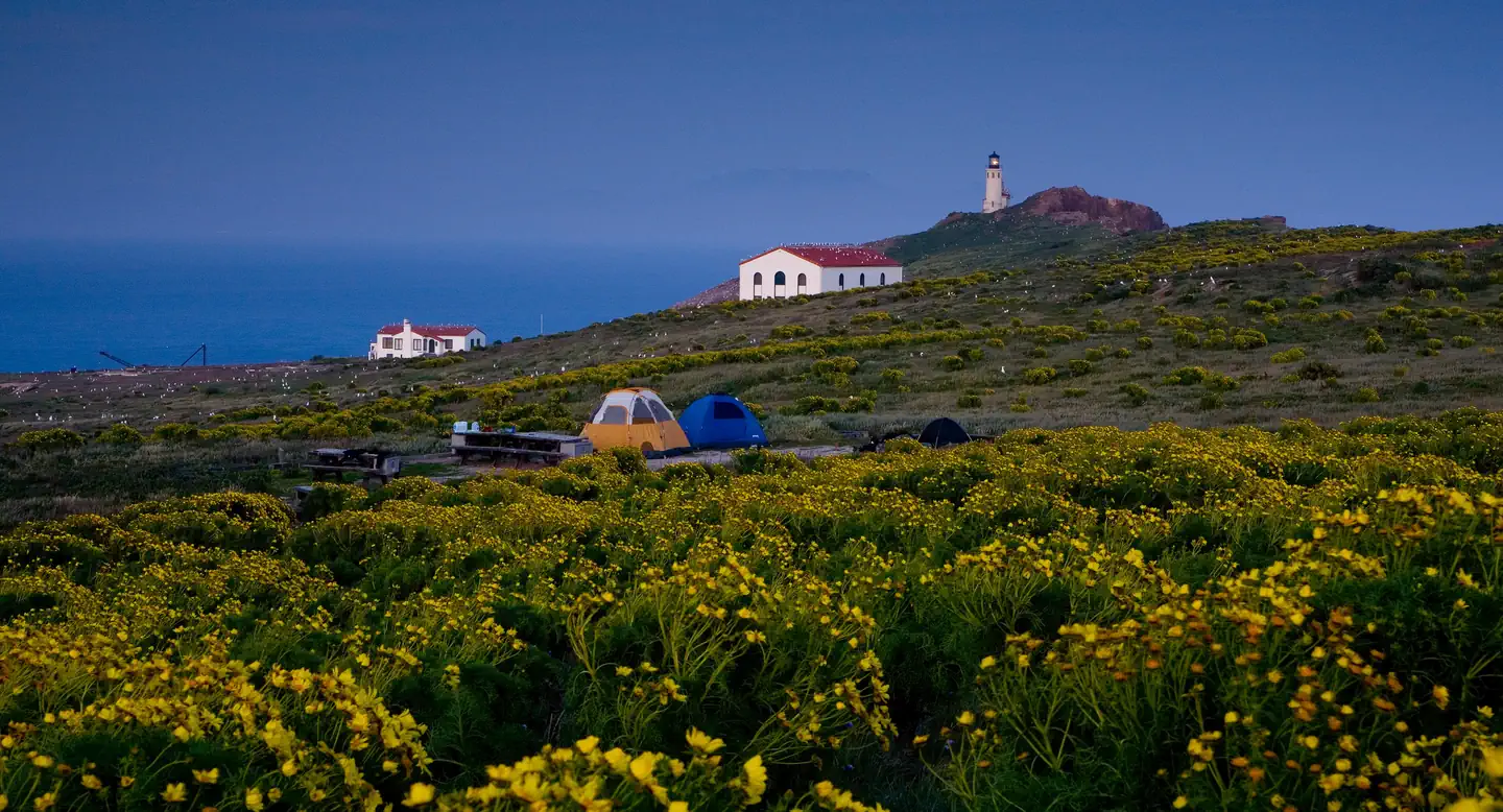
Overview Once visitors have scaled the rugged cliffs using the stairwell from the Landing Cove, they will be rewarded with a campground perched on the bluffs with magnificent coastal views. Anacapa Island, the closest Channel Island to the mainland of California, is comprised of three islets (appropriately named East, Middle, and West Anacapa Islands). Waves have eroded the volcanic island, creating towering sea cliffs, sea caves, and natural bridges, such as forty-foot-high Arch Rock -- a symbol of Anacapa and Channel Islands National Park. Exploring East Anacapa's two-mile trail system allows visitors to experience the island's native vegetation, wildlife, and cultural history. The islands' native vegetation is recovering slowly with the help of the National Park Service's restoration efforts. This recovery, along with the removal of nonnative predators, has aided in the reestablishment of nesting land birds and seabirds. The island is one of the most important seabird nesting sites within the Channel Islands. While the steep cliffs of West Anacapa are home to the largest breeding colony of endangered California brown pelicans, all the islets of Anacapa host the largest breeding colony of western gulls in the world. The rocky shores of Anacapa are perfect resting and breeding areas for California sea lions and harbor seals. Anacapa's rich kelp forests (ideal for kayaking, snorkeling, and diving) and tidepool areas provide visitors with the opportunity to meet some of the resident ocean animals up close. Anacapa Island has a rich human history as well. Shell midden sites indicate where Chumash people camped on the islands thousands of years ago. In addition, visitors can view the 1932 light station. The original lead-crystal Fresnel lens, which served as a beacon to ships until an automated light replaced it in 1990, is on exhibit in the East Anacapa Visitor Center. Recreation With two miles of hiking trails, ocean access nearby the campground, and generally good weather, Anacapa Island offers a variety of recreational activities, including hiking, swimming, snorkeling, diving, kayaking and wildlife/wildflower viewing. In summer, rangers lead an underwater video program. The program includes live video footage of sea life which is projected for visitors to see. It's a great way to stay dry while viewing colorful sea creatures. Since Anacapa Island is a cliff island, access to the water is only at the Landing Cove via a dock. There are no other accessible beaches unless you have a watercraft. There are no services on the island, so all gear has to be brought to the island. For more information about recreational activities in the park, visit https://www.nps.gov/chis/planyourvisit/index.htm. Facilities A half mile hike, including 154 steps, is needed to get from the Landing Cove to the seven-site (4-6 persons per site) campground. Camping is primitive and campers must bring their own food, equipment and water. Picnic table, food storage box, and pit toilet are provided. Natural Features Waves have eroded the 5-mile volcanic island, creating steep, towering sea cliffs, sea caves and natural bridges. Much of the year, the island vegetation looks brown, but the winter rain brings brightly-colored terrain. The altitude is low and ranges from sea level to 250 feet. Nearby Attractions The Landing Cove near the campground is an ideal place for swimming, diving, snorkeling and kayaking, but there are no lifeguards on the island. The island is also home to just over two miles of trails that meander to dramatic overlooks and magnificent coastal views. All hikers must stay on the trails for visitor safety and to protect fragile vegetation and nesting seabirds. No off- trail hiking is allowed.
From the managing agency.
Is ANACAPA ISLAND free?
We do not have a fee on record for ANACAPA ISLAND. Confirm the cost locally before you go.
How do I get to ANACAPA ISLAND?
ANACAPA ISLAND is at 34.0142, -119.3678. We do not hold written directions for this one, so navigate to the coordinates.
Nearby
- Anacapa Island Campground0.0 mi
- Scorpion Canyon Campground11.3 mi
- SANTA CRUZ ISLAND SCORPION11.4 mi
- SANTA CRUZ ISLAND DEL NORTE BACKCOUNTRY16.8 mi
- Del Norte Backcountry Campground16.8 mi
- CIRCLE X RANCH GROUP CAMPGROUND25.6 mi
- Circle X Ranch Campground - CLOSED26.2 mi
- WHEELER GORGE34.7 mi
No other services within 50 mi on the record.
SourceSource data is agency published. Last synced September 19, 2026. Community reports and photos are submitted by travelers and are not verified by the agency.
