
SNOW PEAK CABIN
USFS · Campground · Fee
Fast facts
- Cost
- Fee charged
- Managed by
- USFS
- Type
- Campground
- Hours
- Open 24 hours/day
- Reservations
- fs.usda.gov
- Phone
- 509-775-7400
- Coordinates
- 48.5736, -118.4892
- Last verified
- September 19, 2026
About this place
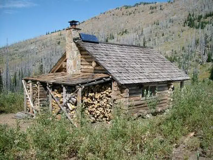
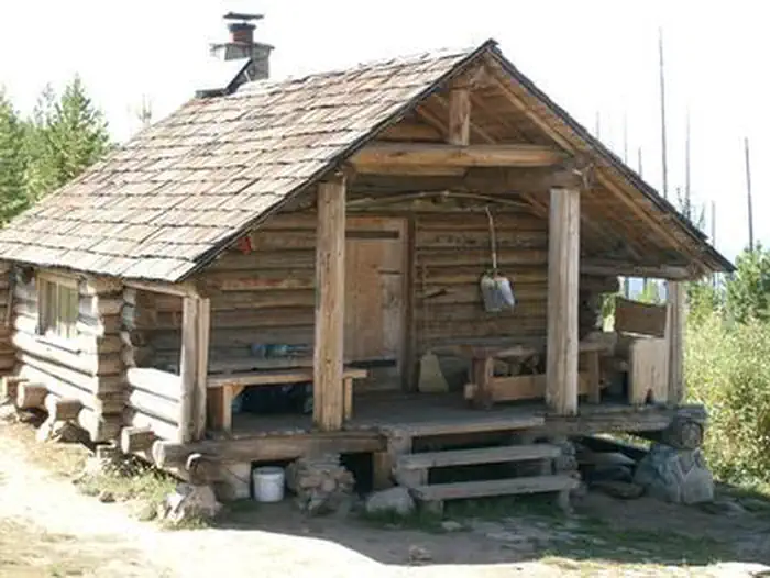
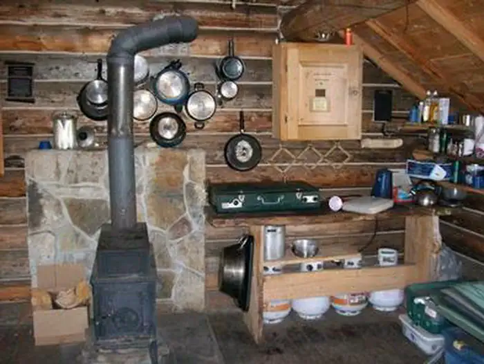
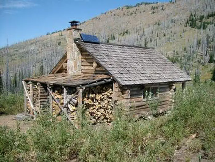
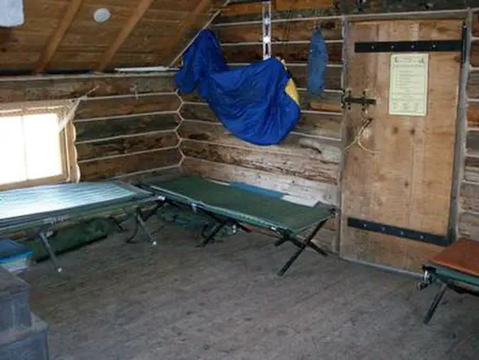
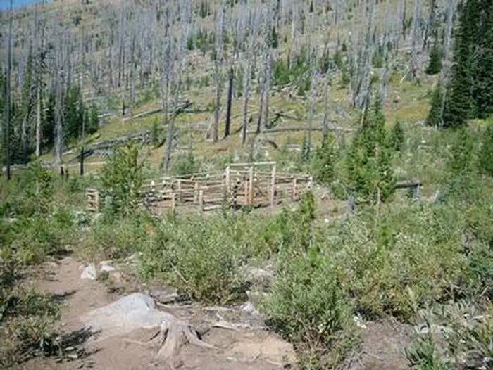
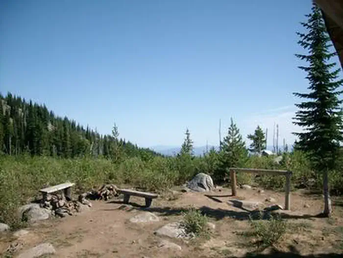
Overview Snow Peak Cabin is located high in the mountains of northeastern Washington state. It provides a year-round base camp from which guests can access thousands of acres of back country for skiing, hunting and exploration. Depending on the season, guests may also choose to enjoy the extensive system of quality mountain bike, horse and hiking trails that connect with the cabin. The cabin is not accessible by vehicle and the area around the cabin is closed to all forms of motorized use. The winter route begins at the Kettle Crest Trailhead on Sherman Pass (State Highway 20) and has a one-way distance of approximately five miles for skiers and snowshoers. Winter visitors are advised to carry snow chains and a shovel in their vehicle as winter storms and icy conditions can make it difficult to exit the trailhead, even after it has been plowed. Hikers, bikers and horseback riders can access the cabin in the summer and fall from the Snow Peak Trailhead via the 3-mile Snow Peak Trail. Guests are responsible for their own travel arrangements and safety, and must bring several of their own amenities. Recreation In addition to camping, visitors to the area enjoy hiking, mountain biking and horseback riding on a variety of trails in the area. The Snow Peak Trail No. 10, Kettle Crest South Trail No. 13, Sherman Loop Trail No. 72 and Edds Mountain Trail No. 3 can all be accessed from the cabin. Climbing, snowshoeing and skiing in the area are also popular. Visitors also enjoy the area for hunting during open seasons, as the open mountain meadows throughout the area entice a variety of wildlife. The cabin is in a remote location and guests are advised to carry a topographic map of the area and a compass when leaving the cabin at any time. Facilities The one-room 17-by-19 cabin has cots and foam pads to accommodate up to four people. It is also equipped with a propane cook stove, a table, basic cookware and cutlery, and a wood stove for heat. Solar-powered lighting and an outhouse are provided. Horse corrals are also available for equestrian campers and a spring fed water trough is located near the cabin along the Kettle Crest 13 South trail. Firewood is provided, but guests must split their own wood with an axe and tools that are provided. Firewood must be flown into the cabin by helicopter every two or three years, which is very expensive. Guests are asked to use the firewood conservatively while heating the cabin. Given the size of the cabin and the efficiency of the wood stove, a little wood can go a long ways. In addition, firewood provided at the cabin is not to be used in any user created outdoor fire rings. Guests must bring their own water for drinking, cooking and cleaning purposes. Sleeping bags, toilet paper, garbage bags and food are also not provided. Cell phone service is not available in the area. Natural Features The cabin sits at an elevation of 6,400 feet, on a ridge in the Kettle River Mountain Range in the Colville National Forest. It was built through the cooperative efforts of the Snow Peak Shelter Alliance and the Colville National Forest. Construction took nearly three years and was completed in 1995. Views from the cabin stretch from the Cascades to the mountains of Canada and northern Idaho. The Kettle Range encompasses an area of 2,700 miles. The range runs north to south, bordered on the east by the Kettle River and the Columbia River, and on the west by the Kettle River, the Curlew Valley and the Sanpoil River. Wildlife in the area include hawks, bear and cougars. Nearby Attractions The cabin is near trailheads, a picnic area and the Sherman Pass Scenic Byway. The popular highway runs 40 miles from the town of Republic to the west and the Columbia River to the east, passing through the center of the Kettle Range. It reaches its highest point, 5,575 feet, at Sherman Pass, the highest mountain pass open year-round in Washington state.
From the USFS.
Is SNOW PEAK CABIN free?
No. SNOW PEAK CABIN charges a fee. It is managed by the USFS. Sites are reservable through fs.usda.gov.
How do I get to SNOW PEAK CABIN?
From Republic, WA, take Highway 20 east for 6.9 miles. Turn right on Hall Creek Road and continue for approximately 3.3 miles. Turn left on Forest Road 2050-100 and continue for 4.6 miles until you reach Snow Peak trailhead. Take the Snow Peak trail for 2.6 miles until it intersects with the Kettle Crest 13 S trail. Turn right onto the Kettle Crest 13 S trail and continue for approximately 0.5 miles. There will be a water trough on the edge of the trail. Turn right onto the path leading to the cabin. Follow that path for approximately 340 feet until you reach the cabin. This route is not accessible in the winter. For directions into the cabin during the winter, please contact the Republic Ranger District at 509-775-7400.
Nearby
- Sherman Overlook2.5 mi
- Jungle Hill Horse Campground4.6 mi
- Wapaloosie Horse Campground6.6 mi
- Beth Lake Campground6.6 mi
- Lambert Creek Horse Camp10.8 mi
- Canyon Creek Campground11.4 mi
- Lake Ellen West Campground11.6 mi
- Trout Lake Campground11.9 mi
No other services within 50 mi on the record.
SourceData from the USFS. Last synced September 19, 2026. Community reports and photos are submitted by travelers and are not verified by the agency.
