
Chisos Basin Group Campground (Big Bend, TX)
Campground · Fee
Fast facts
- Cost
- Fee charged
- Type
- Campground
- Phone
- 432-477-1121
- Coordinates
- 29.2750, -103.3042
- Last verified
- September 19, 2026
About this place
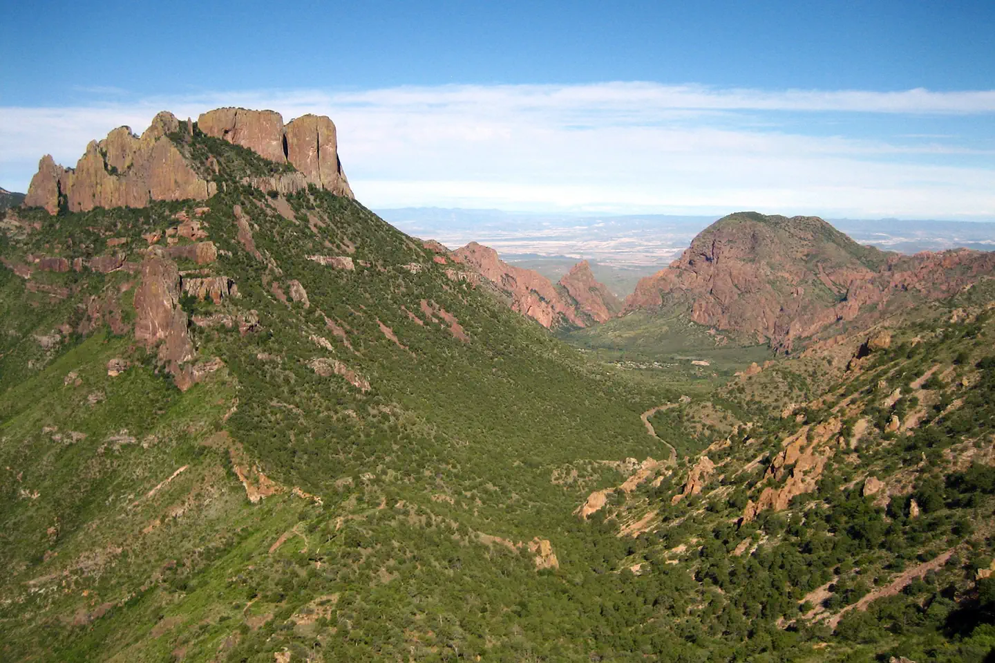
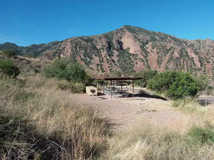
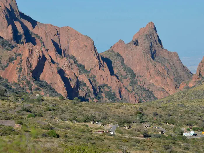
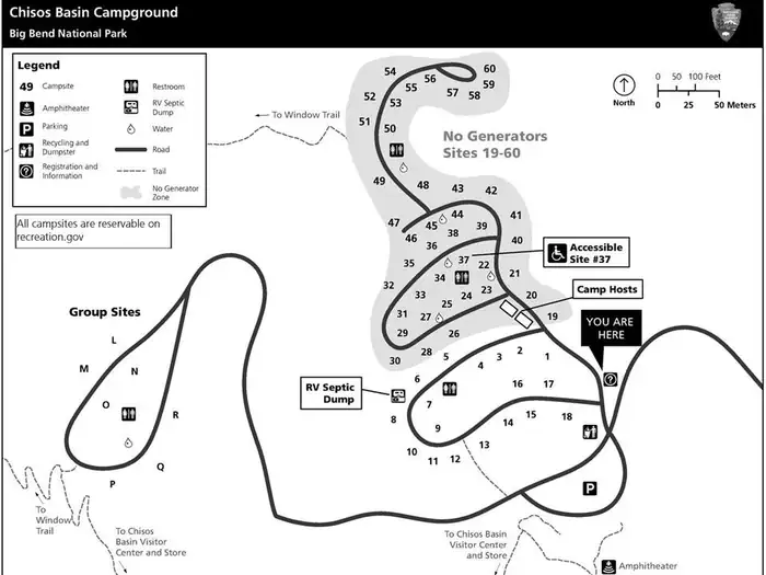
Overview Chisos Basin Group Campground, situated high in the rugged Chisos Mountains, is one of the most sought-after campgrounds in Big Bend National Park. It has seven group camping sites available for groups of nine to 20 people (size is site-dependent). At an altitude of 5,400 ft. (1646 m),, the campground is surrounded on all sides by tall, rocky cliffs and conveniently located near some of the park's most spectacular and popular trails. The Rio Grande is only a short drive away. Also found in the area is the Chisos Basin Visitor Center, the General Store and the Chisos Mountains Lodge , which houses the only restaurant in Big Bend National Park. Recreation This campground is a hub for hikers. Some of the park's most spectacular and popular Day Hike trails are nearby, including the Lost Mine Trail, the Window Trail, the South Rim Trail and the Pinnacles Trail, with its access to the park's highest point, Emory Peak (elevation 7,825 ft./2385 m). Campers can find the trailheads for most of these trails in the main Chisos Basin area a mile or so further down the Basin road from the campground. Access to the river is approximately 30 miles (48 km) away, where visitors can canoe, kayak and fish. Facilities The group campground is located approximately 1/4 mile (.4 km) away from the main Chisos Basin Campground. Each site comes with a picnic table, charcoal grill and bear-proof food storage container and some sites come with picnic shelters for shade. All campsites are within easy walking distance to drinking water and toilets. No RVs, trailers, or generators are allowed. Group Site "O" allows for ONE smaller (up to 20 feet/6 m) recreational vehicle (camper van, pickup camper, or small RV) to camp adjacent to the tent area as part of the larger group. All other sites are exclusively walk-in, tents only. Natural Features The national park is named for a curve in the Rio Grande called the "big bend." For 1,250 miles (2012 km), the river is an International Boundary between the United States and Mexico. The campground lies at the base of several sloping cliffs amidst montane shrubland; desert plants such as Arizona cyprus and mesquite trees fill the landscape. Maple, aspen, pinyon and ponderosa pines grow at higher elevations just above the campground. Though it is lower than the surrounding cliffs, the Chisos Basin is at a higher elevation than other campgrounds within the park. Summer temperatures here are cool, yet warmer than other areas in fall and winter due to the cold air sinking into lower regions. The Chisos Mountains are a popular nesting site for migratory birds . The mountains provide the only nesting ground in the United States for the Colima Warbler, which arrives in mid-April and departs for its wintering grounds in southwestern Mexico by mid-September. Nearby Attractions Big Bend National Park encompasses 801,000 acres (324,153 ha) and the Chisos Basin area is centrally located. This allows visitors an excellent opportunity to explore all areas of the park in a relatively short drive. Big Bend offers excellent hiking trails, miles of rugged dirt roads, and endless possibilities for sightseeing.
From the managing agency.
Is this site free?
No. this site charges a fee.
How do I get to this site?
this site is at 29.2750, -103.3042. We do not hold written directions for this one, so navigate to the coordinates.
Nearby
- Chisos Basin Campground (Big Bend, TX)0.0 mi
- Chisos Basin Campground0.1 mi
- Big Bend Backcountry Camping7.0 mi
- Cottonwood (Big Bend, TX)16.2 mi
- Cottonwood Campground16.3 mi
- Rio Grande Village (Big Bend, TX)21.9 mi
- Rio Grande Village Group Campground (Big Bend, TX)21.9 mi
- Rio Grande Village Campground22.0 mi
No other services within 50 mi on the record.
SourceSource data is agency published. Last synced September 19, 2026. Community reports and photos are submitted by travelers and are not verified by the agency.
