
HURRICANE BRIDGE
Campground · Fee not listed
Fast facts
- Cost
- Not listed. Check locally.
- Type
- Campground
- Phone
- 931-858-3125
- Coordinates
- 36.0289, -85.7475
- Last verified
- September 19, 2026


About this place
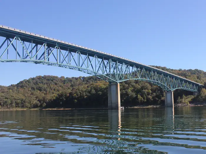
Overview Hurricane Bridge Recreation Area is located on the shores of the scenic Center Hill Lake on central Tennessee's Highland Rim. The lake stretches 64 miles up the Caney Fork River, where visitors come to enjoy boating, fishing and water sports. The 415 miles of forested shoreline provide excellent hiking, hunting and camping opportunities. Recreation Boating, water skiing, canoeing and fishing are popular activities on the water. Anglers will find bream, walleye, smallmouth bass, crappie, catfish and white bass. Below the dam, the Caney Fork River is one of the most productive trout fisheries in the state. Nine miles of hiking trails meander around the lake. The OId 56 Trail is located in the recreation area, and provides 0.9 miles of a paved walking trail. Facilities This large day-use picnic shelter can accommodate up to 125 guests. Water and 15-amp electric hookups are provided, as are flush toilets and drinking water. Two boat ramps and a dock are located on-site. Natural Features Center Hill Lake is surrounded by lush mixed hardwood forests in the hilly Highland Rim region. Whitetail deer, wild turkey, squirrels and rabbits roam the wooded hills around the lake. Hurricane Bridge is located on a peninsula, providing sweeping lake views on three sides of the picnic area. Nearby Attractions Edgar Evins State Park, about 20 minutes from Hurricane Bridge, sits on the shores of the lake. An observation tower at the Visitor Center offers a spectacular view of Center Hill Lake and the surrounding hillsides. Burgess Falls State Park is a 30 minute drive from the campground. Here, the Falling Water River drops approximately 250 feet, creating numerous breathtaking waterfalls. Hiking trails and overlooks help visitors enjoy the scenery. The large Native Butterfly Garden is a popular attraction within the park.
From the managing agency.
Is HURRICANE BRIDGE free?
We do not have a fee on record for HURRICANE BRIDGE. Confirm the cost locally before you go.
How do I get to HURRICANE BRIDGE?
HURRICANE BRIDGE is at 36.0289, -85.7475. We do not hold written directions for this one, so navigate to the coordinates.
Nearby
- FLOATING MILL PARK1.4 mi
- RAGLAND BOTTOM3.9 mi
- Long Branch (Center Hill Lake)6.8 mi
- Center Hill Lake Primitive Camping Areas6.8 mi
- TAILWATER REC AREA20.4 mi
- SALT LICK CREEK20.5 mi
- DEFEATED CREEK PARK20.7 mi
- WARTRACE CK REC AREA22.9 mi
No other services within 50 mi on the record.
SourceSource data is agency published. Last synced September 19, 2026. Community reports and photos are submitted by travelers and are not verified by the agency.
