
LAKE SPRINGS
Campground · Fee not listed
Fast facts
- Cost
- Not listed. Check locally.
- Type
- Campground
- Phone
- 800-533-3478
- Coordinates
- 33.6659, -82.2293
- Last verified
- September 19, 2026
About this place
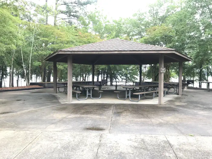
Overview Lake Springs Recreation Area is one of the most popular parks on J. Strom Thurmond Lake. The park is located on Georgia State Highway 221 within twenty minutes of Augusta, Georgia. The 70,000 acre lake and its 1,000+ miles of shoreline provide excellent boating, water skiing, swimming, fishing, hiking and picnicking. A $5 per vehicle day use fee is required to enter the park. All Federal Passes are accepted. Payment can be made on site, credit card only, no cash accepted. The boat ramp and fishing pier are open year-round. All swim beaches, picnic tables, and group shelters close after Labor Day, September 6, and reopen April 28 EXCEPT the Deer Run beach, tables, and group shelter are open year-round. Recreation Thurmond Lake provides some of the best fishing, hunting and water sports in the southeastern United States. Anglers fish for largemouth bass, bream, crappie, catfish and striped bass. The large lake offers endless boating, water skiing, jet skiing, canoeing and swimming opportunities. Hikers have access to many miles of trails in the immediate area. Within the Lake Springs Recreation Area is the 1.8-mile Lake Springs Loop. Outside the park stretches the 27-mile Bartram Trail, which meanders along the scenic shoreline and through Wildwood Park. Shorter sections can be hiked from several intersecting trailheads. Facilities Lake Springs Recreation Area is a wooded day-use area with four group picnic shelters. Water and electrical hookups are provided at each shelter. Other amenities include flush and vault toilets, drinking water, a boat ramp, dock, fish cleaning station, playground and lookout tower. Natural Features Hot, humid summers and mild, pleasant winters characterize this heavily wooded area on the shore of Thurmond Lake. A mixed pine and hardwood forest covers the site, providing summer shade and fall color. Elevation is 345' above sea level. Wildlife is abundant around the lake. Visitors regularly see southern bald eagles, migratory waterfowl, wild turkeys and whitetail deer. Nearby Attractions Numerous parks and recreation areas lie around Thurmond Lake, providing additional boating, swimming, hunting and hiking opportunities. Nearby cities house museums, art galleries, zoos, restaurants, and shopping areas. The Augusta National Golf Club hosts the Masters Golf Tournament annually the first week of April.
From the managing agency.
Is LAKE SPRINGS free?
We do not have a fee on record for LAKE SPRINGS. Confirm the cost locally before you go.
How do I get to LAKE SPRINGS?
LAKE SPRINGS is at 33.6659, -82.2293. We do not hold written directions for this one, so navigate to the coordinates.
Nearby
- BELOW DAM SOUTH CAROLINA1.3 mi
- WEST DAM1.7 mi
- PETERSBURG1.8 mi
- RIDGE ROAD1.9 mi
- CLARKS HILL2.4 mi
- MODOC3.7 mi
- PARKSVILLE8.9 mi
- WINFIELD11.1 mi
No other services within 50 mi on the record.
SourceSource data is agency published. Last synced September 19, 2026. Community reports and photos are submitted by travelers and are not verified by the agency.
