
Trail Bridge
Campground · Fee not listed
Fast facts
- Cost
- Not listed. Check locally.
- Type
- Campground
- Phone
- N/A
- Coordinates
- 44.2805, -122.0470
- Last verified
- September 19, 2026
About this place
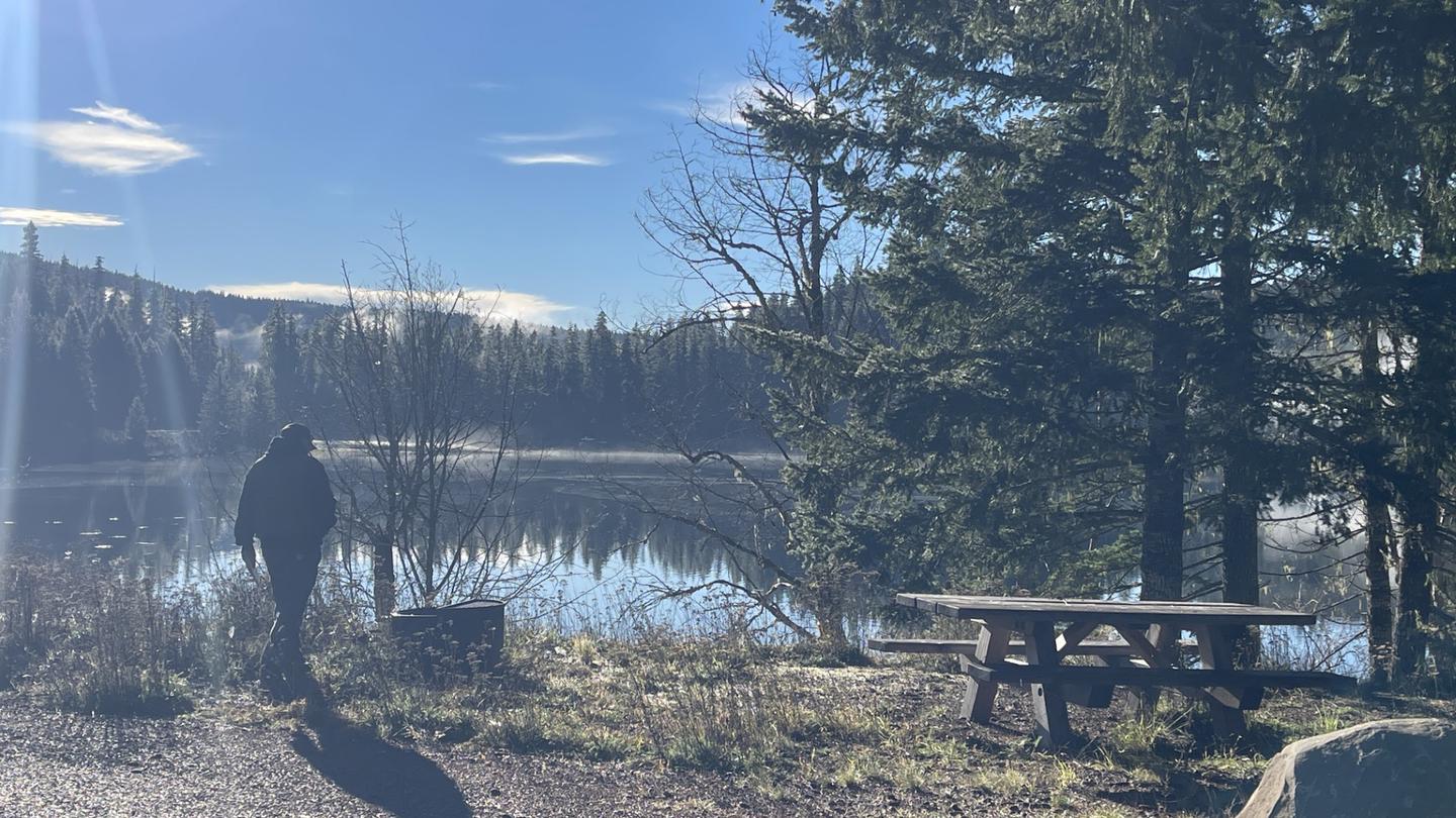
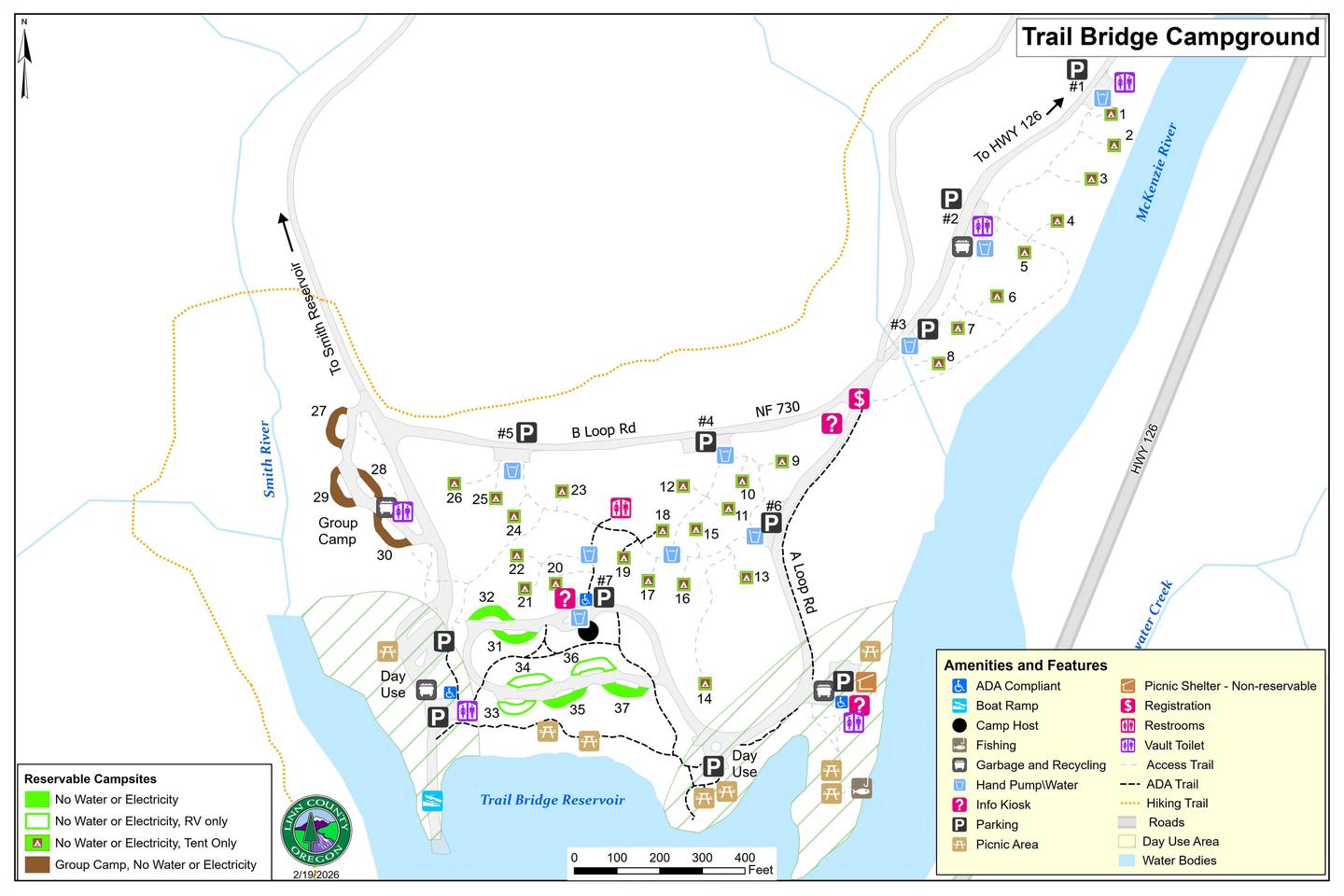
Overview Trail Bridge is a fully reservable campground after May 15th, 2026. First come, first serve is available only on sites that are not previously reserved and only one night at a time. This campground has 26 walk-in/tent only sites, 7 RV sites, and 1 group camp area that has 4 sites. There is a boat ramp with minimal parking. Campground has 4 vault bathrooms and 1 flush toilet bathroom. Potable water spigots throughout campground. No hook-ups. Day Use Fee are and Extra Vehicle Fee area. Campfires allowed until and unless otherwise posted. Fire bans are common during the summer months. Please plan accordingly. Scan and Pay might be offered at this campground; It is recommended that you pay by cash or check for FCFS campsites. There are no refunds, modifications, cancellations, or other fee changes allowed with FCFS payments. This system is the same as putting cash into a fee tube and cannot be refunded. Please download the Rec.Gov app prior to arriving at the campground as there may be no cellular service or very limited service at the campground. If no Scan & Pay option is available you must pay via cash or check. Camp ground has 26 Walk In-Tent Only sites, 7 Pull-Thru RV Nonelectric sites, and 1 Group Area that has 4 Pull-Thru sites. Water is available throughout camp ground via spigots. ADA parking is available. Vault & Flush toilets available. Recreation Boating, fishing, camping, hiking, sightseeing, mountain biking, etc. Facilities Walk in tent sites, pull through RV sites, boat ramp, group camping area, flush restrooms, vault restrooms, day use area, potable water available. Natural Features Reservoir, Blue Pool/Tamolich Falls nearby Nearby Attractions Blue Pool/Tamolich Falls, Clear Lake, Fish Lake, Sahalie Falls, Koosah Falls, McKenzie River Trail
From the managing agency.
Is Trail Bridge free?
We do not have a fee on record for Trail Bridge. Confirm the cost locally before you go.
How do I get to Trail Bridge?
Trail Bridge is at 44.2805, -122.0470. We do not hold written directions for this one, so navigate to the coordinates.
Nearby
- Trail Bridge Campground0.0 mi
- Olallie on McKenzie Highway - Willamette (OR)1.7 mi
- Olallie Campground1.8 mi
- Lakes End Campground3.6 mi
- ICE CAP CAMPGROUND4.8 mi
- Cold Water Cove Campground6.2 mi
- Cold Water Cove - Willamette NF (OR)6.4 mi
- Paradise Campground7.0 mi
No other services within 50 mi on the record.
SourceSource data is agency published. Last synced September 19, 2026. Community reports and photos are submitted by travelers and are not verified by the agency.
