
HORSFALL
Campground · Fee not listed
Fast facts
- Cost
- Not listed. Check locally.
- Type
- Campground
- Phone
- 541-271-6000
- Coordinates
- 43.4458, -124.2444
- Last verified
- September 19, 2026
About this place
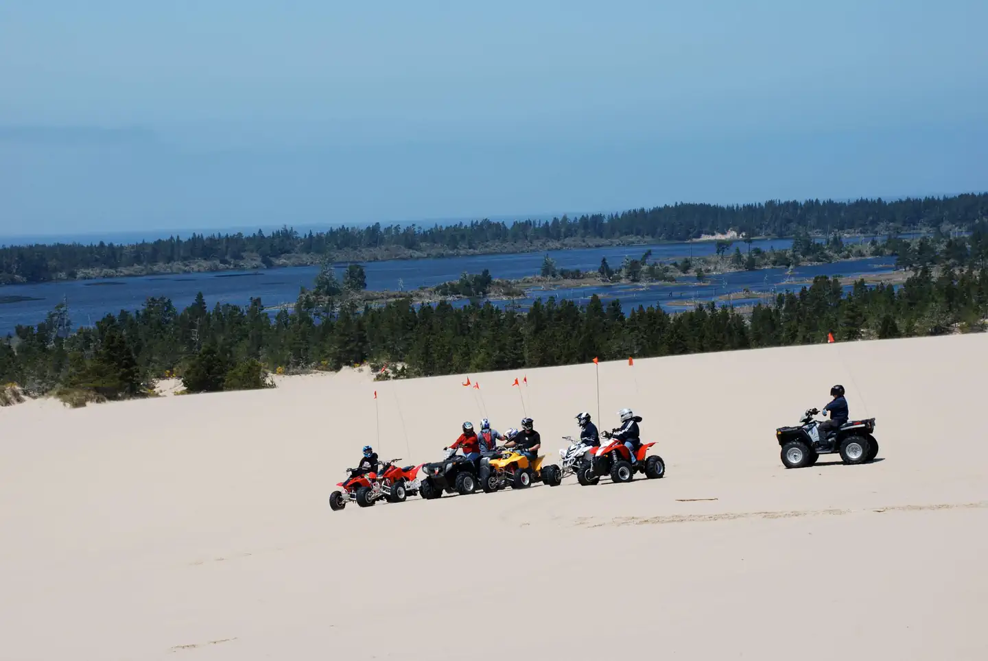
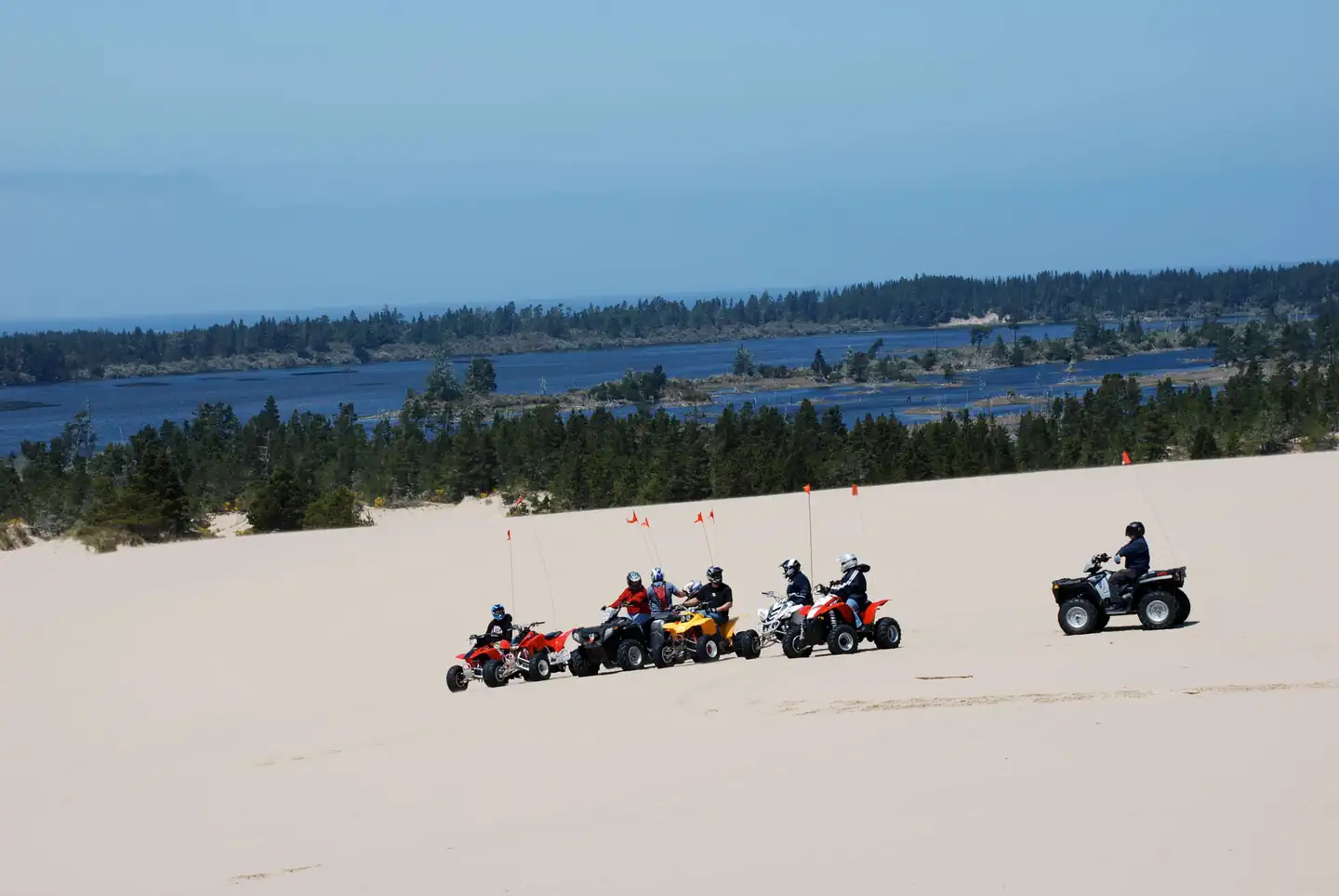
Overview Horsfall Campground, located in the Oregon Dunes National Recreation Area, provides access to miles and miles of dunes. These dunes are open to off-road vehicle use, making this area a prime destination for adventure seekers looking to ride on the sand. The campground also sits within a mile of Horsfall Lake, Bluebill Lake, and a handful of small, tranquil ponds. Recreation The campground is an outstanding home base for off-road vehicle riding on the dunes. Off-road vehicle trails and open riding zones are located northwest of the campground. Horsfall Beach is located to the west at the end of Horsfall Beach road. Nearby non-motorized opportunities include Bluebill Lake Trail and the Wild Mare Horse Trail (which is open to horseback riders and hikers). Facilities Amenities include flush toilets, drinking water, trash collection, and recycling. An ATV loading ramp is also available. Each campsite contains a picnic table and a campfire ring with a grill. Natural Features At an elevation of 100 feet, Horsfall sits in a valley of dunes near the Pacific Coast. Horsfall Lake, Spirit Lake, Bluebill Lake, and a number of smaller ponds are located nearby. The Haynes Inlet is a short distance east, and Coos Bay is to the south. The climate at Horsfall Campground is typically mild year round. Contact Info For facility specific information, please call (541) 271-6000. Nearby Attractions Explore Coos Bay, a picturesque inlet where the Coos River flows into the Pacific Ocean. The Bay provides an outstanding habitat for sea birds. Charges & Cancellations Campsites that are not occupied after 24 hours of arrival time will be considered as a "no show" and sites will be released for others to reserve. If campers will be arriving after 24 hours of their arrival time, they are encouraged to call the ranger station at 541-271-6000 to let staff know.
From the managing agency.
Is HORSFALL free?
We do not have a fee on record for HORSFALL . Confirm the cost locally before you go.
How do I get to HORSFALL ?
HORSFALL is at 43.4458, -124.2444. We do not hold written directions for this one, so navigate to the coordinates.
Nearby
- HORSFALL SAND CAMPING0.2 mi
- Horsfall Campground0.3 mi
- BLUEBILL CAMPGROUND1.0 mi
- WILD MARE HORSE CAMP1.2 mi
- Wild Mare Campground1.2 mi
- HORSFALL BEACH1.7 mi
- Horsfall Beach Campground1.7 mi
- HAUSER SAND CAMPING3.1 mi
No other services within 50 mi on the record.
SourceSource data is agency published. Last synced September 19, 2026. Community reports and photos are submitted by travelers and are not verified by the agency.
