
CEDAR LAKE (OKLAHOMA)
Campground · Fee not listed
Fast facts
- Cost
- Not listed. Check locally.
- Type
- Campground
- Phone
- 918-653-2991
- Coordinates
- 34.7586, -94.6944
- Last verified
- September 19, 2026



About this place
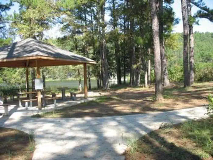
Overview Cedar Lake is located in southeast Oklahoma, in the pine and hardwood-forested mountains of the Ouachita National Forest. The campground is situated on the shores of the scenic lake, a popular destination for boating, fishing, horseback riding and hiking. Recreation The campground is a popular starting point for the Winding Stair Mountain Equestrian Trails, a system of over 70 miles of marked horseback riding trails. Hiking, swimming, boating and fishing on Cedar Lake are popular activities. A swimming area, boat ramp and fishing piers are available within the recreation area. A hiking trail traverses around the the perimeter of Cedar Lake offering varied views of the lake and its tributaries. The Talimena Scenic Byway is located within 10 miles of the campground, offering mountain top views of the valleys around Cedar Lake and historic sites along the way. The Talihina State Park, the western terminus of the Ouachita National Recreation Trail (OT), is located 21 miles from the Cedar Lake Campground. The OT extends across the Forest for 192 miles, the longest continuous trail system on the Forest. Kelly Branch Rifle Range is located 10 miles from the recreation area. Cedar Lake Campground offers a wide variety of camping opportunities, from campsites with electric and water at the campsites, basic campsites with no electric or water at the campsites and tent sites. Cedar Lake Equestrian Camp is one of the largest equestrian campgrounds in the Southern Region with amenities such as electrical/water connections and corrals at the campsites. Facilities The campground offers a variety of sites, including equestrian, group and family sites. Shady Lane (SHRV) sites have electric and water hookups; Sandy Beach sites have electric and water connections; North Shore family sites are basic campsites with community water spigots scattered through the area and no electrical connections. Most equestrian sites have electric and water connections at the campsites. Picnic tables, grills, campfire rings and lantern posts are provided, as are flush toilets, warm showers and drinking water. Picnic pavilions are on-site. Horse corrals are located within the equestrian area. Natural Features Cedar Lake covers 86 acres and is situated at an elevation of 900 feet. Fall foliage season usually occurs from the last two weeks in October to the first two weeks in November. The Ouachita National Forest covers 1.8 million acres in central Arkansas and southeastern Oklahoma. The forest encompasses 700 miles of trails, 43 vistas, six wilderness areas and the highest elevations between the Blue Ridge Mountains and the Rockies. Nearby Attractions Talimena National Scenic Byway is located 10 miles from the campground. Ouachita National Recreation Trail (OT), western terminus trailhead is located at the Talihina State Park, 21 miles from the campground. Heavener, Oklahoma, Heavener Runestone Park is located 14 miles from the campground. Charges & Cancellations Refunds may be requested for the following: Death Medical emergency Storm event Mechanical
From the managing agency.
Is CEDAR LAKE (OKLAHOMA) free?
We do not have a fee on record for CEDAR LAKE (OKLAHOMA). Confirm the cost locally before you go.
How do I get to CEDAR LAKE (OKLAHOMA)?
CEDAR LAKE (OKLAHOMA) is at 34.7586, -94.6944. We do not hold written directions for this one, so navigate to the coordinates.
Nearby
- Cedar Lake Equestrian Camp1.0 mi
- Cedar Lake Campground1.0 mi
- Cedar Lake Group Campground1.0 mi
- Winding Stair Campground3.1 mi
- Winding Stair Campground (OK)3.2 mi
- Winding Stair Campground3.2 mi
- Billy Creek Campground5.1 mi
- Little Pines Campground25.4 mi
No other services within 50 mi on the record.
SourceSource data is agency published. Last synced September 19, 2026. Community reports and photos are submitted by travelers and are not verified by the agency.
