
Morefield Campground
Campground · Fee
Fast facts
- Cost
- $38.00
- Type
- Campground
- Season
- October 20 to April 24
- Sites
- 534 total · 267 reservable · 267 first come
- Reservations
- visitmesaverde.com
- Phone
- 1-800-449-2288
- Coordinates
- 37.3015, -108.4179
- Last verified
- September 19, 2026
About this place
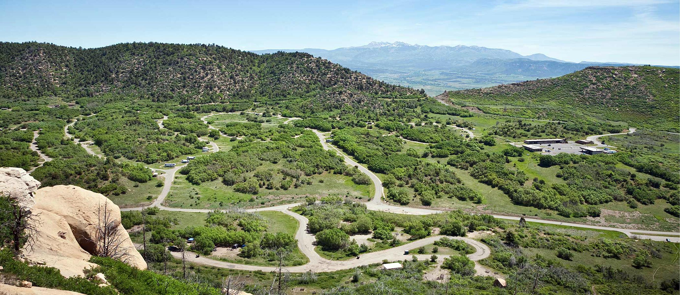
Morefield Campground is four miles from the park entrance. The 267 campsites are situated within a high-elevation, grassy canyon filled with Gambel oak, native flowers, deer, and wild turkeys. Each site has a picnic table, gravel tent pad, and fire pit/BBQ grill. A camp store offers registration, food, and camp supplies. Firewood, gasoline, showers, a coin-operated laundromat, and a kennel are located nearby. The campground is managed by park concessioner Aramark and is open between spring and fall.
From the managing agency.
Is Morefield Campground free?
No. Morefield Campground charges $38.00. 267 of its sites are reservable through visitmesaverde.com.
Can I bring an RV to Morefield Campground?
Morefield Campground has 534 sites on record. 267 sites are reservable and 267 are first come.
When is Morefield Campground open?
The season on record runs October 20 to April 24. Dates move with weather and with the managing office, so check before a shoulder-season trip.
How do I get to Morefield Campground?
Morefield Campground is just off the Main Park Road, near milepost 4. Once you exit Hwy 160 and enter the park, continue on the Main Park Road for four miles until you reach the turn off for Morefield Campground on your right.
What is the weather like at Morefield Campground?
Spring temperatures range from 40 to 70 F. Snowstorms can occur as late as May. Summer temperatures can reach well into the 90s F. Thunderstorms are common in July and August. Fall temperatures can range from 50 to 75 F. Snowfall can occur as early as October.
What are the rules at Morefield Campground?
Quiet hours are 10:00 pm to 6:00 am. Keep all tents on designated graveled pads. Up to 2 tents per site are permitted if the site can accommodate them. Up to 2 cars or 4 motorcycles are permitted per site if they can be parked without obstructing traffic. No more than one unit may hook up to utilities in full hookup sites. Keep all coolers, food items, and cooking utensils locked in your vehicle when not in use. This is for your protection and that of park wildlife. Fires must be kept in designated fire grates only. Collection of firewood is prohibited. Bundles of wood are available at the camp store. All pets must be leashed and under physical restraint at all times. Pets are not allowed on hiking trails but may be walked along paved roads and parking lots. Please dispose of pet waste properly. All wastewater must be properly contained. Sinks and dump stations are available for disposal purposes. Off-trail hiking is restricted, so please stay on designated trails. No bicycles or motorized vehicles.
Nearby
- TARGET TREE CAMPGROUND13.0 mi
- Mcphee Campground15.4 mi
- MCPHEE RECREATION COMPLEX15.5 mi
- Transfer Campground16.2 mi
- House Creek Campground16.1 mi
- HOUSE CREEK16.3 mi
- Aspen Guard Station17.3 mi
- Jersey Jim Fire Tower18.7 mi
No other services within 50 mi on the record.
SourceSource data is agency published. Last synced September 19, 2026. Community reports and photos are submitted by travelers and are not verified by the agency.
