
Winhall Brook Camping Area
Campground · Fee
Fast facts
- Cost
- Fee charged
- Type
- Campground
- Phone
- 802-824-4570
- Coordinates
- 43.1630, -72.8104
- Last verified
- September 19, 2026
About this place
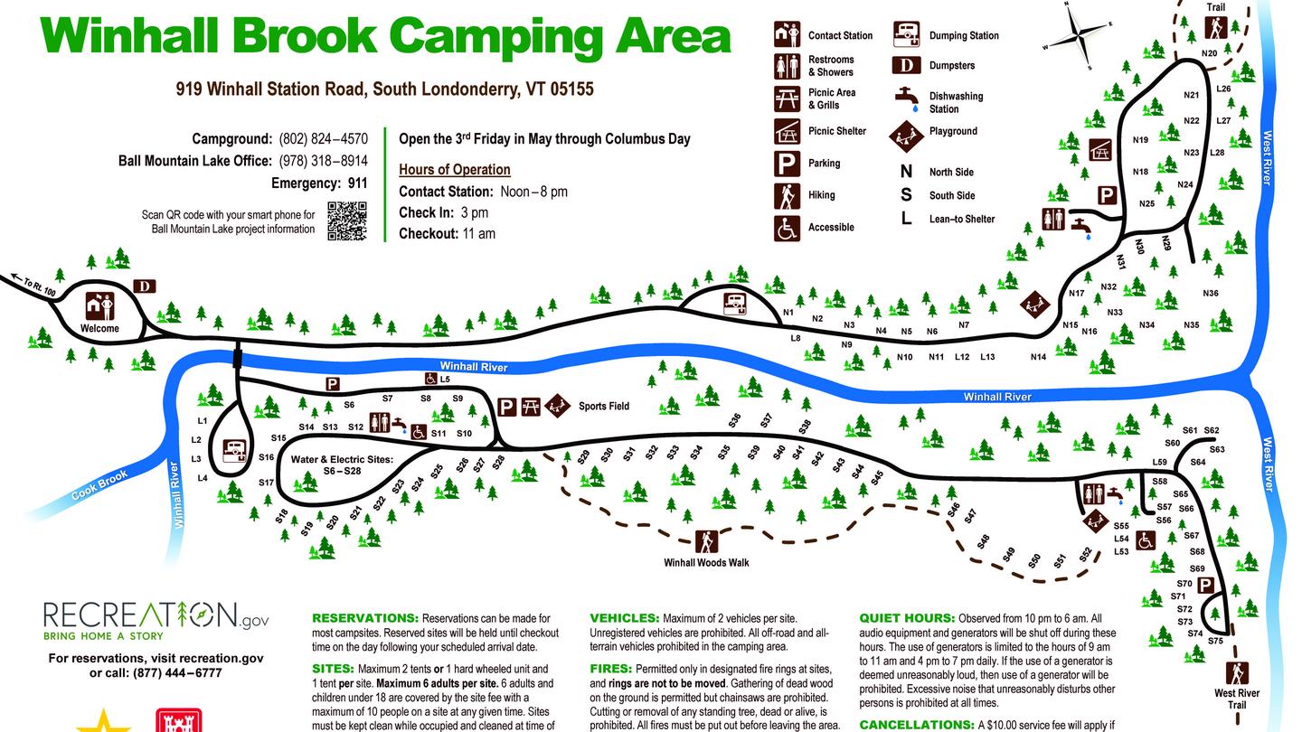
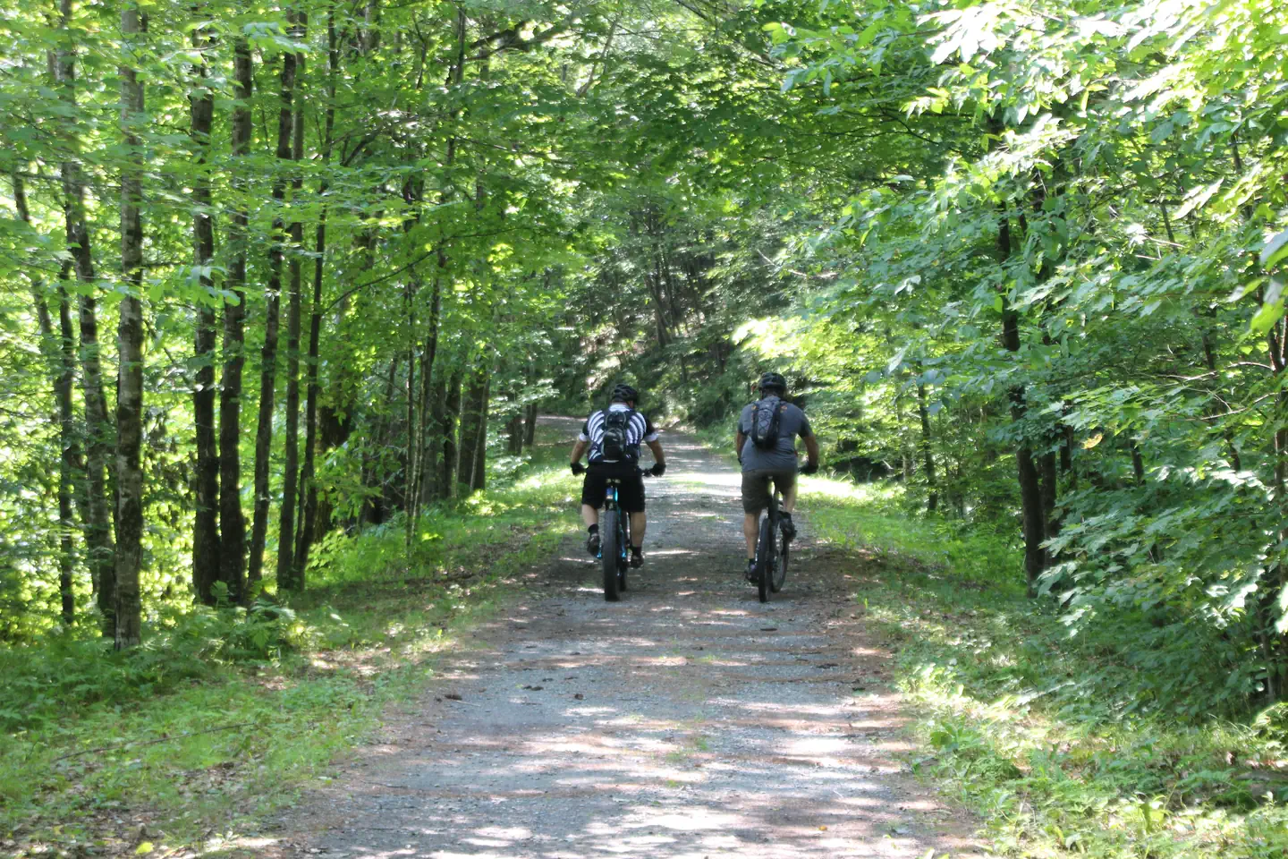
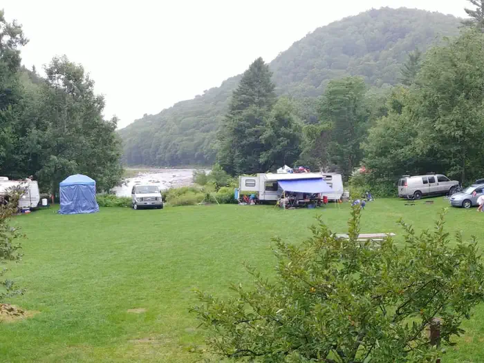
Overview Winhall Brook Camping Area is nestled in the Green Mountains of Vermont along Winhall Brook and the West River, seven miles north of Ball Mountain Lake. The campground has strong appeal to the outdoorsman at heart, offering hiking, biking and fishing opportunities in a beautiful natural setting. Recreation The Winhall Brook Camping Area rests among the Winhall River, and its confluence with the West River, providing substantial opportunities for fishing and river access. Hiking and biking are popular summer activities during stays within the campground, and the snowy winter months allow opportunities outside the recreation season, including cross-country skiing and snowshoeing. A picnic shelter located on the North Side provides space for larger gatherings during the recreation season. The West River Trail stretches 16 miles along sections of the long-since-abandoned West River Railroad, connecting the villages of South Londonderry, Jamaica and Townshend, each with conveniences for those passing through. Hikers going south along the trail from the Winhall Brook Camping Area will pass notable waterfalls, including Angel Falls just north of Ball Mountain Lake, and Hamilton Falls, south of Ball Mountain Dam. The West River is the main tributary for Ball Mountain Lake, a flood control reservoir with hiking and scenic overlooks available year-round. Lake access is available at Ball Mountain Lake's car-top boat launch, with the shores providing additional opportunities for fishing and swimming during one's stay. Twice a year, controlled releases from Ball Mountain Dam provide ideal whitewater conditions along the West River, attracting rafting and kayaking enthusiasts from all across New England. Releases are typically scheduled for the first weekend in May and the last weekend in September. Facilities Winhall Brook offers 111 campsites within the North and South camping areas, located on either side of the Winhall River. Available campsites include: 74 standard non-electric sites. 14 standard non-electric sites with lean-to shelters. 23 standard sites with water and 50-amp electric hookups (Sites S6 - S28). During their stay, campers can enjoy various day-use opportunities within the park, such as playgrounds, picnic sites, a basketball court, volleyball court, and hiking trails, including several miles of the scenic West River Trail. Three restroom facilities within the campground provide flush toilets, showers, drinking water, and dish washing stations for all campers. Dump stations are available on either side of the campground. Natural Features Winhall Brook consists of broad grassy meadows amidst a beautiful northern hardwood forest, providing outstanding fall colors and wildlife habitat. Visitors may catch glimpses of the region's native fauna, which include moose, white-tailed deer, black bear, bald eagles, owls, osprey, woodpeckers and a wide variety of songbirds. Contact Info For local information, please call (802) 824-4570 or call (978) 318-8914 for general information. Nearby Attractions Angel Falls flows just south of the Winhall Brook Camping Area, accessible via the West River Trail traveling downriver towards Ball Mountain Lake. A custom stone bridge continues the West River Trail across the falls' pool for an up close view during your hike. The Green Mountain National Forest begins just 12 miles west of the Winhall Brook Camping Area, offering multiple opportunities for hiking, backpacking, biking, and scenic views. Head south on Vermont Route 100 towards Rawsonville, before turning west onto Vermont Route 30 towards Manchester, Vermont. Charges & Cancellations Please see Recreation.gov changes and cancellation policy at the link below: Changes and cancellations
From the managing agency.
Is Winhall Brook Camping Area free?
No. Winhall Brook Camping Area charges a fee.
How do I get to Winhall Brook Camping Area?
Winhall Brook Camping Area is at 43.1630, -72.8104. We do not hold written directions for this one, so navigate to the coordinates.
Nearby
- Hapgood Pond Campground7.4 mi
- HAPGOOD POND7.5 mi
- Bromley Shelter8.2 mi
- Stratton Pond Recreation Area8.9 mi
- Townshend Lake Recreation Area8.9 mi
- Stratton View Shelter & Tent Area9.0 mi
- Douglas Trail Shelter9.2 mi
- Spruce Peak Shelter9.4 mi
No other services within 50 mi on the record.
SourceSource data is agency published. Last synced September 19, 2026. Community reports and photos are submitted by travelers and are not verified by the agency.
