
TOADSTOOL (NE) NEBRASKA NF
Campground · Fee
Fast facts
- Cost
- Fee charged
- Type
- Campground
- Phone
- N/A
- Coordinates
- 42.8581, -103.5839
- Last verified
- September 19, 2026
About this place
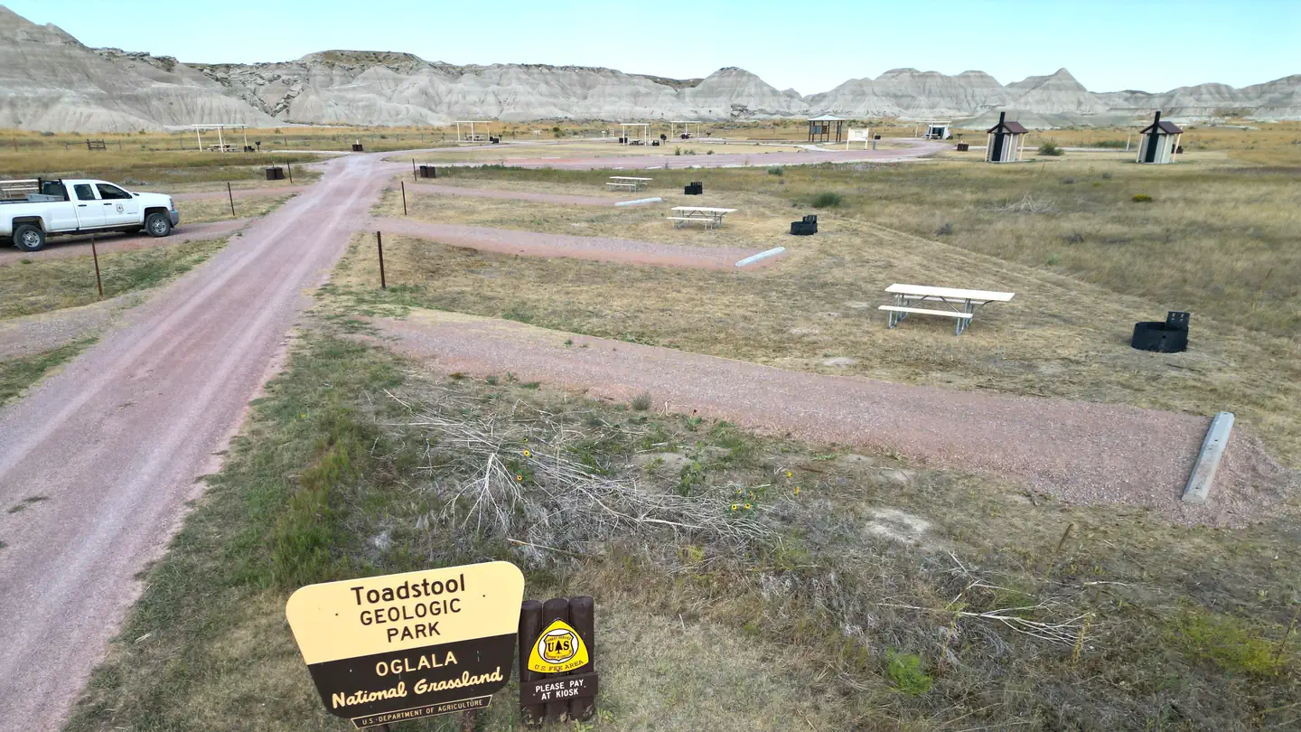
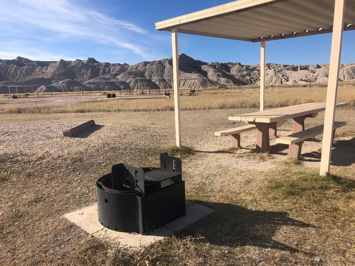
Overview Located on the beautiful Oglala National Grassland in northwestern Nebraska, Toadstool Geologic Park is a stark, other-worldly landscape unlike any place in Nebraska. Its name was inspired by the narrow clay pedestals topped with slabs of sandstone that resemble toadstool mushrooms. It is one of the most memorable places in the grassland with its unique layers, formations, and scientifically valuable fossil deposits. Toadstool is a key link in understanding the earth's history from 38 to 24 million years ago. Formed by mostly volcanic ash and alluvial river deposits, geologists consider it the "type section for the White River Geologic Group", meaning that all other similar-aged deposits in North America are compared to the geological standard designated at Toadstool. The campground consists of twelve campsites with picnic tables, fire rings, upright grills, and two accessible vault toilets. There is no water. Special features: In 1984 the Forest Service constructed a sod house in the campground near the site of a sod house built in 1929. The new "soddie" provides a look into the past when homesteaders on the grasslands used the only abundant material available. The original sod house was lived in briefly before being abandoned and signs of the original structure no longer exist. Recreation The trailhead at the campground provides access to three hiking trails each with varying degrees of difficulty. A one mile interpretive loop highlights many examples of eroded clay/sandstone formations. While on the trail, follow our brochure to learn the fascinating geology of the area. The Bison Trail leaves the interpretive loop at the half way point and continues up the canyon to the Hudson-Meng Education and Research Center. Toadstool Campground to Hudson Meng is 3 miles one way. A five mile loop begins at the campground and proceeds on the graveled section of the interpretive trail for a short distance before heading north through the badlands and grasslands on the Great Plains Trail. After 1.5 miles the Great Plains Trail intersects with the 918 Road. Follow the signs to return to the Bison Trail and Toadstool Campground. The loop can be done in reverse going the other direction on the interpretive trail as you leave the campground. The Great Plains Trail, developed by the Great Plains Trail Alliance, is a cross country network of public land trails and roads beginning in Guadalupe National Park and ending at the Canadian border. The Bison Trail, 918 Road, and part of the 5 mile loop are part of this network. Information on the Great Plains Trail can be found at www.greatplainstrail.org Facilities Two vault toilets. Nearby Attractions Hudson Meng Education and Research Center Located on the beautiful Oglala National Grassland in northwestern Nebraska, the Hudson-Meng Education and Research Center houses one of the most important paleo-archeological discoveries in North America. Visitors can tour the bonebed enclosure and discover the mysterious past of the Bison antiquus (extinct bison) that died here. A rancher first brought attention to the bonebed in 1954. This started an ongoing quest to discover what caused the death of so many bison. Archeologists continue to research the exact nature of past events and the role ancient Paleo-Indian people may have played in them. While theories are plentiful, there is still no clear answer to the mystery. The Hudson-Meng Education and Research Center’s Bison Bonebed Tour encourages visitors to develop their own ideas based on the evidence presented. The Bison Trail connects the Hudson-Meng visitor center to Toadstool Geologic Park. This is an unforgettable three-mile (one way) hike across the Oglala Grassland. Toadstool Geologic Park is well-known for its unusual rock formations and fossils. The natural history dates as far back as 30 million years ago. The site is located in the shadow of Nebraska's picturesque Pine Ridge, overlooking the Oglala and Buffalo Gap National Grasslands and north to the Black Hills of South Dakota. If you make a discovery on a national grassland or national forest, make sure of its location and report it right away to the nearest Forest Service office. https://youtu.be/wM7gKaUP2dw
From the managing agency.
Is TOADSTOOL (NE) NEBRASKA NF free?
No. TOADSTOOL (NE) NEBRASKA NF charges a fee.
How do I get to TOADSTOOL (NE) NEBRASKA NF?
TOADSTOOL (NE) NEBRASKA NF is at 42.8581, -103.5839. We do not hold written directions for this one, so navigate to the coordinates.
Nearby
- Toadstool Geological Park & Campground0.0 mi
- Soldier Creek Campground11.0 mi
- SOLDIER CREEK (NE) NEBRASKA NF11.0 mi
- Roberts Tract Campground25.3 mi
- ROBERTS TRACT (NE) NEBRASKA NF25.3 mi
- Red Cloud Campground31.6 mi
- RED CLOUD (NE) NEBRASKA NF31.6 mi
- Cottonwood Springs Campground40.1 mi
No other services within 50 mi on the record.
SourceSource data is agency published. Last synced September 19, 2026. Community reports and photos are submitted by travelers and are not verified by the agency.
