
Doughton Park Campground
Campground · Fee
Fast facts
- Cost
- $30.00
- Type
- Campground
- Season
- October 26 to May 21
- Sites
- 108 total · 31 reservable · 77 first come
- Reservations
- recreation.gov
- Phone
- 336-372-8877 (MAY - OCTOBER)
- Coordinates
- 36.4289, -81.1544
- Last verified
- September 19, 2026
About this place
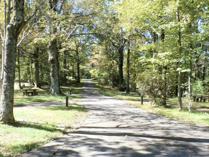
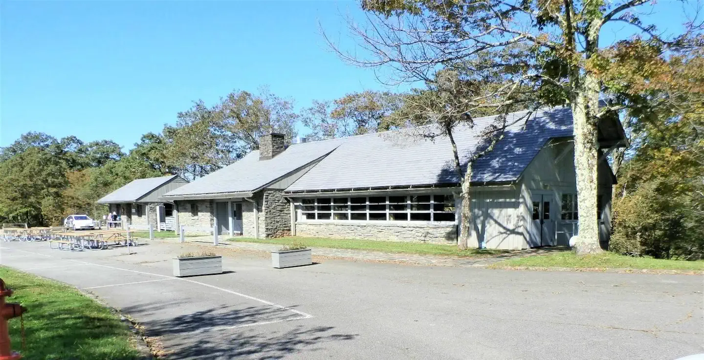
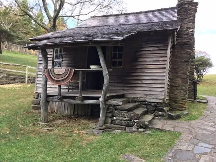
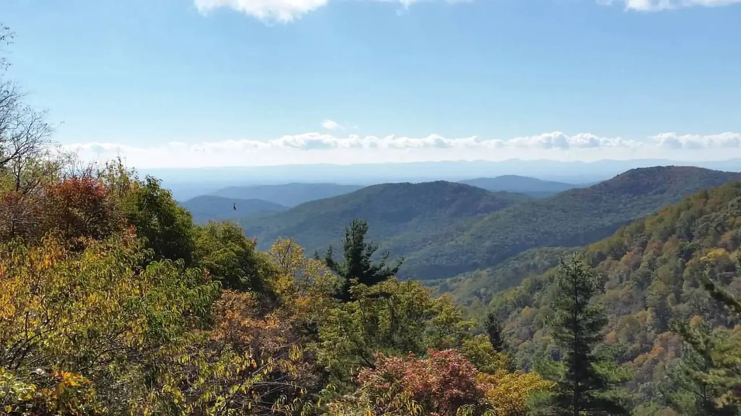
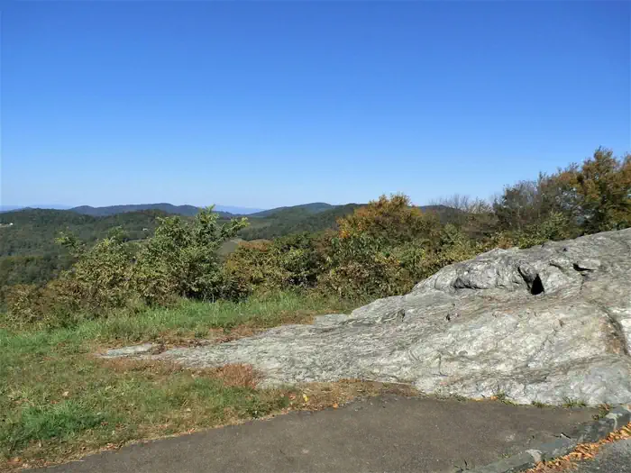
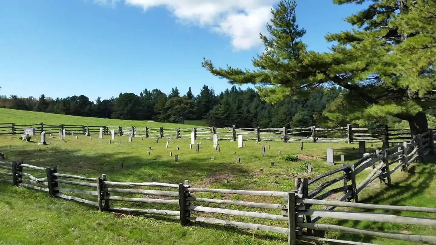
Overview Nestled in a landscape of mountains, open meadows and pioneer cabins, Doughton Park Campground is surrounded by 30 miles (48 km) of hiking trails offering opportunities to view wildlife as well as get a feel for the lives of those who lived here long ago. Originally known as The Bluffs, the area came by its present name in honor of Congressman Robert L. Doughton, a long-time advocate and supporter of the Parkway. Recreation Over 30 miles of trails are available varying from strenuous to easy. Bicycles and motorized vehicles are prohibited on trails. Mileage listed is only traveling one way. Double the trail mileage to include out and back trip. Trail elevations can change more than 2,000 feet as trails descend into the Basin Cove Creek area from the parkway. Maps available on the Blue Ridge Parkway.gov website. Bluff Mountain Trail (7.5 miles) offers many scenic vistas and traverses relatively flat terrain. The trail runs near the parkway and is accessible from many locations along its route from Brinegar Cabin to Basin Cove Overlook. Cedar Ridge Trail (4.4 miles) descends a forested ridgeline to Grassy Gap Fire Road. Trailhead is located at the Brinegar Cabin. Grassy Gap Fire Road (6.1 miles) is wide enough for hikers and horseback riders to travel side by side. The trail starts at Milepost 243.9 and ambles down the mountainside past the primitive campground to State Route 1730 (Longbottom Road). Horseback riders must enter and exit at Longbottom Road. Flat Rock Ridge Trail (5.0) miles begins on the mountain-top meadow of Basin Cove Overlook. And ends on the damp, cool banks of Basin Cove Creek. NC Thurmond Game Lands and bear sanctuary border the south side of the trail. Basin Cove Creek Trail (3.2 miles) is accessible only from the grassy Gap Fire Road at the Long Bottom Road (State Hwy 1730). A 1.7-mile hike is required to reach the beginning of the Basin Cove Creek. It winds past cascading waterfalls to the century-old Caudill Cabin, former home of the Martin Caudill family. Part of the once-thriving Basin cove Community, this cabin was one of the few structures that withstood the devasting 1916 flood. Prepare for over 26 creek crossings on this trail. The total trip one way is 4.9 miles and 9.8 miles for the total trip. Bluff Ridge Primitive Trail (2.7 miles) is the shortest but steepest route into Basin Cove. The strenuous climb up the trail makes the hike seem much longer. Trailhead location is in the Bluffs Picnic Area. Fodder Stack Trail (1.4 miles roundtrip) shows off its delicate display of wildflowers in the spring. It is the easiest hike through a mixture of pine and hardwood forest with a short, steep brief beginning. Recommended for families. Trailhead is at Wildcat Rocks Overlook. The Brinegar Cabin dates from about 1885 and was the home of Martin Brinegar and his family. Brinegar was a cobbler as well as a farmer. His home is open Memorial Day weekend days through October. Hand-loom weaving and other craft demonstrations are often given during the summer months. The one-room Caudill Cabin exhibit can be viewed from the scenic Wildcat Rocks (milepost 240.6). Historic Cemetery: near milepost marker 245.5. The cemetery contains some three dozen graves dating from the 1880's to more recent times. The Basin Cove Creek complex (mileposts 238 - 244) (located off the Parkway on Longbottom Road) has Rainbow and Brook Trout where the streams are stocked. Anyone with a valid Virginia or North Carolina fishing license is welcome, but please check with the visitor center for any special regulations. Facilities Doughton Park has a picnic area (at milepost 241), a campground (milepost 239), comfort stations, drinking water and access to 30 miles (48 km) of trail over bluegrass bluffs. The historic Bluff’s restaurant has reopened (at milepost 241). The restaurant’s web page, www.bluffsrestaurant.org, provides information on hours and menu. Campsites are shaded under an umbrella of thick trees, and provide campers with tables, latern posts, plus, campfire rings and grills. The site also offers camper conveniences like flush toilets, drinking water and a dump station. Doughton Park Campground usually has campsites available. Three group sites are available by reservation at www.recreation.gov. In addition to the 33 sites available for advance reservation, 70 campsites are available on a first-come, first-served basis. Availability of first come, first served sites cannot be tracked through Recreation.gov. These sites must be booked in person at the campground kiosk. With regard to backcountry camping: A permit is required to camp at Basin Cove Backcountry Camping. The cost is $15 per night. Permits and other details are available at https://www.recreation.gov/ . Natural Features Rolling ridgetop meadows and steep mountainsides characterize the 7,000-acre Doughton Park. The elevation is a cool 3688 feet. It is one of the best places along the motor road to view white-tailed deer, raccoons, red and gray foxes, and bobcats. Visitors can enjoy spectacular shows of flame azalea and rhododendron in the late spring and fields of Dense Blazing Stars in mid to late July. Nearby Bluffs picnic area features open areas for night sky viewing with limited light pollution. The Blue Ridge Parkway is a scenic byway that follows the high crests of the central and southern Appalachians for 469 miles from Shenandoah National Park in Virginia, to the Great Smoky Mountains National Park in North Carolina. Nearby Attractions Mount Airy, NC : Andy Griffith's hometown, the ideal American town that was the inspiration for Mayberry--Hwy 52 South; 12 miles south of Fancy Gap, VA: https://www.visitmayberry.com/ New River National Wild and Scenic River offers excellent opportunities for tubing, canoeing, kayaking, and fishing . Multiple access points and several local outfitters are available within a 30‑minute drive of the campground. https://www.fws.gov/rivers/river/new Sparta, NC & Allegheny County: https://www.alleghanycountychamber.com/ West Jefferson, Jefferson Lansing, and Todd: https://ashechamber.com/ Wilkes County: https://wilkescountytourism.com/#/ Yadkin Valley, NC: North Carolina Wine Country - Yadkin Valley, NC
From the managing agency.Official page
Is Doughton Park Campground free?
No. Doughton Park Campground charges $30.00. 31 of its sites are reservable through recreation.gov.
Can I bring an RV to Doughton Park Campground?
Doughton Park Campground has 108 sites on record. 31 sites are reservable and 77 are first come.
When is Doughton Park Campground open?
The season on record runs October 26 to May 21. Dates move with weather and with the managing office, so check before a shoulder-season trip.
How do I get to Doughton Park Campground?
GPS Info. (Latitude, Longitude): 36.42889, -81.15444 36°25'44"N, 81°9'16"W Campground is located at Parkway Milepost 239.2 in North Carolina.
What is the weather like at Doughton Park Campground?
The Parkway varies in elevation from under 650 feet at Virginia's James River to over 6,000 feet near Mount Pisgah in North Carolina. Weather can vary tremendously. Higher elevations can be cloudy and foggy while lower elevations are clear. Temperatures along the Parkway are often cooler than in surrounding foothills. Carry a jacket or blanket and emergency supplies in the car. Be aware of changing weather conditions and approaching weather systems, as summer heat can bring afternoon thunderstorms.
Nearby
- Basin Cove Backcountry Camping2.7 mi
- Fish Dam Creek Park20.5 mi
- W. Kerr Scott Visitor Assistance Center Conference Room21.0 mi
- Dam Site Shelter21.0 mi
- FORT HAMBY PARK21.6 mi
- BERRY MOUNTAIN PARK SHELTER21.8 mi
- BANDITS ROOST21.8 mi
- Comer's Rock Recreation Area23.4 mi
No other services within 50 mi on the record.
SourceSource data is agency published. Last synced September 19, 2026. Community reports and photos are submitted by travelers and are not verified by the agency.
