
WHITETAIL CABIN
USFS · Campground · Fee
Fast facts
- Cost
- Fee charged
- Managed by
- USFS
- Type
- Campground
- Hours
- Open 24 hours/day
- Reservations
- recreation.gov
- Phone
- CALL FOR COMBINATION PRIOR TO YOUR STAY - M-F 8:00 TO 4:30 CALL 406-784-2344. AFTER HOURS OR WEEKENDS CALL 406-740-1594.
- Nearest dump station
- Burgess Rv Dump Station · 96.1 mi
- Coordinates
- 45.6403, -105.9761
- Last verified
- September 19, 2026
About this place
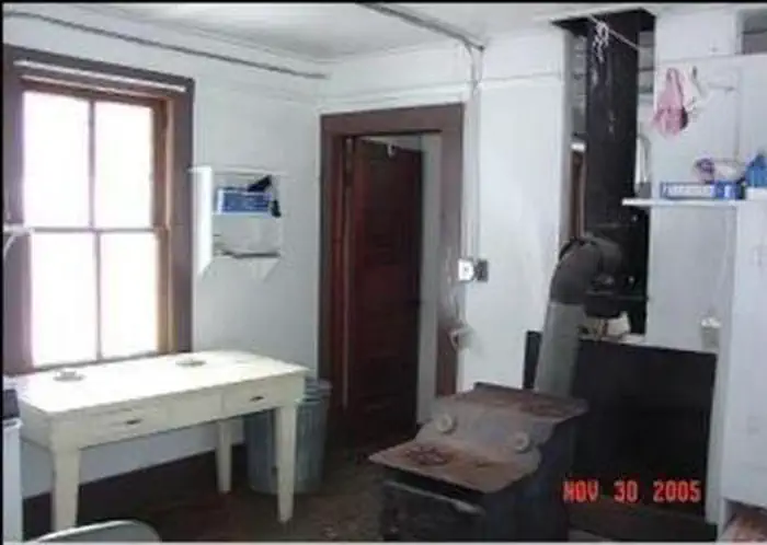
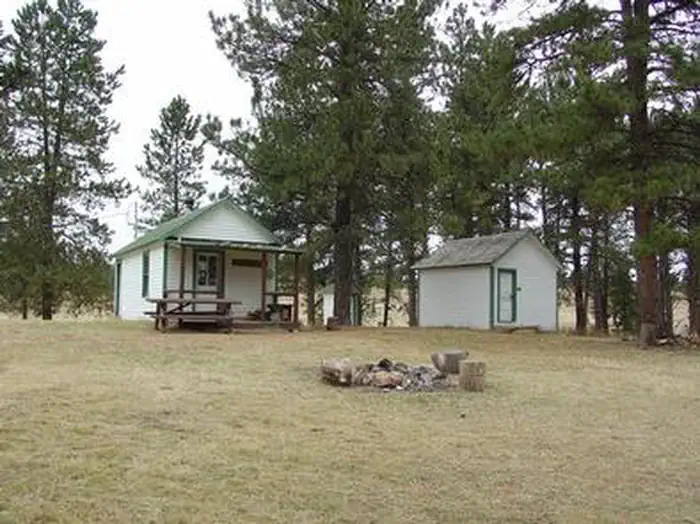
Overview Whitetail Cabin sits at an altitude of 4,048 feet in the north end of the Custer National Forest approximately 20 miles from Ashland, Montana. The cabin was built in the 1930s by the Civilian Conservation Corps. Formerly a ranger station, it is now a registered historic site. The cabin is available year-round and is accessible by car, but guests should be prepared to hike about 100 yards to the cabin in winter, depending on road conditions. Some creature comforts are provided, but guests will need to bring several of their own amenities. Recreation Hiking, mountain biking and horseback riding are popular options in the area. Horse facilities are provided at the cabin. In winter, the landscape is ideal for cross-country skiing and snowshoeing. The cabin is popular with hunters during elk, deer and turkey hunting seasons. Facilities The 2-room cabin sleeps 4 and comes furnished with 2 sets of bunkbeds with mattresses, a table with 4 chairs, electric range, electric refrigerator, cleaning equipment and some basic cooking and eating utensils. A wood burning stove is provided, along with a limited supply of firewood. A picnic table and campfire ring are located in front of the cabin. An outhouse with pit toilet is located nearby. Horse facilities include a corral, 1 hitching rails and approximately 5 acres of fenced area to contain livestock. Seasonal spring water can be used for livestock consumption only, but guests should call the Ranger District to check water availability in advance. No water is available at the cabin. Guests must bring their own supply of water for drinking, cooking and washing. Items such as bedding, lanterns or flashlights, matches, extra toilet paper, first aid supplies, trash bags, dish soap, and towels are not available. Guests are expected to pack out their trash and clean the cabin before leaving. Natural Features The cabin sits in an open area backed by a stand of ponderosa pine. It is located in the Ashland Ranger District, which features a landscape of ponderosa pines and steep rocky outcroppings. Custer National Forest supports populations of bear, mule and whitetail deer, antelope, elk, cougar and bobcat ( bear precautions ). A variety of birds also inhabit the area.
From the USFS.Official page
Is WHITETAIL CABIN free?
No. WHITETAIL CABIN charges a fee. It is managed by the USFS. Sites are reservable through recreation.gov.
How do I get to WHITETAIL CABIN?
From Ashland, MT travel 5 miles east on US 212. Turn left on East Fork Otter Creek Road and go 12 miles northeast. Turn right on Forest Road 4777 and then right on Forest Road 4466. Whitetail Cabin is at the end of the road.
Nearby
SourceData from the USFS. Last synced September 19, 2026. Community reports and photos are submitted by travelers and are not verified by the agency.
