
BULL RIVER PAVILION
USFS · Campground · Fee
Fast facts
- Cost
- Fee charged
- Managed by
- USFS
- Type
- Campground
- Phone
- 406-827-3533
- Coordinates
- 48.0350, -115.8447
- Last verified
- September 19, 2026



About this place
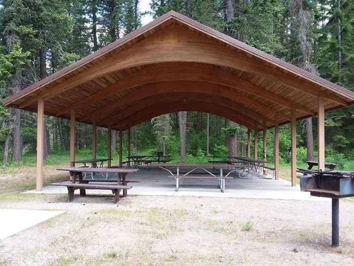
Overview Bull River Pavilion offers an excellent view of the Bull River and surrounding forest. It's located right in the thick of a variety of recreational opportunities and provides a large group with the perfect place to picnic in northwestern Montana. Recreation The rivers give visitors ample opportunity for fishing, swimming and boating. Large and smallmouth bass, perch, rainbow and brown trout and squawfish can be found in the clear, cool waters. Boating, sailing and water skiing are also popular activities on the reservoir. Visitors enjoy tours of the Noxon Rapids Dam, which is located less than 10 miles southeast of the pavilion. It is an earthen, gravity-type, hydroelectric dam that has been in operation for more than 50 years. Facilities The accessible pavilion can accommodate up to 100 people, has space for up to 5 camping vehicles and approximately 7 single vehicles. A camping unit is defined as a car, truck motor home or bus with a towed boat trailer or car. Remember, do not block traffic in the parking loop to maintain access for emergency vehicles. Electricity is available within the structure. It is also equipped with picnic tables, campfire rings and grills. Accessible vault toilet and drinking water are provided. A camping vehicle is defined as a car, truck motor home or bus with a towed boat trailer or car. The adjacent campground offers over a dozen accessible sites for tent and RV camping. A boat ramp, fishing dock and access to the reservoir are available within the campground. All parking surfaces are gravel. Natural Features The pavilion is located in a wooded area at the confluence of the Bull River and the Clark Fork River. The rivers empty into 3,200-acre Cabinet Gorge Reservoir, at an elevation of about 2,200 feet. A variety of trees forest the area, including cedar and Douglas fir. Nearby Attractions
From the USFS.
Is BULL RIVER PAVILION free?
No. BULL RIVER PAVILION charges a fee. It is managed by the USFS.
How do I get to BULL RIVER PAVILION?
BULL RIVER PAVILION is at 48.0350, -115.8447. We do not hold written directions for this one, so navigate to the coordinates.
Nearby
- Bull River Campground0.2 mi
- Big Eddy Picnic/Boat Campground4.3 mi
- Big Eddy Campground4.3 mi
- BULL RIVER GUARD STATION5.9 mi
- Bad Medicine Campground8.3 mi
- GEM PEAK LOOKOUT RENTAL8.9 mi
- Marten Creek Campground11.5 mi
- Marten Creek Campground11.5 mi
No other services within 50 mi on the record.
SourceData from the USFS. Last synced September 19, 2026. Community reports and photos are submitted by travelers and are not verified by the agency.
