
Wallace Creek Day Use Area
Campground · Fee
Fast facts
- Cost
- Fee charged
- Type
- Campground
- Phone
- 662-563-4571
- Coordinates
- 34.1637, -89.8871
- Last verified
- September 19, 2026


About this place
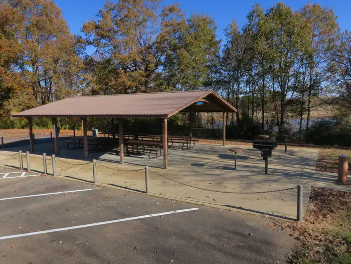
Overview Wallace Creek is a quiet, family-oriented campground situated along the banks of Enid Lake in the forests of northern Mississippi. Picnic shelter is located at boat ramp for family gathering. View a virtual tour of Enid Lake. Recreation Enid Lake has been recognized as one of America's Top 10 Fishing Spots, with white crappie, bass and catfish available in abundance. The lake is the home of the world record white crappie, which weighed an impressive 5 pounds, 3 ounces. Fishing tournaments are held annually at the lake. Hiking trails wind along the lakeshore and throughout the surrounding landscape, offering hiking, biking and horseback riding opportunities. Boating is a popular pastime on the lake, and boat ramps are provided at the campground. Facilities Wallace Creek Recreation areaoffers 101 campsites, along with one large group picnic shelters. Modern amenities includes full hookups and flush toilets. Playgrounds and interpretive trail offer additional recreation opportunities. Picnic sites and large picnic shelter complete with grills and picnic tables make the area perfect for large groups or family trips. Natural Features Enid Lake is part of a dam project on the Yocona River. The dam creates almost 16,000 acres of water for the millions of annual visitors to enjoy. An additional 44,000 acres of thick, green forests surround the lake, offering countless recreational opportunities for campers, equestrians, hikers and more. Nearby Attractions The nearby towns of Water Valley and Batesville, Mississippi offers shopping, hotels, restaurants and emergency care facilities if needed. Memphis, Tennessee, approximately 60 miles, offers tours of Graceland, Elvis Presley home. His birthplace is located in nearby Tupelo, Mississippi.
From the managing agency.
Is Wallace Creek Day Use Area free?
No. Wallace Creek Day Use Area charges a fee.
How do I get to Wallace Creek Day Use Area?
Wallace Creek Day Use Area is at 34.1637, -89.8871. We do not hold written directions for this one, so navigate to the coordinates.
Nearby
- WALLACE CREEK0.3 mi
- Hickory Ridge0.6 mi
- McCurdy Point0.7 mi
- Outlet Channel (Enid Lake)1.2 mi
- Riverview1.5 mi
- Plum Point Campground1.9 mi
- PERSIMMON HILL(ENID LAKE)1.9 mi
- Persimmon Hill Day Use Area2.3 mi
No other services within 50 mi on the record.
SourceSource data is agency published. Last synced September 19, 2026. Community reports and photos are submitted by travelers and are not verified by the agency.
