
FLOUR LAKE CAMPGROUND
USFS · Campground · Fee
Fast facts
- Cost
- Fee charged
- Managed by
- USFS
- Type
- Campground
- Hours
- Quiet hours are 10:00 p.m. until 6:00 a.m.
- Reservations
- fs.usda.gov
- Phone
- (218)388-2203
- Coordinates
- 48.0525, -90.4083
- Last verified
- September 19, 2026



About this place
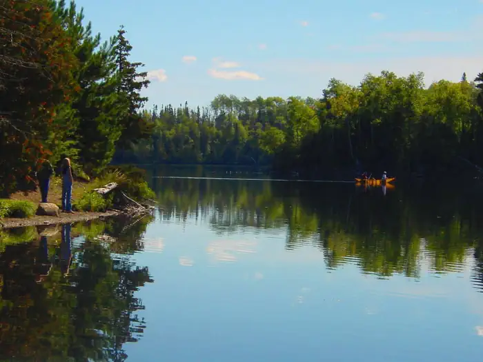
Overview Flour Lake Campground provides a convenient home base for exploring the Boundary Waters Canoe Area Wilderness (BWCAW). Its scenery, amenities and access to outdoor recreation areas make it a popular campground for canoeing, kayaking, boating, and fishing. Superior National Forest, located in northeastern Minnesota's Arrowhead Region, is comprised of 3 million acres. The forest spans 150 miles along the United States-Canada border. Visitors can find recreation opportunities year-round, including travel in the famed Boundary Waters. Recreation The eastern edge of Flour Lake has two separate portages for entering the BWCAW, thus this campground attracts canoe and kayak enthusiasts. Portages link Flour Lake with East Bearskin Lake and Moon Lake. Flour Lake also provides great fishing for bass, walleye and lake trout. Entering the BWCAW requires a permit. Day use permits are available at no charge; inquire at the campground host site. View recreation guides and maps of hiking trails and canoe routes in the national forest. The half-mile Honeymoon Bluff Trail begins a short walk up the road from the campground and offers a great vista of Hungry Jack Lake. Many additional hiking, mountain biking and cross-country ski trails are nearby. Facilities Flour Lake Campground has private sites, each containing a picnic table and campfire ring with grill, and several have views of the lake. Some are reservable, while others are first-come, first-served. Large RVs are easily accommodated. The campground has accessible vault toilets, a solar-powered drinking water system, trash and recycling facilities and a public boat ramp. A fee dump station is nearby. Natural Features The campground sits on the quiet shore of 352-acre Flour Lake in a stand of mixed hardwoods and pine. The lake features several shallow bays that are frequented by a variety of wildlife, including moose, beavers, bald eagles, ducks, loons, songbirds and bears. Nearby Attractions Golden Eagle Lodge, the lake concessionaire, offers many other services and conveniences as well as watercraft rental, coin-operated showers and approved firewood. By far, the most popular nearby attraction is the BWCAW, with over 1,200 miles of canoe routes, 12 hiking trails and over 2,000 designated campsites. Boundary Waters Canoe Area Wilderness Additional sites of interest
From the USFS.
Is FLOUR LAKE CAMPGROUND free?
No. FLOUR LAKE CAMPGROUND charges a fee. It is managed by the USFS. Sites are reservable through fs.usda.gov.
How do I get to FLOUR LAKE CAMPGROUND?
Flour Lake Campground is located on Flour Lake 30 miles up the Gunflint Trail northwest of Grand Marais. From MN 61, turn north on County Road 12 (Gunflint Trail) at Grand Marais. Follow Co 12 about 27 miles to Co 22(Clearwater Road). Turn right. Travel 3 miles on Co 22 to the campground entrance.
Nearby
- EAST BEARSKIN LAKE CAMPGROUND1.3 mi
- Iron Lake Campground9.6 mi
- IRON LAKE9.6 mi
- Ball Club Lake Camping Area10.4 mi
- Ball Club Lake Camping Area10.6 mi
- Two Island Lake Campground12.0 mi
- Kimball Lake Campground15.5 mi
- Devil Track Lake Campground15.8 mi
No other services within 50 mi on the record.
SourceData from the USFS. Last synced September 19, 2026. Community reports and photos are submitted by travelers and are not verified by the agency.
