
Hurricane River Campground
Campground · Fee
Fast facts
- Cost
- $25.00
- Type
- Campground
- Season
- October 15 to May 15
- Sites
- 21 total · 21 reservable · 0 first come
- Reservations
- recreation.gov
- Phone
- 906 387-3700 OR 906 494-2660
- Coordinates
- 46.6640, -86.1662
- Last verified
- September 19, 2026

About this place
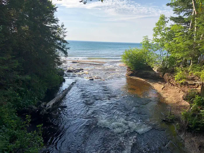
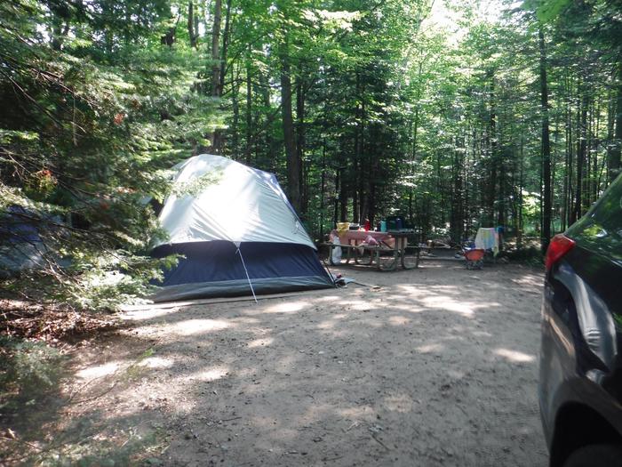
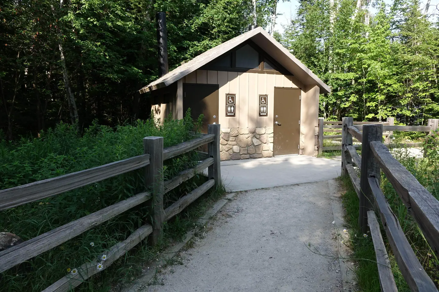
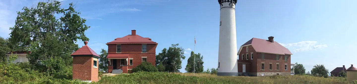
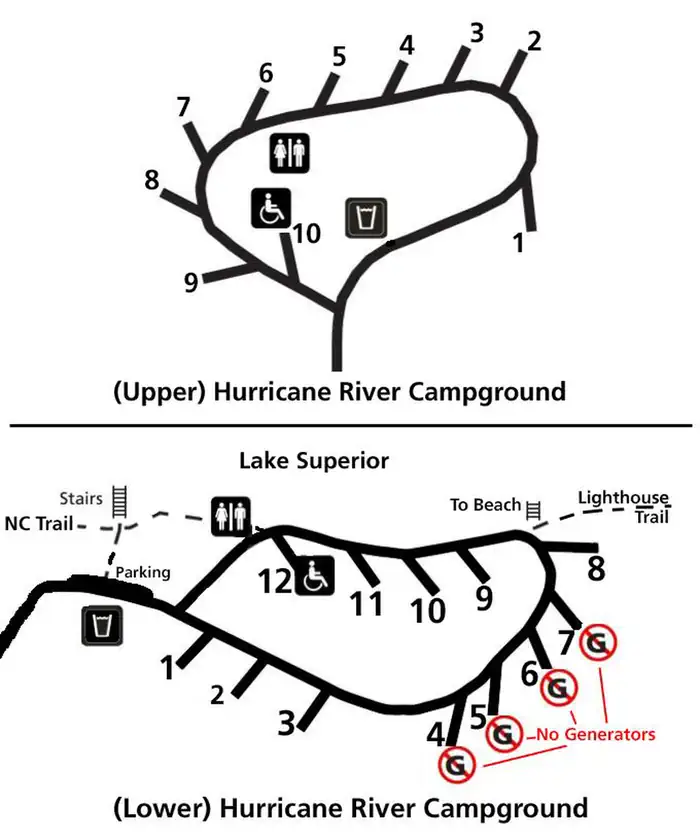
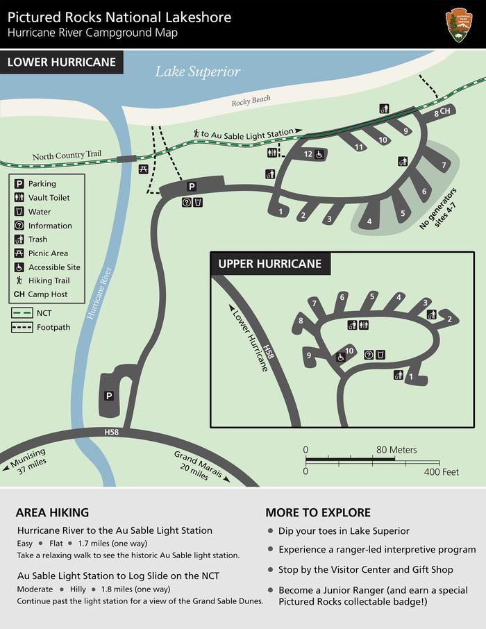
Overview Pictured Rocks National Lakeshore hugs the Lake Superior shoreline for more than 40 miles along Michigan's northern coast. Lake Superior is the largest, deepest, coldest, and most pristine of all the Great Lakes. Camping at Pictured Rocks National Lakeshore is a great way to relax and enjoy the beauties the lakeshore has to offer. Campgrounds are rustic, and do not provide electric or sewer hookups. Campers, trailers, and RVs are welcome, note there are generator free areas. Cell phone reception is limited, so unplug, unwind, and enjoy the serenity Pictured Rocks National Lakeshore Campgrounds has to offer. Hurricane River Campground is located 12 miles (19 km) west of Grand Marais and is divided into two separate sections off County Highway (H-) 58, Hurricane River Upper, and Hurricane River Lower. The Upper Campground has 10 sites and the Lower Campground has 12. Campground amenities include water, pit toilets, picnic tables, fire rings, and handicap accessible sites. Hurricane River Lower Campground is the trailhead for the Au Sable Light Station, which is a 3-mile (5 km) round trip stroll to the lighthouse with views of Lake Superior, Jacobsville Sandstone, and Shipwreck remains. Upper Hurricane River is tucked back in the woods with beautiful deciduous trees between sites allowing for the woodsy experience of Northern Michigan. Recreation Pictured Rocks National Lakeshore offers 100 miles (161 km) of hiking trails leading to waterfalls, beaches, forest wilderness, cultural sites, and breathtaking cliff-top views of Lake Superior. Whether you have only a few minutes, hours, or days to see a portion of the lakeshore, one of these hikes may be for you. Lake Superior's rugged shoreline invites boaters to explore the beautiful Pictured Rocks National Lakeshore with its miles of colorful sandstone cliffs and long stretches of sandy beaches. Peaceful inland lakes also invite boaters to linger in the northwoods. Check the marine weather forecast before venturing out. Watch the weather carefully while on the lake. The weather can change suddenly and unexpectedly. Just because it's calm in Munising Bay or Grand Marais Harbor does not mean it is calm along the more distant shores. The Pictured Rocks cliffs rise 50 to 200 feet (15 to 61 m) directly from the lake, offering precious few protected places if the wind and waves increase. Facilities Pictured Rocks National Lakeshore drive-in campsites are rustic and do not have electric, water, or sewer hookups. Campsites provide a picnic table, fire ring with grill grate, and tent pad. The campgrounds have vault toilets and well water. Tent-style enclosures for campsite portable toilets are strictly prohibited. Typically there is no cell phone reception. Natural Features Sandstone cliffs, beaches, sand dunes, waterfalls, inland lakes, deep forest, and wild shoreline beckon you to visit Pictured Rocks National Lakeshore. The power of Lake Superior shapes the park's coastal features and affects every ecosystem, creating a unique landscape to explore. Hiking, camping, sightseeing, and four-season outdoor opportunities abound. Nearby Attractions Kayak and Other Guided Tours and Pictured Rocks Boat Cruises within the national lakeshore are offered by authorized private companies. Pontoon boat and other rentals for use on Lake Superior are available in nearby communities. Charges & Cancellations
From the managing agency.Official page
Is Hurricane River Campground free?
No. Hurricane River Campground charges $25.00. 21 of its sites are reservable through recreation.gov.
Can I bring an RV to Hurricane River Campground?
Hurricane River Campground has 21 sites on record. 21 sites are reservable and 0 are first come.
When is Hurricane River Campground open?
The season on record runs October 15 to May 15. Dates move with weather and with the managing office, so check before a shoulder-season trip.
How do I get to Hurricane River Campground?
Hurricane River campground is located 12 miles west of Grand Marais on County Road H-58
What is the weather like at Hurricane River Campground?
https://www.nps.gov/piro/planyourvisit/weather.htm
What are the rules at Hurricane River Campground?
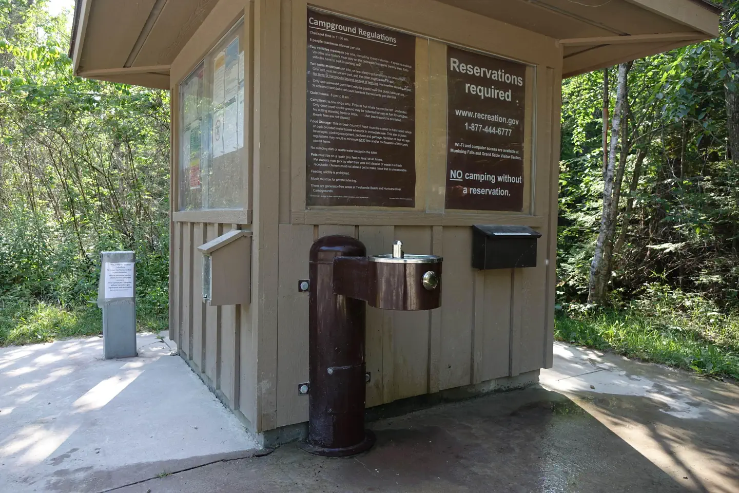
Camping is limited to 14 days per year within the park. Quiet hours are 8 pm to 8 am. This includes generator use. Music should be for private listening only. Check out time is 11 am. Pets must be on a 6 ft or less leash at all times. 1-2 vehicles per site, including towed trailers. They must be parked within the delineated campsite parking slot. No more than 8 people per site. No more than 2 tents or hammocks per site. One tent must be placed on the tent pad and the second placed within 6 ft of the pad. A screened tent may be placed over the picnic table. Campfires are permitted in fire rings only. Do not leave fires unattended. No firewood collecting in campground. Do not hang lanterns from trees. Do not put nails in trees. Food & odors attract bears! ALL food, beverages, cooking equipment, toiletries, food containers, and pet food MUST be locked in a hard-sided vehicle at any time - DAY or NIGHT - when not in immediate use. Garbage must be placed in trash cans. Violation may result in a fine.
Nearby
- Au Sable East Group Backpacking Site1.5 mi
- Au Sable East Individual Backpacking Sites1.5 mi
- Benchmark Individual Backpacking Sites2.0 mi
- Twelvemile Beach Campground2.9 mi
- Twelvemile Beach Campground and Cabin3.0 mi
- Masse Homestead Group Backpacking Site3.6 mi
- Masse Homestead Individual Backpacking Sites3.8 mi
- Sevenmile Creek Group Backpacking Site5.3 mi
No other services within 50 mi on the record.
SourceSource data is agency published. Last synced September 19, 2026. Community reports and photos are submitted by travelers and are not verified by the agency.
