
DAM EAST REC. AREA (DAY USE)
Campground · Fee not listed
Fast facts
- Cost
- Not listed. Check locally.
- Type
- Campground
- Phone
- 618-594-5253
- Coordinates
- 38.6083, -89.3083
- Last verified
- September 19, 2026
About this place
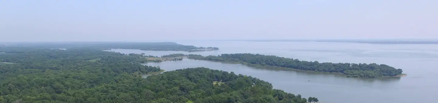
Overview Dam East Recreation Area is situated on the southern shore of Carlyle Lake, a prime getaway for city-dwellers and families. Located 50 miles east of St. Louis, the area offers the peaceful retreat of a small town combined with the grandeur of Illinois' largest man-made lake. Recreation The area provides fun both on the water and on shore. Boat ramps and courtesy docks are provided, and the vast lake allows for plenty of water sports. Fishing is a popular pastime, and the lake offers year-round varieties of fish such as bluegill, crappie, channel catfish, flathead catfish, white bass, largemouth bass, freshwater drum, carp and walleye. A multi-use biking and walking trail is located a short walk away. Facilities Dam East has a courtesy dock and two boat ramps, including one of the best high water ramps on the lake. Visitors can walk or bike across the dam to the Dam West facilities. Natural Features Created in 1967, the 26,000-acre lake is recognized as one of the nation's top ten inland sailing lakes and hosts several annual races and regattas. Carlyle Lake is home to an array of wildlife that can be seen throughout the year. Its waters and shores are a resting spot for migratory waterfowl and other birds. There are six established Watchable Wildlife Sites with viewing towers open to the public around the lake. Nearby Attractions Carlyle Lake Visitor Center, located in the Dam West Recreation Area, has information available and nature exhibits on display, including a 215-gallon aquarium with native fish. Contact Info For facility specific information, please call (618) 594-2484.
From the managing agency.
Is DAM EAST REC. AREA (DAY USE) free?
We do not have a fee on record for DAM EAST REC. AREA (DAY USE). Confirm the cost locally before you go.
How do I get to DAM EAST REC. AREA (DAY USE)?
DAM EAST REC. AREA (DAY USE) is at 38.6083, -89.3083. We do not hold written directions for this one, so navigate to the coordinates.
Nearby
- Dam East - McNair Campground0.9 mi
- DAM EAST SPILLWAY (DAY USE)2.3 mi
- DAM WEST SPILLWAY2.7 mi
- Dam West Campground3.0 mi
- DAM WEST DAY USE3.9 mi
- COLES CREEK DAY USE4.1 mi
- Coles Creek Campground4.2 mi
- LOTUS GROUP AREA4.7 mi
No other services within 50 mi on the record.
SourceSource data is agency published. Last synced September 19, 2026. Community reports and photos are submitted by travelers and are not verified by the agency.
