
CASTLE BUTTE LOOKOUT
USFS · Campground · Fee
Fast facts
- Cost
- Fee charged
- Managed by
- USFS
- Type
- Campground
- Hours
- Open 24 hours/day
- Reservations
- recreation.gov
- Phone
- 208-926-4258
- Nearest dump station
- Cedar Flats Dump Station · 28.1 mi
- Coordinates
- 46.4342, -115.2192
- Last verified
- September 19, 2026
About this place
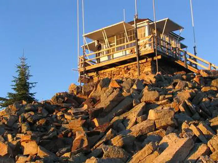
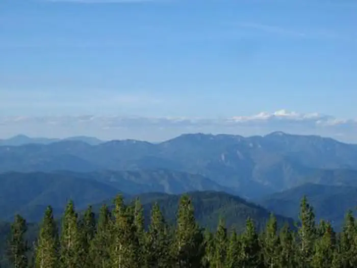
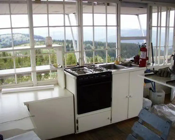
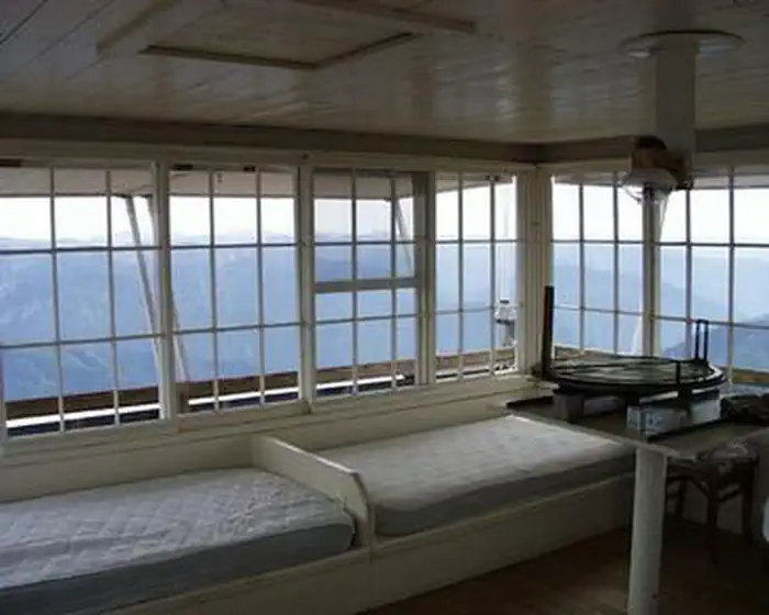
Overview Castle Butte Lookout is a unique cabin perched on a rocky point, 6,659 feet above sea level. It offers breathtaking, 360-degree views of the Selway-Bitterroot Wilderness, the Seven Devils Mountains, the Great Burn area and the deep canyons of the North Fork Clearwater River's upper drainages. A cabin was first constructed on this site in 1916 and was replaced in 1928 with a log cabin featuring a cupola. The current lookout was built in 1950. Access to the lookout is via the Lolo Motorway, a primitive, single-lane road constructed by the Civilian Conservation Corps in the early 1930s. It is not recommended for large RVs, vehicles with low ground clearance or trailers. Guests should be prepared to walk about 100 feet up steep, rocky terrain to reach the lookout. Castle Butte Lookout is equipped with a few creature comforts, but guests will need to bring some gear and supplies to help make their stay enjoyable. The panoramic view guarantees a memorable stay. Recreation Hikers can follow the paths of the Nez Perce and Lewis and Clark on the historic Lolo Trail. The Lolo Motorway is popular with off-road vehicle enthusiasts. Click here for an Idaho OHV safety message. Huckleberries are abundant in the summer, offering good berry picking opportunities. Facilities Castle Butte Lookout can accommodate four people and comes equipped with two twin beds with foam mattresses, two cots, a table with two chairs, mop & bucket, a propane cook stove, propane lights, propane heater and propane. A pit toilet is located in a separate building outside. Click here for additional cabin details. The cabin does not have electricity or water. Guests should bring their own water supply as there is no close water source. Guests must provide their own emergency lighting, garbage bags, bedding, matches, toilet paper, cookware and cooking utensils. The cabin should be cleaned before departure. Natural Features The lookout is surrounded by a rocky landscape that quickly gives way to dense forests of lodgepole and ponderosa pines. This unique facility offers an ideal vantage point to watch sunrises and sunsets, and gaze at the stars. Wildlife enthusiasts may spot eagles, bears, moose, elk, deer and mountain goats. Contact Info For facility specific information, please call (208) 942-0313. Nearby Attractions The Lolo Motorway stretches for 100 miles through scenic mountain landscapes. Summer visitors can see meadows and hillsides blanketed in colorful wildflowers. Travelers should be prepared for rough, sometimes treacherous conditions. No services are located along this road, so travelers should have plenty of gas, food and water for the drive.
From the USFS.Official page
Is CASTLE BUTTE LOOKOUT free?
No. CASTLE BUTTE LOOKOUT charges a fee. It is managed by the USFS. Sites are reservable through recreation.gov.
How do I get to CASTLE BUTTE LOOKOUT?
From Kooskia, ID, take U.S. 12 east for about 65 miles and turn left on Road 107/Gravey Creek Road/Saddle Camp Road. Drive for about 6 miles, then take a slight right on Road 107/Gravey Creek Road. In about 3 miles, turn left toward Lolo Motorway/Lolo Trail. Take the first right onto Lolo Motorway/Lolo Trail. Drive for about 9.5 miles, then Lolo Motorway turns right and becomes Forest Road 561. From Missoula, MT, take U.S. 12 west for about 75 miles and turn right on Road 107/Gravey Creek Road/Saddle Camp Road. Drive for about 6 miles, then take a slight right on Road 107/Gravey Creek Road. In about 3 miles, turn left toward Lolo Motorway/Lolo Trail. Take the first right onto Lolo Motorway/Lolo Trail. Drive for about 9.5 miles, then Lolo Motorway turns right and becomes Forest Road 561.
Nearby
SourceData from the USFS. Last synced September 19, 2026. Community reports and photos are submitted by travelers and are not verified by the agency.
