
ARID PEAK LOOKOUT
USFS · Campground · Fee
Fast facts
- Cost
- Fee charged
- Managed by
- USFS
- Type
- Campground
- Reservations
- recreation.gov
- Phone
- 208-245-4517
- Nearest dump station
- Cedar Flats Dump Station · 88.1 mi
- Coordinates
- 47.3589, -115.7653
- Last verified
- September 19, 2026
About this place
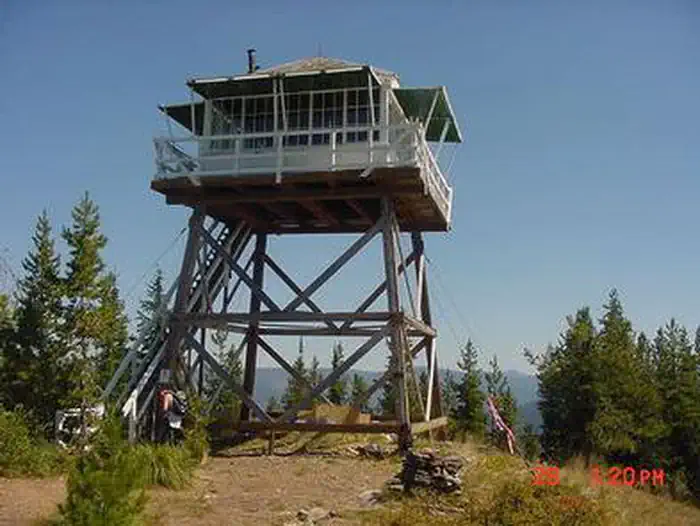
Overview Arid Peak Lookout was built in 1934 to help detect fires that may have been sparked by the Milwaukee Railroad Line. It was last staffed in 1969 and sat idle for over 25 years before being renovated by a team of over 30 volunteers, the Forest Fire Lookout Association and the U.S. Forest Service. Arid Peak Lookout was restored to its original splendor in 1997 and is available for rent to the public. The lookout is listed on the National Register of Historic Lookouts and provides epic 360 degree views of the Bitterroot Mountains. Access to the cabin requires a moderately-steep 3 mile hike and availability is dependent on weather conditions. Recreation The Hiawatha Bicycle Trail is considered the "crown jewel" of rail-to-trail mountain biking trails as it zips across seven trestles and through 10 tunnels in the magnificent Bitterroot Mountains. The trail can be accessed just over 10 miles from the lookout. The lookout offers access to the Arid Peak Trail #173, Mozier Peak Trail #174, and Kyle Creek Trail #175. All three trails are great for day-hiking, but can also be explored over longer backpacking treks or on horseback. Facilities The cabin fits up to four guests. Furnishings include two cots with mattresses, basic cooking gear, dishes, a propane lantern, propane camp stove, water containers, a table with two chairs and a wood stove. An outhouse is located outside the tower. No water is available so guests must bring their own or boil and treat stream water. Propane canisters are not included; a stock of 16.4 ounce canisters are required to use cooking and lighting equipment. Other items to pack include bedding, food, binoculars, a first aid kit, flashlights, towels, toilet paper, and dish soap. Natural Features The Arid Peak Lookout is located within the St. Joe River area of the Idaho Panhandle National Forests, an area that includes most of what was originally established as the St. Joe National Forest. The area is known for its blue-ribbon cutthroat trout streams, Wild and Scenic Rivers and extensive roadless and primitive areas. The St. Joe Rover area is also nationally recognized for its elk herds. The 20 foot tower sits at an elevation of 5,306 feet and overlooks the beautiful Loop Creek area and the scenic Hiawatha Bicycle Trail. The mixed conifer forest around the facility includes Douglas fir and spruce. Wildlife sightings of elk, deer, black bears, moose and bald eagles are common. This is bear country; Visitors are advised to be aware of and practice bear safety. Contact Info For facility specific information, please call (208) 245-2531. Nearby Attractions The town of Avery has the nearest conveniences.
From the USFS.Official page
Is ARID PEAK LOOKOUT free?
No. ARID PEAK LOOKOUT charges a fee. It is managed by the USFS. Sites are reservable through recreation.gov.
How do I get to ARID PEAK LOOKOUT?
ARID PEAK LOOKOUT is at 47.3589, -115.7653. We do not hold written directions for this one, so navigate to the coordinates.
Nearby
SourceData from the USFS. Last synced September 19, 2026. Community reports and photos are submitted by travelers and are not verified by the agency.
