
AMPHITHEATER (CO)
Campground · Fee not listed
Fast facts
- Cost
- Not listed. Check locally.
- Type
- Campground
- Phone
- 928-537-8888
- Nearest dump station
- Taylor Lagoons Dump Station · 83.2 mi
- Coordinates
- 38.0225, -107.6617
- Last verified
- September 19, 2026
About this place
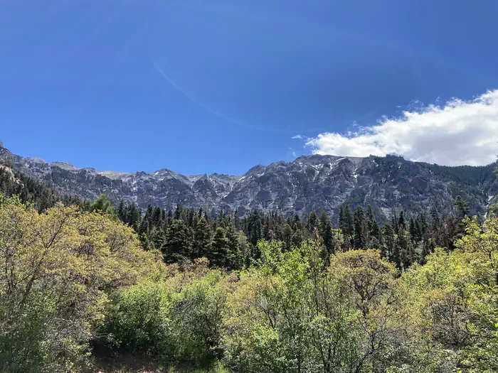
Overview Amphitheater Campground is located near the town of Ouray, Colo., at an elevation of 8,400 feet. Visitors enjoy the area for its beautiful scenery and great hiking and off-road trail opportunities. Recreation Many hiking trails are found in the immediate area, including the popular Upper Cascade Falls Trail, which begins at the campground. Baby Bath Tubs and Chief Ouray Mine trails can also be accessed from the same trailhead. The campground is a favorite among jeep and off-road enthusiasts for its close proximity to a number of exciting trails in the surrounding area. Facilities The campground offers single-family campsites, several of which are designated for tent camping only. Each site is equipped with a picnic table and campfire ring. Vault toilets, drinking water and trash collection are provided. Natural Features The campground is named for the natural rock amphitheater that stands over Ouray. The massive gray cliffs were created by ancient volcanic and glacial activity. The campground is situated on the mountainside above Ouray, with stellar views of the amphitheater. A forest of Gambel oak trees and mixed conifers covers the area. Nearby Attractions Ouray is known as America's Switzerland. The charming, historic, mountain town offers a variety of dining, shopping and lodging options, as well as a hot springs pool and a variety of annual festivals.
From the managing agency.
Is AMPHITHEATER (CO) free?
We do not have a fee on record for AMPHITHEATER (CO). Confirm the cost locally before you go.
How do I get to AMPHITHEATER (CO)?
AMPHITHEATER (CO) is at 38.0225, -107.6617. We do not hold written directions for this one, so navigate to the coordinates.
Nearby
SourceSource data is agency published. Last synced September 19, 2026. Community reports and photos are submitted by travelers and are not verified by the agency.
