
WYANDOTTE A CAMPGROUND
Campground · Fee not listed
Fast facts
- Cost
- Not listed. Check locally.
- Type
- Campground
- Phone
- 530-534-6500
- Nearest dump station
- Jackson Meadows Rv Dump Station · 29.3 mi
- Nearest water fill
- Indian Creek Camp Ground-Potable Water · 94.2 mi
- Coordinates
- 39.7450, -120.9875
- Last verified
- September 19, 2026
About this place
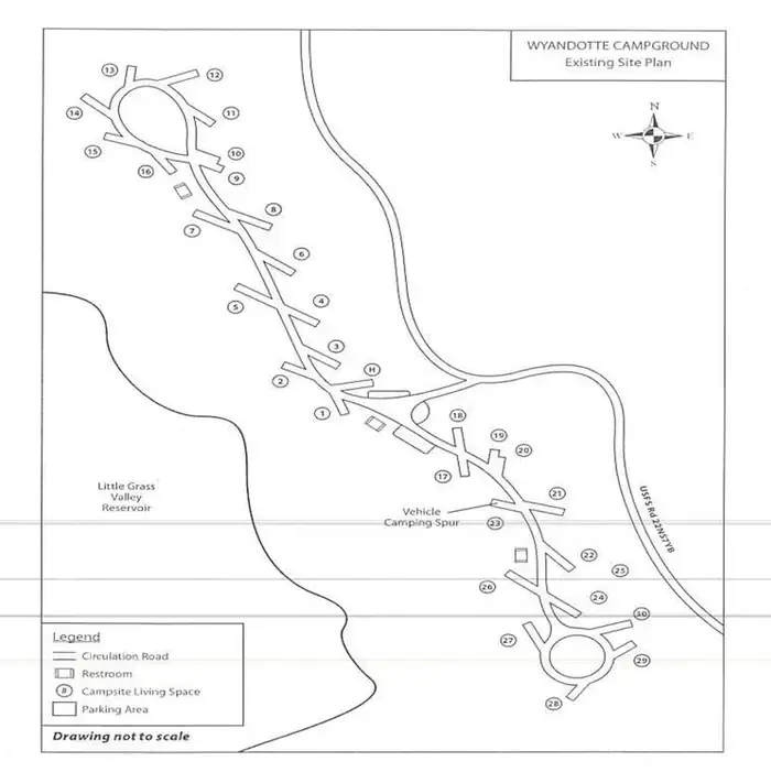
Overview Wyandotte Campground is located within 5 miles of the town of La Porte, CA on the Feather River Ranger District. At an elevation of 5100 feet, the campground is nestled in a natural mixed-conifer forest environment. Little Grass Valley reservoir is a 1600 ac., clear mountain lake with plenty of summer and winter recreation opportunities available. Little Grass Valley Reservoir part of a larger network of streams, rivers, and reservoirs that link features of the South Fork Feather River system with Lake Oroville. Scenic vistas, watchable wildlife, and historic mining sites are in immediate or close proximity to the facility. Operations are seasonal due to winter snow, and delayed openings may result from late snow. Recreation There is plentiful wildlife including bear, deer, squirrel, songbirds, bald eagle and osprey. Activities at the facility include camping, power and flatwater boating, swimming, fishing, hiking, wildlife watching, scenery viewing, and historic sites.
From the managing agency.
Is WYANDOTTE A CAMPGROUND free?
We do not have a fee on record for WYANDOTTE A CAMPGROUND. Confirm the cost locally before you go.
How do I get to WYANDOTTE A CAMPGROUND?
WYANDOTTE A CAMPGROUND is at 39.7450, -120.9875. We do not hold written directions for this one, so navigate to the coordinates.
Nearby
- LITTLE BEAVER A CAMPGROUND 0.0 mi
- Running Deer Campground1.2 mi
- Red Feather Campground1.3 mi
- Little Beaver Campground1.4 mi
- Wyandotte Campground1.4 mi
- Black Rock Campground1.6 mi
- Tooms Rv Campground1.6 mi
- Peninsula Tent Campground1.7 mi
- Jackson Meadows Rv Dump Station29.3 mi
- Indian Creek Camp Ground-Potable Water94.2 mi
SourceSource data is agency published. Last synced September 19, 2026. Community reports and photos are submitted by travelers and are not verified by the agency.
