
Patterson Guard Station
Campground · Fee not listed
Fast facts
- Cost
- Not listed. Check locally.
- Type
- Campground
- Phone
- 530-233-5811
- Nearest dump station
- Merrill Dump Site · 55.4 mi
- Coordinates
- 41.1978, -120.1887
- Last verified
- September 19, 2026




About this place
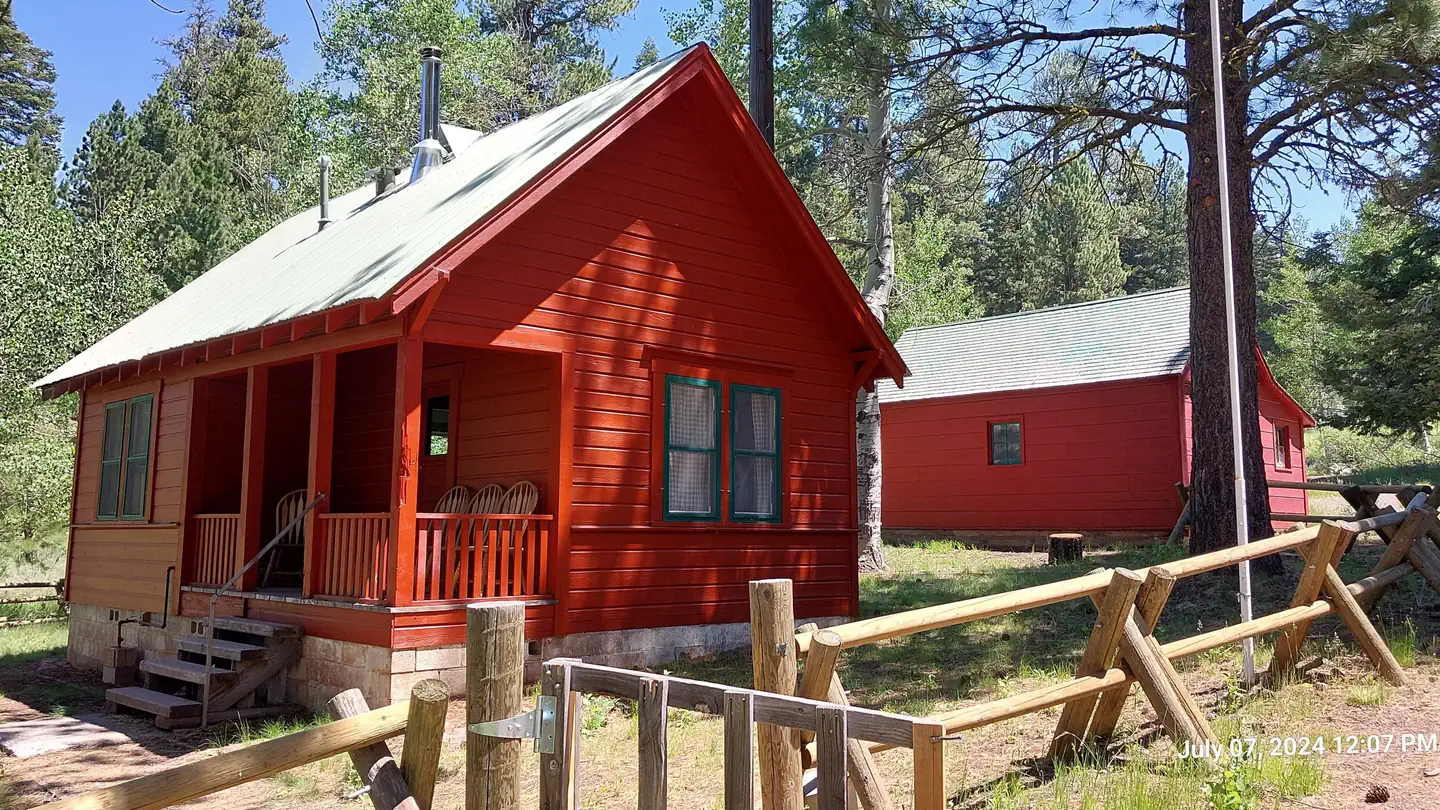
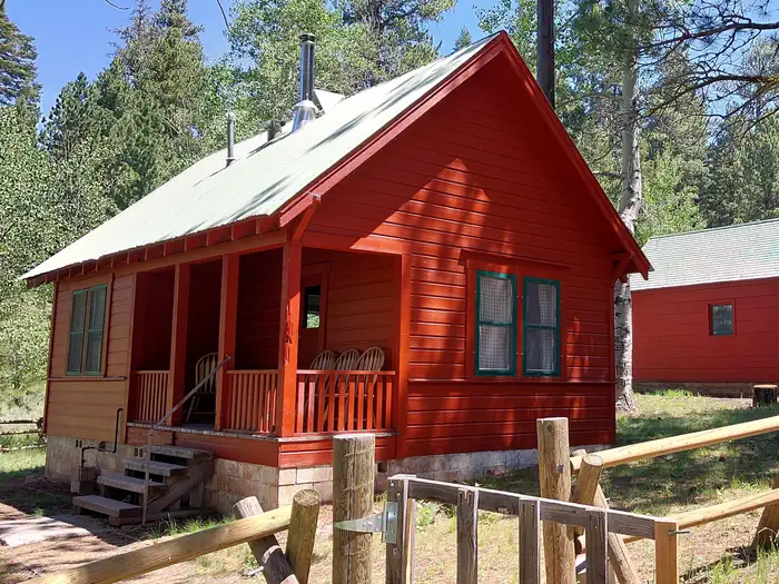
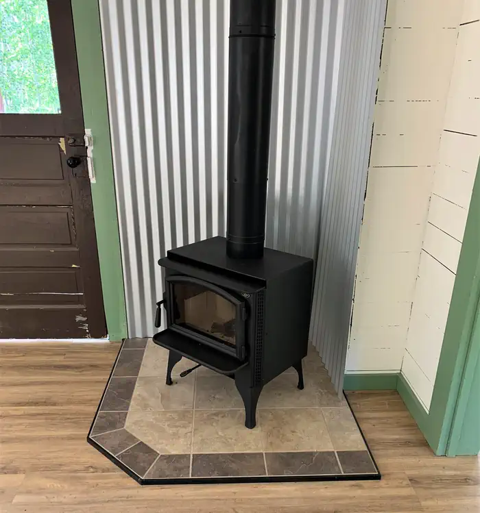
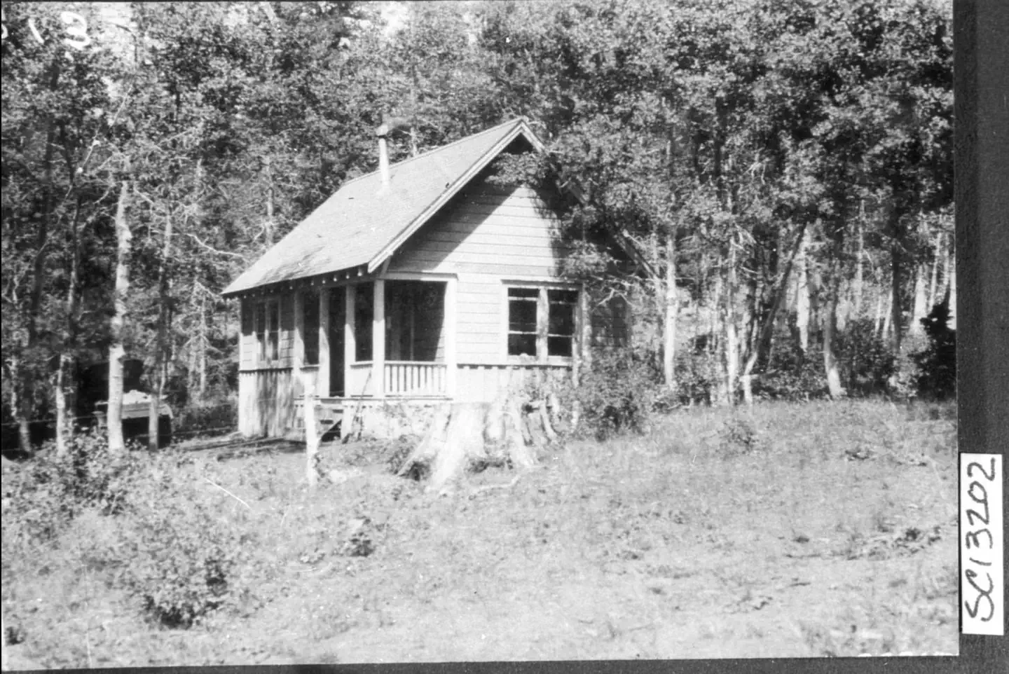
Overview *Altitude is 7,080 feet above sea level* Set on the edge of a meadow surrounded by Aspen, Fir and Pine trees, Patterson Guard Station has stood since 1921. It served the Modoc National Forest as a fully staffed fire office and guard station until 1981. Just a few footsteps from the Summit Trail and one-quarter mile from the wilderness boundary, Patterson Guard Station can be your basecamp for trips into the South Warner Wilderness or the perfect place to disconnect and relax. The cabin only has one set of bunkbeds (two mattresses). There is a large turn-around parking area directly adjacent to the cabin which can accommodate camper trailers, smaller RVs and gooseneck horse trailers. No hook-ups . If your party exceeds 8 persons, the adjacent Patterson Campground offers 6 developed campsites for $15/night. Click here to view the full reservation calander and additional details not included on this page. Recreation Hiking & Horseback Riding The nearby trails within the South Warner Wilderness offer wild landscapes and solitude for hikers and horseback riders. The Wilderness Act of 1964 prohibits the use of motorized and/or mechanized equipment within the Wilderness area (limited exceptions are provided by the Americans with Disabilities Act). South Warner WIlderness maps are advised and always available at the Modoc National Forest Supervisor's Office in Alturas, Calif. Maps may also be available at the Likely General Store in Likely, Calif. Off-Highway Vehicles Many of the roads near Patterson Guard Station, outside of the wilderness area, are open to Off-Highway Vehicles. Motor Vehicle Use Maps are available online and at the Modoc National Forest Supervisor's Office in Alturas, Calif. Boating Blue Lake, 9 miles west, features a boat ramp and dock for motorized and non-motorized watercraft. Help keep this lake clean by following the California Invasive Species Prevention Program Please respect the 10 mph speed limit on the lake. If speed-boating is your thing, consider launching your boat at West Valley Reservoir instead. Facilities Patterson Guard Station was restored in 2022 thanks to funding from the Bipartisan Infrastructure Law. The guard station is currently equiped with one bunk bed (two matresses). There will also be two chairs that each convert to a single bed. Pots and pans will be provided. Pets are allowed. The guard station features a new refrigerator and oven/range fueled by propane (provided). New floors and a wood-burning stove (firewood provided) make this facility almost as cozy as your own home. Potable water is not available on-site. Non-potable water may be available but visitors should bring all the water needed for drinking and washing. An outhouse stands roughly 100 feet from the front door, across the driveway. Entering this facility requires walking up at least two stairs to enter the back door, three stairs up to the front porch and door. As your reservation approaches, you will be instructed on how to obtain codes/keys to the entry gate and guard station doors. THINGS YOU MUST BRING WITH YOU: DRINKING WATER AND WATER FOR WASHING BATTERY POWERED LANTERNS AND LIGHTS FOR INDOOR USE BUG SPRAY AND FIRST AID KITS BEDDING (SLEEPING BAGS, BLANKETS, SHEETS, PILLOWS) Check-in is 2pm and check-out is 11am. Maximum occupancy is listed at eight (8) but when it comes to sleeping arrangments, the guard station will only accomdate four (4) persons. Natural Features The Warner Mountains form a prominent Northwestern boundary of the basin and range geologic province that envelops the entire state of Nevada. This range was once a sedimentary basin between volcanoes of the ancestral Cascade Range until the Warners went through their own phases of active volcanism between ~28 million years ago until as recently as 2 to 3 million years ago. Dramatic uplift on the eastern side of this range provides breathtaking views, best seen from Surprise Valley, east of the Warners. South-facing slopes in the Warner Mountains are often dry and host Lodgepole and Ponderosa Pine, Juniper trees and Sagebrush. North facing slopes are wetter and host Fir trees. Aspen trees are found along streams and boggy areas beside Corn Lillies that can grow up to 5 feet tall before drying up by mid-summer. Nearby Attractions Blue Lake, 9 miles West, offers a boat ramp and dock with a kayak launcher, fishing platform, day use area with grills and picnic tables and a developed campground with 40+ developed campsites at $15/night. Cedarville, California, is a historic western town offering restuarants, a grocery store, and shopping oppourtunities. 31 miles North along County Road 1. Contact Info This location is unstaffed. To speak with our main office for general information, please call: (530) 233-5811.
From the managing agency.
Is Patterson Guard Station free?
We do not have a fee on record for Patterson Guard Station. Confirm the cost locally before you go.
How do I get to Patterson Guard Station?
Patterson Guard Station is at 41.1978, -120.1887. We do not hold written directions for this one, so navigate to the coordinates.
Nearby
SourceSource data is agency published. Last synced September 19, 2026. Community reports and photos are submitted by travelers and are not verified by the agency.
