
Cottonwood Cove Campground
Campground · Fee not listed
Fast facts
- Cost
- Not listed. Check locally.
- Type
- Campground
- Sites
- 45 total · 45 reservable · 0 first come
- Reservations
- recreation.gov
- Nearest water fill
- Petroglyph Canyon · 38.2 mi
- Coordinates
- 35.4878, -114.6950
- Last verified
- September 18, 2026
About this place
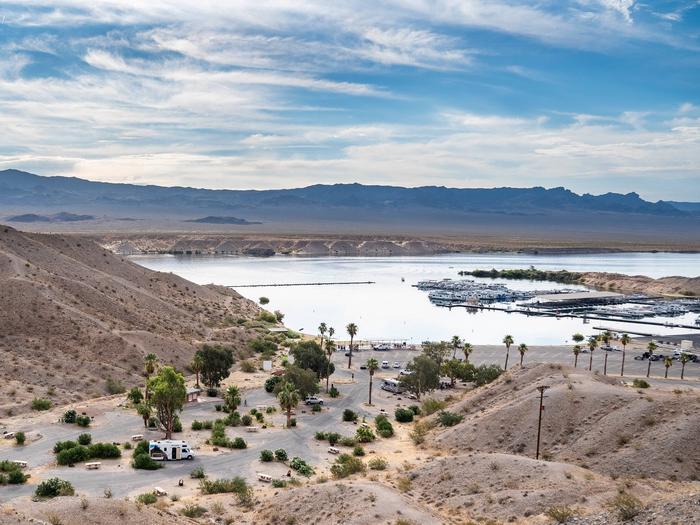
Cottonwood Campground is located near Searchlight, Nevada, along Lake Mohave. It’s open year-round and features paved sites that can accommodate tents or RVs, along with tables, fire pits and/or grills. Restrooms and water spigots are located throughout the campsite.
From the managing agency.Official page
Is Cottonwood Cove Campground free?
We do not have a fee on record for Cottonwood Cove Campground. Confirm the cost locally before you go.
Can I bring an RV to Cottonwood Cove Campground?
Cottonwood Cove Campground has 45 sites on record. 45 sites are reservable and 0 are first come.
How do I get to Cottonwood Cove Campground?
Cottonwood Cove Campground is at 35.4878, -114.6950. We do not hold written directions for this one, so navigate to the coordinates.
Nearby
SourceSource data is agency published. Last synced September 18, 2026. Community reports and photos are submitted by travelers and are not verified by the agency.
