
RUSSIAN RIVER
Campground · Fee not listed
Fast facts
- Cost
- Not listed. Check locally.
- Type
- Campground
- Phone
- (907)288-7756
- Coordinates
- 60.4835, -149.9735
- Last verified
- September 19, 2026


About this place
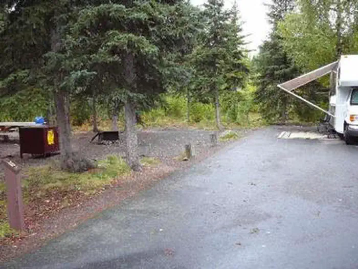
Overview Russian River Campground is perched between the Russian and Kenai Rivers in south-central Alaska. It lies within driving distance of two main population centers, 110 miles south of Anchorage and 40 miles east of Soldotna, surrounded by the Chugach National Forest and the Kenai National Wildlife Refuge. Each year, this area is visited by over 100,000 people who recreate at the Russian River Campground, Ferry Access Site, Sportsman's Boat Launch, Russian Lakes Trail and K'beq Site. Hiking, biking and fishing are popular pastimes. Recreation The Russian River is the most popular sockeye salmon stream in Alaska and a top-rated spot for rainbow trout. Retention of sockeye salmon is legal from June 11th to August 20th. Silver salmon can be retained from July 1st to September 30th. Trout can be retained from June 11th through April 30th. Anglers are required to have a State of Alaska Fishing license and obey all regulations and emergency orders. Kenai Peninsula is also a hiker's paradise, boasting hundreds of miles of maintained trails. The following two trails are accessible from the campground. The Russian Lakes Trail begins in the campground, and is the most popular trail on the Chugach National Forest. Most hikers travel only 2.3 miles to Russian River Falls where a viewing platform allows views of leaping salmon. More ambitious hikers and backpackers can travel another 19 miles past two lakes to the Upper Trailhead on Snug Harbor Rd. Along the trail, three public use cabins can be reserved; Barber Cabin, Aspen Flats Cabin and Upper Russian Lake Cabin. The Angler's Trail also begins in the Russian River Campground and travels 1.25 miles from the Russian River Canyon to the Kenai-Russian River Confluence. Along the way, 22 sustainable river access points allow anglers to enter the Russian River. At the confluence, hardy anglers can cross the Russian River (hip-waders recommended) and continue along the Kenai River, where another 15 access points are located. Staircases lead to this trail from campground loops as well as day use parking lots. Facilities The campground consists of 83 campsites and 130 day-use parking spaces. The campground is open with full service from May through September with 24-hour operation at the "contact station." Compliance with all campground rules and regulations is necessary to insure a safe experience for everyone. Water, vault toilets, tables, fire pits and dumpsters are available, as well as paved roads and parking spurs. Natural Features The campground sits at an elevation of 400 feet on the Eastern Kenai Peninsula in the Chugach National Forest. The forest, spanning more than 5 million acres, is comprised of jagged mountains, deep fjords and glacier-fed rivers. Contact Info For local information, please call (907) 522-8368 or call (907) 288-3178 for general information. Nearby Attractions Resurrection Pass Trail: This trail climbs from 500 to 2,600 feet over 38 miles. It connects the towns Hope and Cooper Landing via a historic route. Russian River Ferry: The ferry transports anglers across the Kenai River. Sportsman's Boat Launch: The boat launch provides boat access to the Kenai River. K'beq Interpretive Site: At this site, tribal members share traditions, stories and culture with visitors through interpretive walks featuring archeological sites, traditional plant use, informational signs, and artifacts. The gift shop features Native art.
From the managing agency.
Is RUSSIAN RIVER free?
We do not have a fee on record for RUSSIAN RIVER. Confirm the cost locally before you go.
How do I get to RUSSIAN RIVER?
RUSSIAN RIVER is at 60.4835, -149.9735. We do not hold written directions for this one, so navigate to the coordinates.
Nearby
- Russian River Cg, Th, Complex0.0 mi
- Cooper Creek Cg, Th2.9 mi
- COOPER CREEK SOUTH3.1 mi
- Barber Cabin (Chugach National Forest, AK)3.2 mi
- TROUT LAKE CABIN5.4 mi
- ROMIG CABIN6.9 mi
- JUNEAU LAKE CABIN7.3 mi
- Hidden Lake Campground7.8 mi
No other services within 50 mi on the record.
SourceSource data is agency published. Last synced September 19, 2026. Community reports and photos are submitted by travelers and are not verified by the agency.
